BONANZA LAND LLC
PORTFOLIO · VOLUME I
GILPIN COUNTY, COLORADO
Nearly 800 acres across Colorado's historic Central Mining District
A collection of extraordinary mountain landscapes assembled over three decades
Presented by VEDA MODERN
View from Dakota Hill · Apex Assemblage
Gilpin County
At the Heart of Colorado's Historic Gold District
The story of the Bonanza Land LLC Portfolio begins in Gilpin County-one of Colorado's smallest counties geographically, yet one of the most consequential in the history of the American West.
The discovery of gold in Gregory Gulch in 1859 helped ignite the great migration to the Colorado mountains. Mining camps rapidly became towns, roads climbed previously inaccessible valleys, mills filled the gulches, and thousands of mining claims were surveyed across the surrounding mountains. Black Hawk, Central City, Nevadaville, Apex, Quartz Hill, and the neighboring mining districts became part of an extraordinary landscape shaped by exploration, industry, ambition, and settlement.
More than a century and a half later, that history remains physically embedded in the land. Patented mining claims still trace nineteenth-century surveys across mountainsides. Historic roads, shaft houses, tramway grades, foundations, mining equipment, and former townsites survive among forests that have gradually reclaimed portions of the landscape.
It is within this remarkable setting that Bonanza Land LLC spent more than three decades researching, assembling, developing, and stewarding the properties presented in Volume I.
Rather than representing a single contiguous landholding, the Gilpin County properties encompass a series of distinctive assemblages, each shaped by its own geography, history, ownership pattern, and future opportunity. Together, they provide an extraordinary cross-section of Colorado's historic mining landscape-from creek corridors and ghost towns to alpine ridgelines, established communities, development opportunities, and the historic headquarters from which much of the portfolio was assembled.
Introduction
The Bonanza Land LLC Portfolio is the result of more than three decades of patient acquisition, research, consolidation, development, and stewardship. What began with individual historic mining properties evolved over time into a series of significant land assemblages-properties brought together not through a single acquisition, but through years of identifying opportunities, understanding fragmented ownership, and recognizing connections across the landscape.
Volume I presents the Gilpin County properties within that larger portfolio. Each assemblage has its own history, geography, character, and potential, yet together they reflect a consistent philosophy: understand the land, respect what came before, and consider thoughtfully what might come next.
The Five Assemblages
Each assemblage represents a distinct chapter in the Bonanza Land LLC Portfolio. Together they form one of Colorado's most significant privately assembled collections of historic mountain properties.
Bonanza Ridge
A premier ridgeline overlooking Historic Central City, offering exceptional opportunities for thoughtfully planned residential, hospitality, and mixed-use development.
The Apex Assemblage
Expansive alpine landscapes, panoramic summits, and historic mining terrain surrounded by National Forest, offering extraordinary opportunities for conservation, recreation, and visionary mountain development.
The Fool's Luck Placer
A rare private mountain corridor following Missouri Gulch through forests, riparian habitat, ponds, and historic waterways.
Nevadaville • Quartz Hill • Prosser Gulch
One of Colorado's most historically significant mining landscapes, where heritage, conservation, hospitality, and adaptive reuse converge.
The Crest of Alps Hill
A south-facing mountain ridgeline overlooking the Continental Divide, where existing VEDA residences demonstrate the successful integration of architecture within an extraordinary alpine landscape.
241 Gregory Street
The operational headquarters supporting the stewardship, management, and long-term vision of the Bonanza Land LLC portfolio.
The chapters that follow introduce each assemblage individually, revealing the landscapes, history, and opportunities that together define the Bonanza Land LLC Portfolio.
Beyond Gilpin County
The Bonanza Land LLC Portfolio extends beyond the Gilpin County properties presented in Volume I.
Additional holdings comprising more than 350 acres in neighboring Clear Creek County represent another significant chapter in the broader collection assembled and stewarded over more than three decades. These properties are currently being documented and will be presented separately as Volume II - The Clear Creek County Properties.
Together, the Gilpin and Clear Creek County holdings represent a much larger body of mountain land shaped by Colorado's mining history-historic claims, alpine ridgelines, creek corridors, development opportunities, and carefully assembled properties spanning two of the state's most historically significant mountain counties.
We invite you to explore the Gilpin County assemblages presented in this volume while recognizing them as part of a larger story of land assembly, stewardship, history, and opportunity that continues beyond the county line.
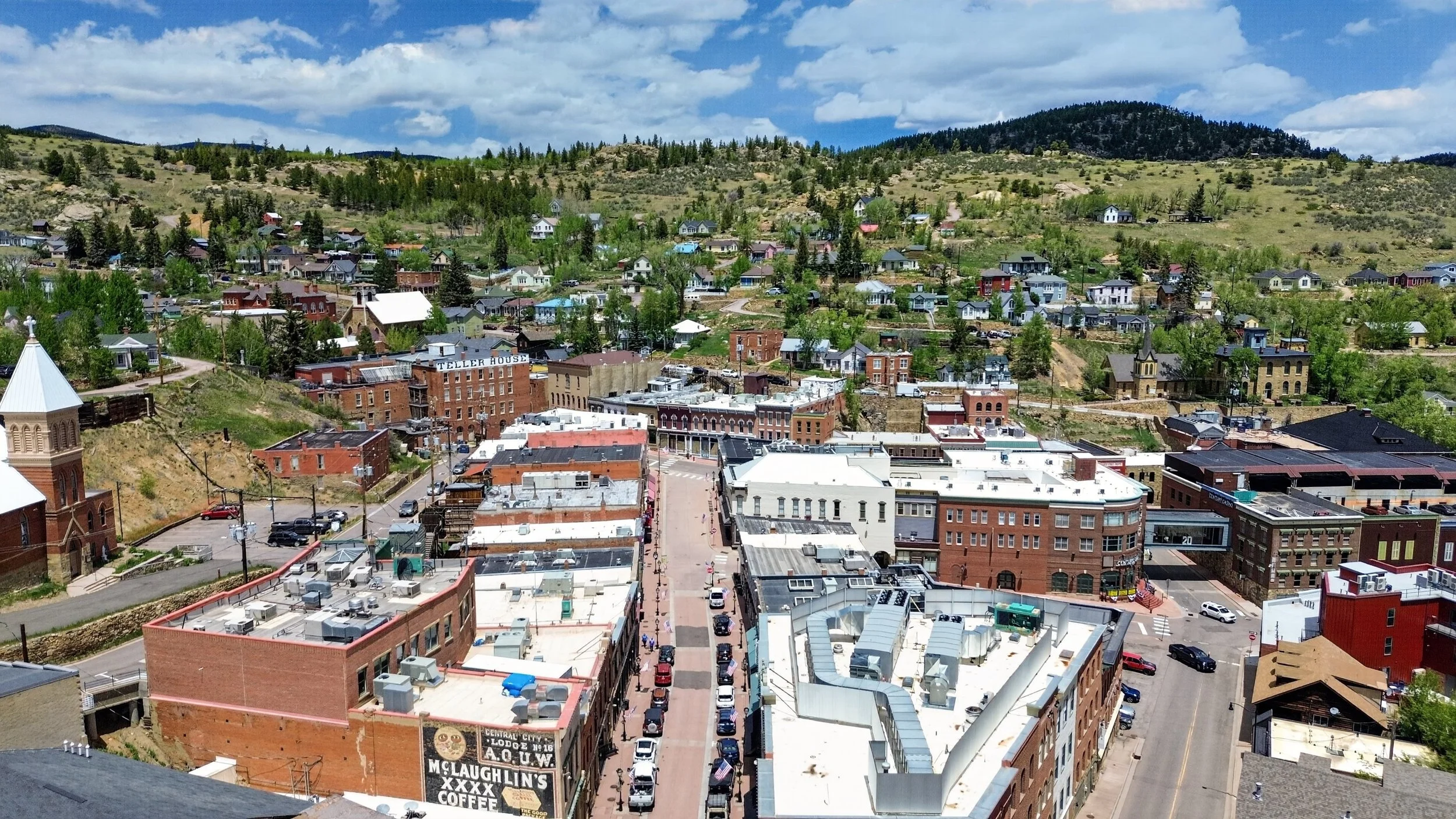
Historic Central City and Bonanza Ridge
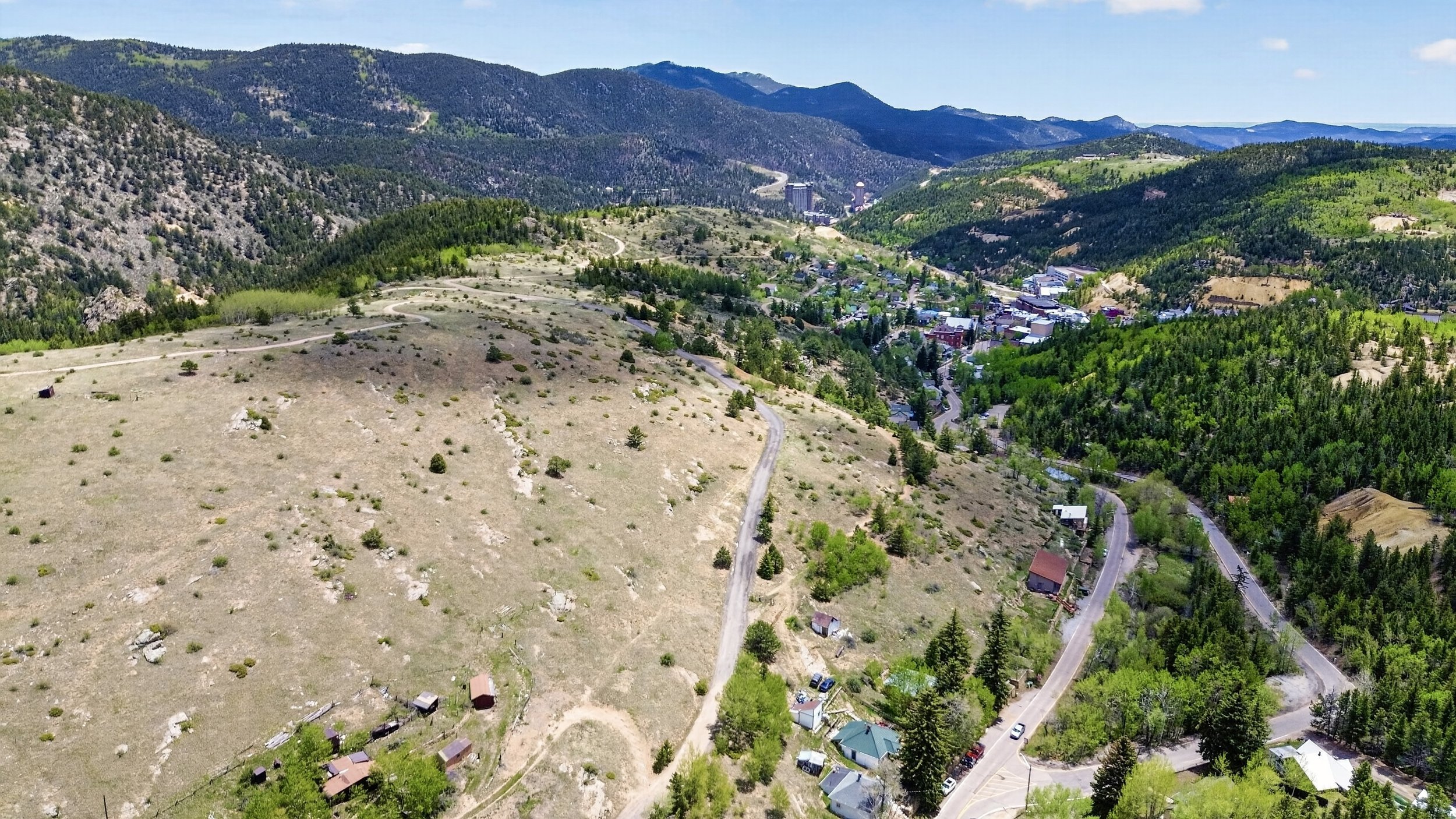
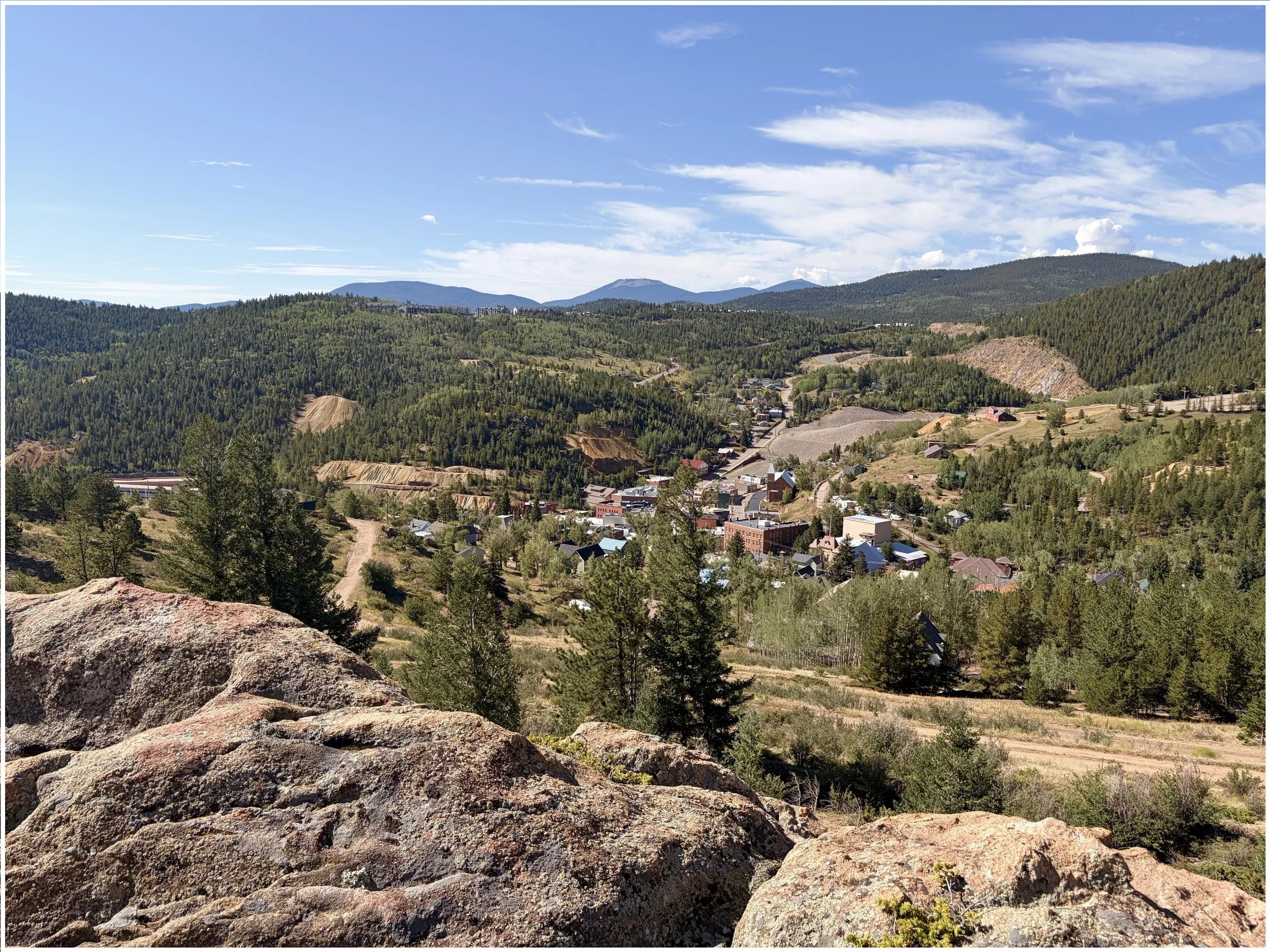
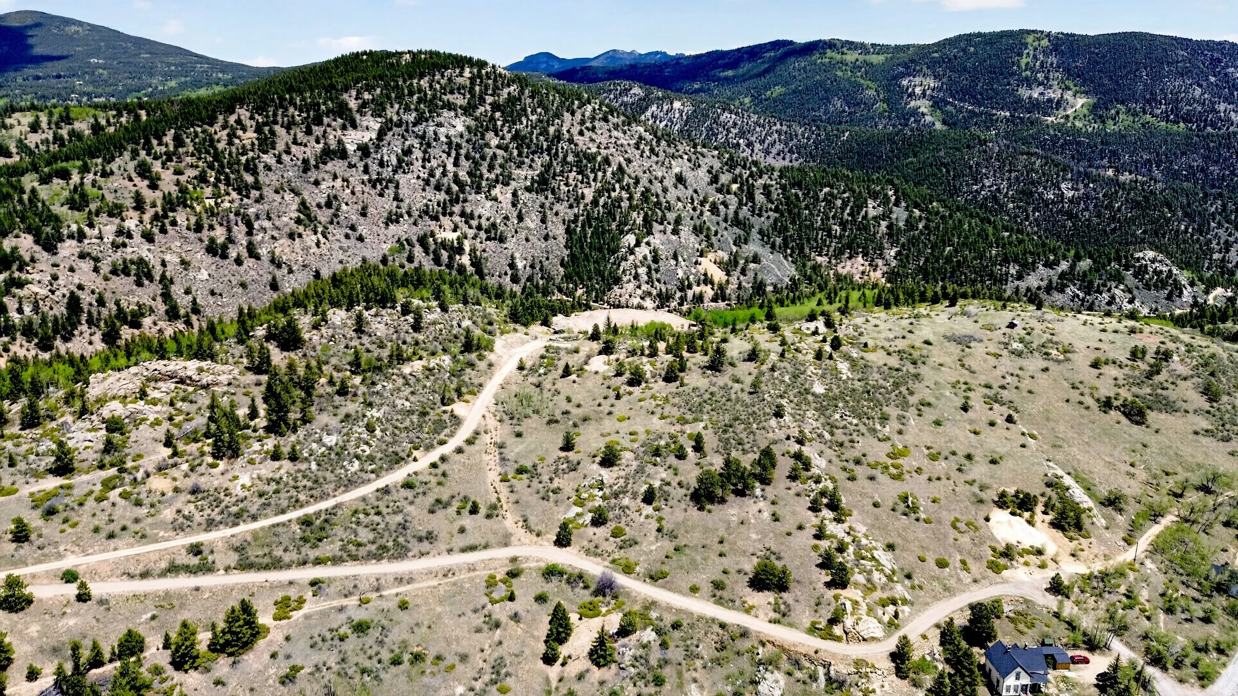
Bonanza Ridge rises above Historic Central City, stretching more than 4,000 feet east to west. The distinctive granite outcrops visible near the center of the ridgeline have become one of the defining landmarks of the assemblage.
The Story
Every property has a history.
Few portfolios have one.
The Bonanza Land LLC Portfolio was not assembled through a single transaction, nor was it created to fulfill a single development vision. It emerged gradually, as exceptional opportunities presented themselves throughout Colorado's Historic Central Mining District.
Each acquisition was unique. Some were historic mining claims overlooking Central City. Others occupied prominent ridgelines, alpine summits, historic townsites, or secluded mountain valleys. Individually, each property possessed its own character and significance. Collectively, they revealed something far greater-a remarkable collection of landscapes reflecting both the extraordinary geography and enduring history of one of the American West's most celebrated mining regions.
Within Gilpin County, the portfolio is presented in Volume I as six distinct offerings, each with its own identity, character, and possibilities. Together, they represent decades of thoughtful stewardship, patient acquisition, and long-term vision-an ownership position that would be extraordinarily difficult, if not impossible, to recreate today.
The pages that follow introduce not only the individual properties and assemblages, but also the landscapes, stories, and legacy that connect them. They invite the reader to look beyond parcel boundaries and acreage and to understand how these properties relate to one another-and to the remarkable history of the place they occupy.
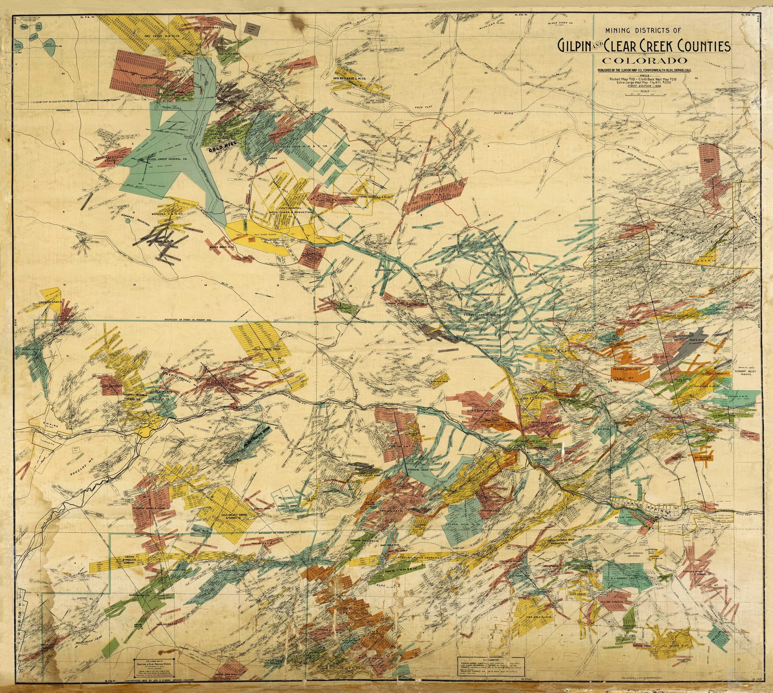
The story begins long before this portfolio was assembled. It begins with the landscape itself—one of the most intensely claimed and historically significant mining districts in the American West.
The Portfolio Today
A century has passed since thousands of mining claims blanketed these mountains. While many were consolidated, abandoned, or absorbed into public ownership, others remained in private hands, often fragmented across generations of ownership.
The Gilpin County properties presented in Volume I represent one of the most significant privately assembled collections to emerge from this historic landscape. Rather than functioning as a single holding, they are organized into six distinct offerings, each defined by its own geography, history, character, and opportunities.
Together, these properties encompass alpine summits, historic mining districts, prominent ridgelines, secluded mountain valleys, creek corridors, and development opportunities. Individually, each offering tells its own story. Collectively, they illustrate the remarkable diversity of Colorado's Historic Central Mining District and the decades of research, acquisition, consolidation, development, and stewardship required to assemble a collection of this scale.
CHAPTER I
____________________________________________________________
BONANZA RIDGE
A Landscape Between History and Tomorrow
Overview
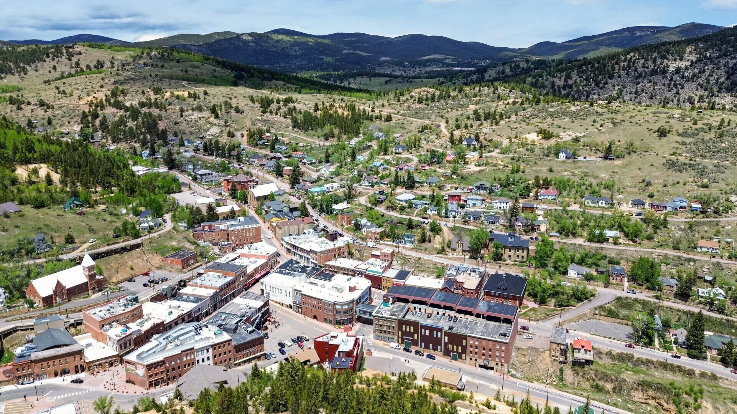
Rising above Historic Central City, Bonanza Ridge occupies one of the most commanding landscapes in Colorado's Historic Central Mining District. Granite outcrops crown the ridgeline, forests blanket its slopes, and panoramic views extend across historic mining camps, the Continental Divide, and Colorado's Front Range. From this elevated landscape, the relationship between the mountains, the town, and the terrain that shaped Colorado's earliest gold discoveries becomes immediately apparent.
While its scenery and history define Bonanza Ridge's character, its immediate adjacency to Historic Central City makes the assemblage equally compelling from a planning and investment perspective.
Unlike many large mountain landholdings, Bonanza Ridge benefits from close proximity to municipal water and sewer, electrical infrastructure, paved roads, and city services-an uncommon combination that expands the range of thoughtful future possibilities.
Whether envisioned as a collection of private mountain estates, carefully planned residential neighborhoods, boutique hospitality, mixed-use development, or significant open-space preservation, the assemblage possesses an uncommon degree of flexibility. Whatever direction its future takes, the landscape offers the rare opportunity to balance responsible growth with long-term stewardship.
Few remaining mountain properties combine dramatic scenery, direct adjacency to an authentic Colorado mining town, existing municipal infrastructure, and meaningful long-term potential on this scale. Bonanza Ridge represents not simply an investment in land, but an opportunity to help shape the next chapter of one of Colorado's most remarkable mountain landscapes.
The Landscape
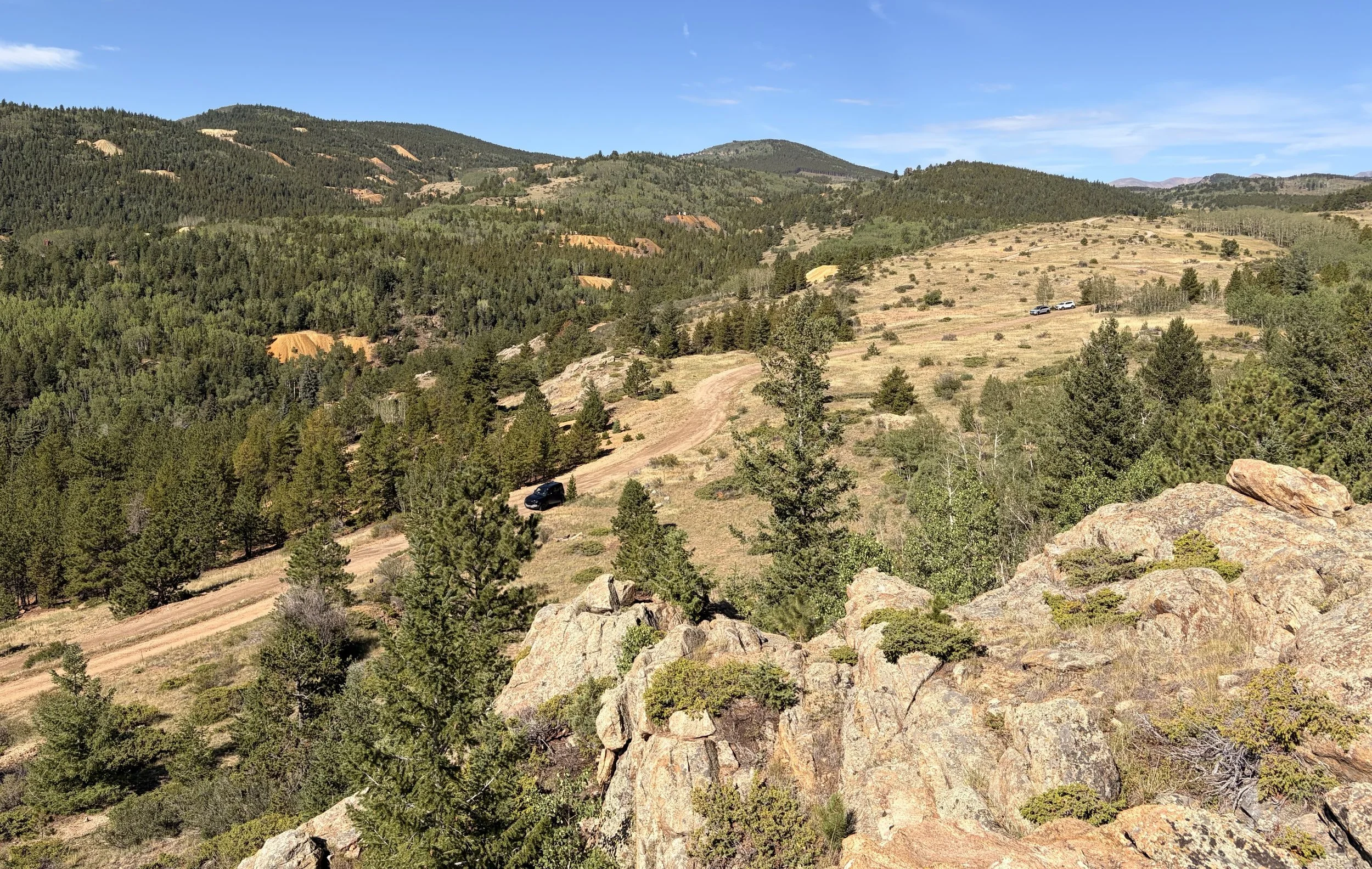
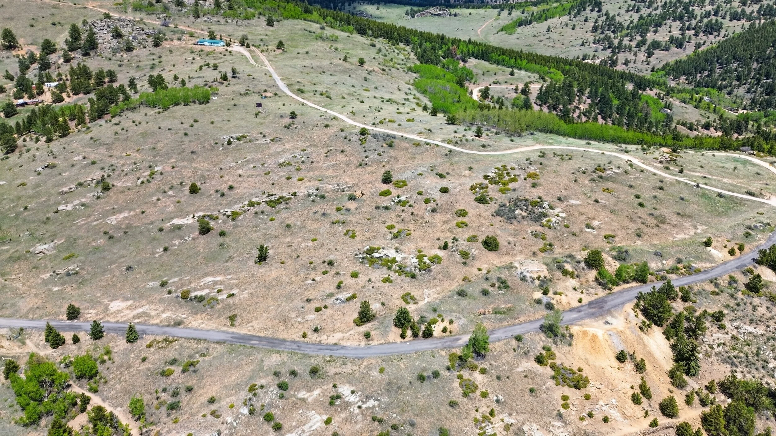
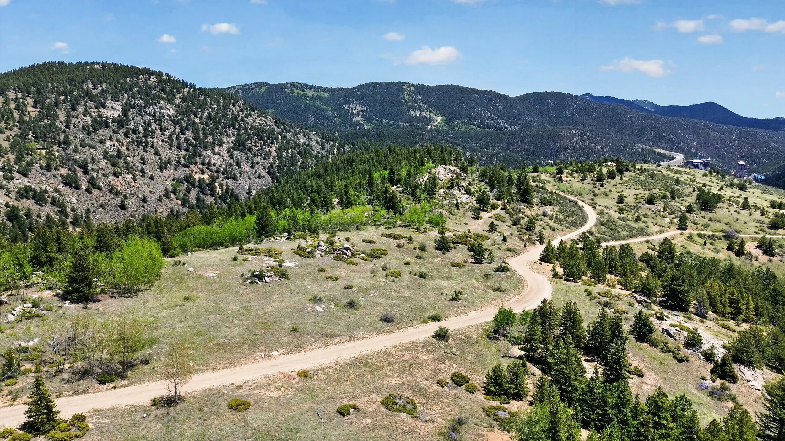
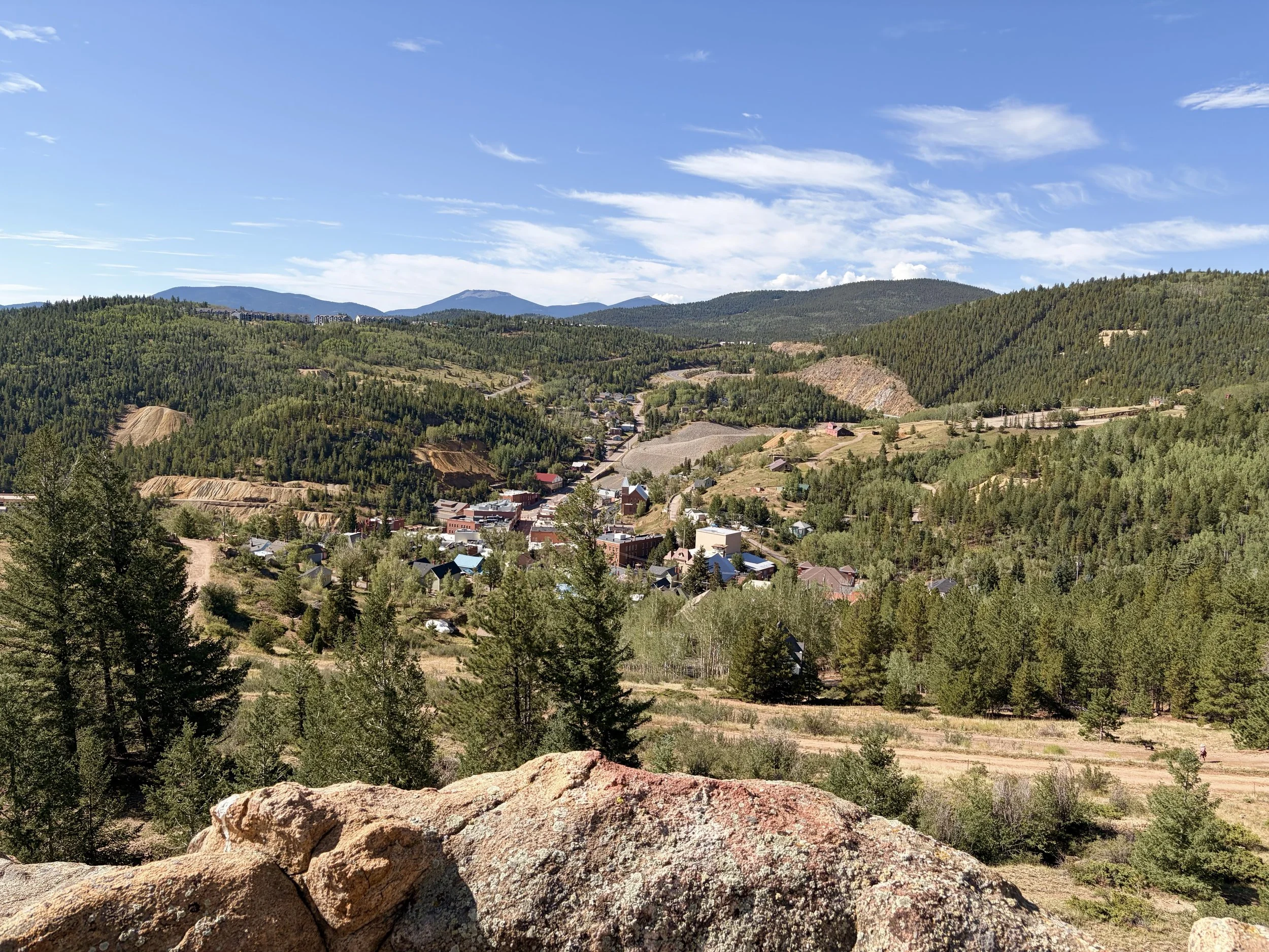
Granite outcrops, open meadows, and evergreen forests converge along the ridgeline to create a mountain landscape of remarkable beauty, ecological diversity, and enduring character. Here, geology, vegetation, and sweeping views combine to define an environment that is at once rugged, resilient, and unmistakably Colorado.
History
The mountains surrounding Bonanza Ridge are more than a remarkable landscape-they occupy the heart of the district where Colorado's Gold Rush began and where some of the state's most consequential mining communities took shape.
Following the discovery of gold in nearby Gregory Gulch in 1859, the surrounding mountains were transformed with extraordinary speed. Central City and Black Hawk emerged below, while mining activity spread across the neighboring hillsides toward Nevadaville, Quartz Hill, and the surrounding districts. Claims were surveyed across the mountains, wagon roads and tramways connected mines with mills and communities, and the landscape became part of one of the richest hard-rock gold districts in the American West.
Bonanza Ridge stood above this activity. Its location overlooking Historic Central City places it within a landscape where the physical relationship between town, mine, mountain, and transportation can still be understood today.
More than a century and a half later, forests have reclaimed much of the mountainside and the sounds of mining have faded. Yet historic claim boundaries, stone foundations, scattered mine workings, and the enduring topography continue to reveal the imprint of that extraordinary era. Bonanza Ridge remains both a remarkable natural landscape and a quiet witness to the events that helped shape Colorado.
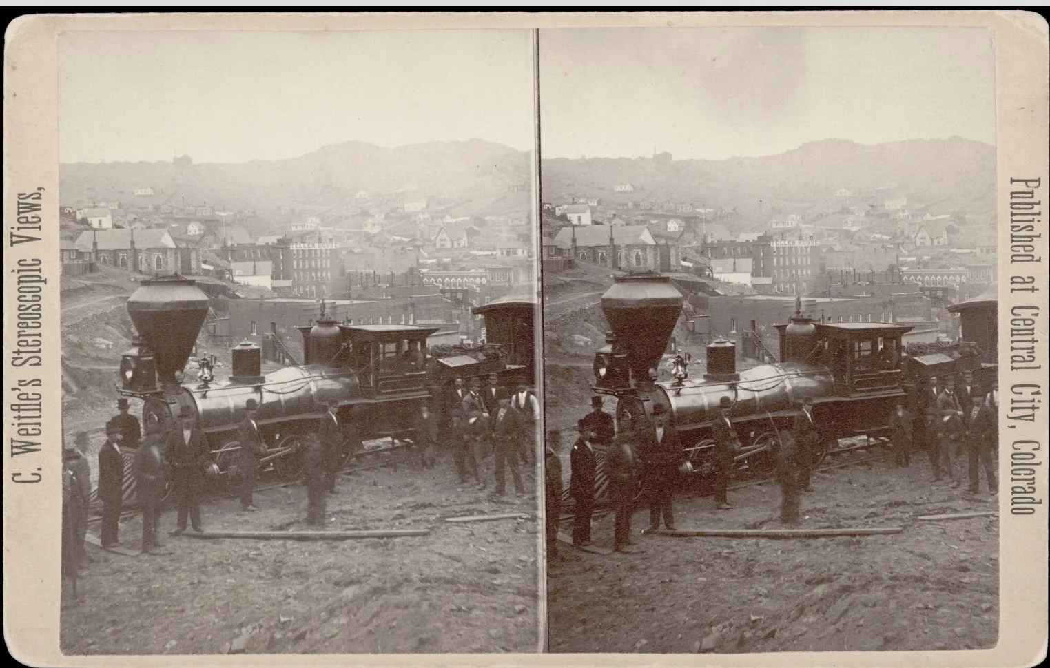
The historic photographs that follow offer a glimpse into this transformative period-revealing the intensity of activity that once surrounded these mountains and the remarkable degree to which nature has since reclaimed the landscape while preserving traces of its history.
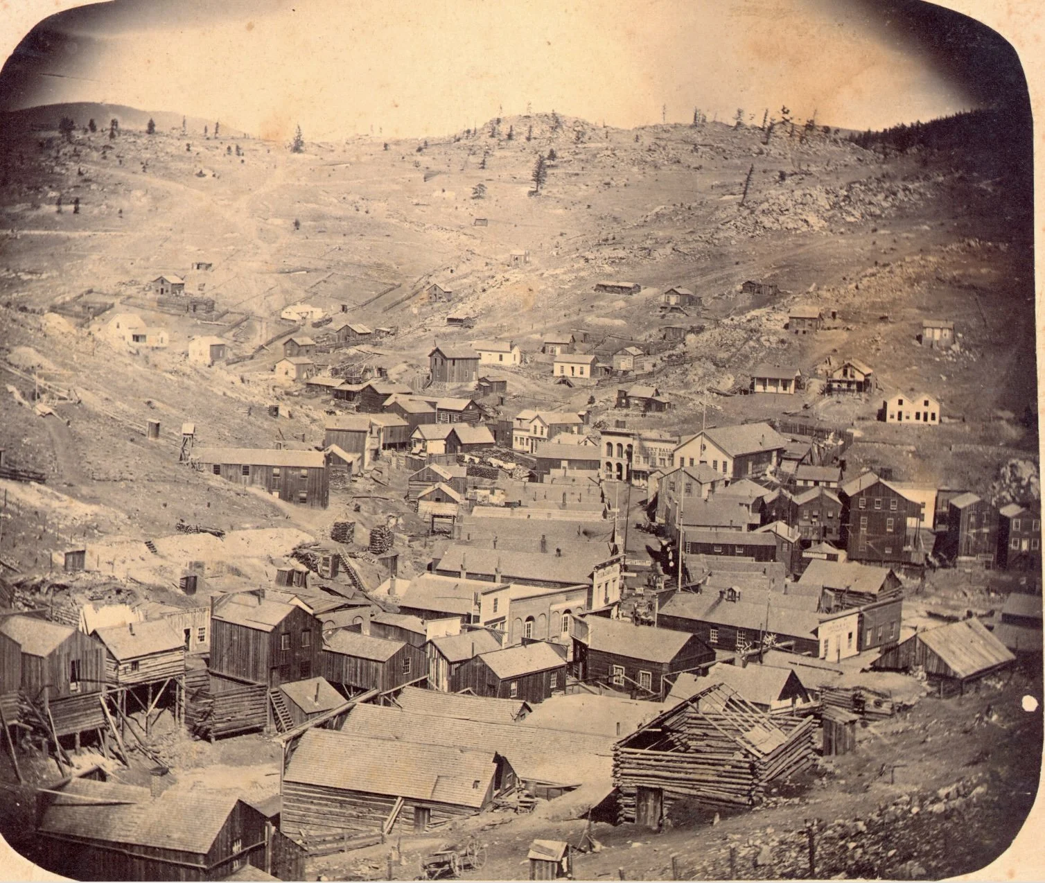
Historic Central City prior to the Great Fire of 1874, when much of the original wooden business district still lined Eureka Street. The fire transformed the town and ushered in the construction of many of the masonry buildings that define the National Historic Landmark District today.
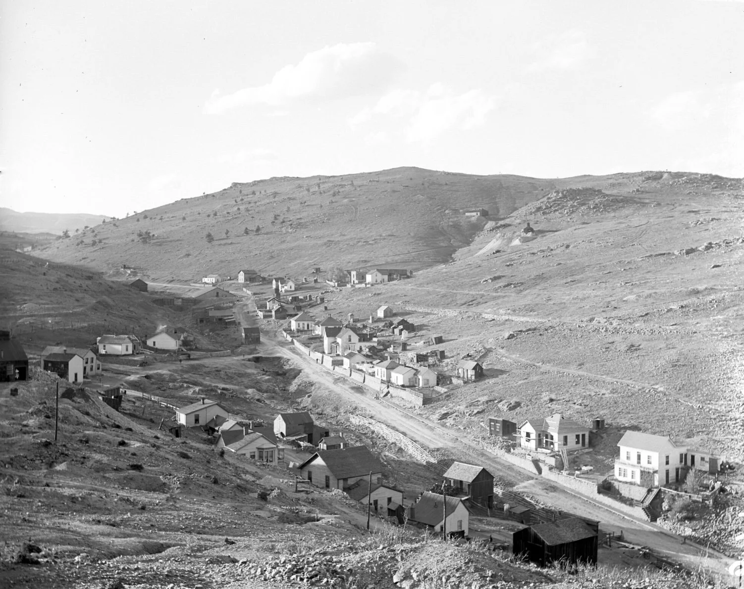
Looking west across the lower slopes of Bonanza Ridge toward the intersection of G Street and Eureka Street. The Gilpin Tram route can be seen climbing east above the homes, with Barrett Street running just beyond the rail line. Today, Bonanza Ridge continues to overlook this historic gateway into Central City's mining district, preserving a visual connection between the landscape and the community that grew beneath it.
Many of these ridgelines and transportation corridors remain visible today, allowing visitors to stand in the same landscape and trace the evolution of Historic Central City over more than 150 years.
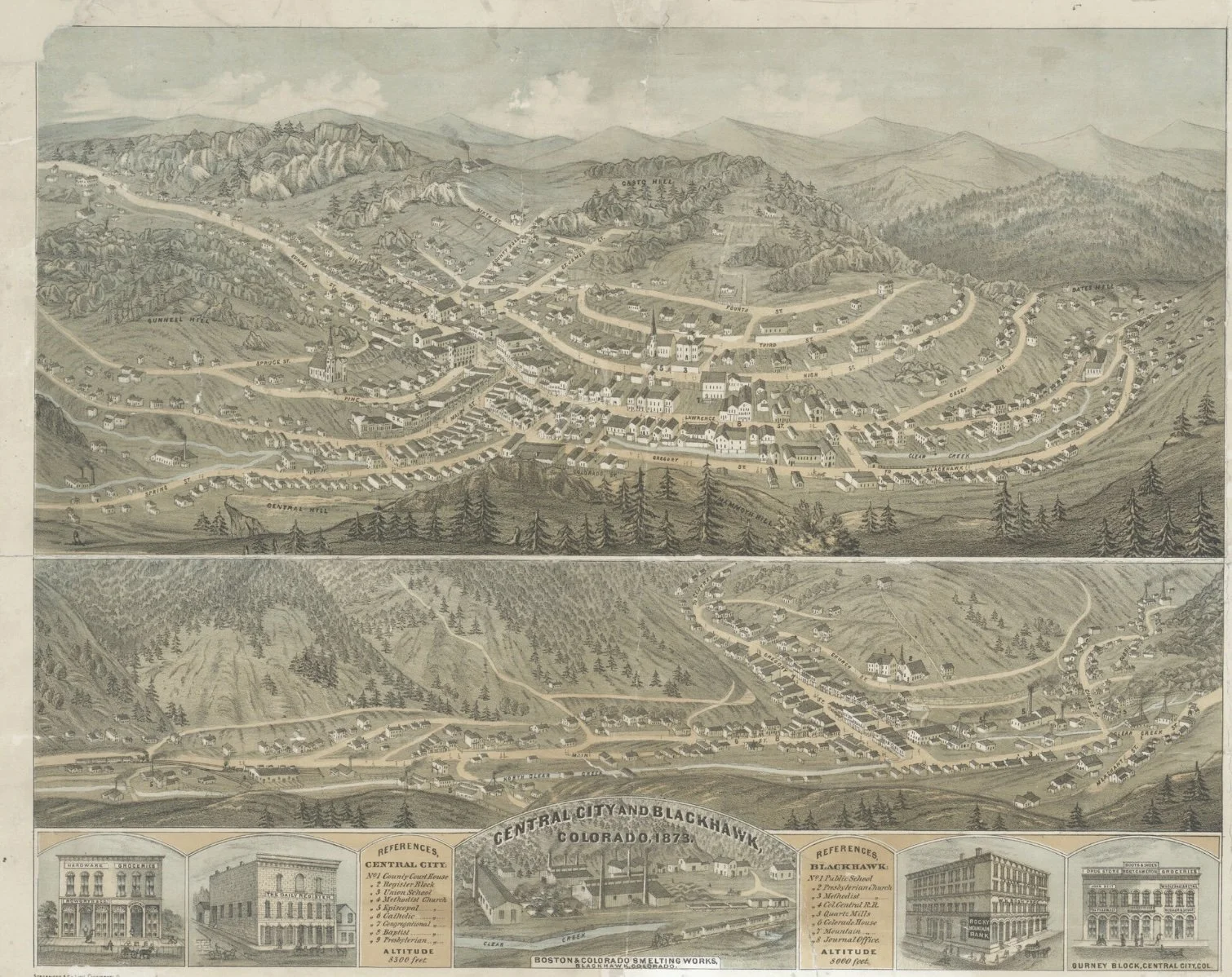
"By 1873, Central City and Black Hawk had become the commercial heart of Colorado's Central Mining District..."
THE OPPORTUNITY
Where history, infrastructure, and vision converge.
Bonanza Ridge represents one of the last significant undeveloped mountain landscapes immediately adjoining Historic Central City. With exceptional proximity to municipal water and sewer, electrical infrastructure, paved road access, and city services, the assemblage presents opportunities that have become increasingly rare throughout Colorado's mountain communities.
The scale, location, and configuration of the property create remarkable flexibility for future planning. Thoughtfully designed single-family neighborhoods, townhomes, multifamily residences, neighborhood-serving commercial uses, boutique hospitality, and carefully integrated mixed-use development all warrant thoughtful consideration, subject to applicable planning, entitlement, and regulatory approvals.
Equally compelling is the opportunity to preserve significant open space, protect prominent ridgelines, enhance public access, and strengthen the relationship between the surrounding landscape and Historic Central City. The most enduring communities are those that respect the places they inhabit, and Bonanza Ridge offers the rare opportunity to contribute thoughtfully to the continuing evolution of one of Colorado's most remarkable mountain landscapes.
"The opportunity is not simply to build within the landscape, but to become one of its next stewards."
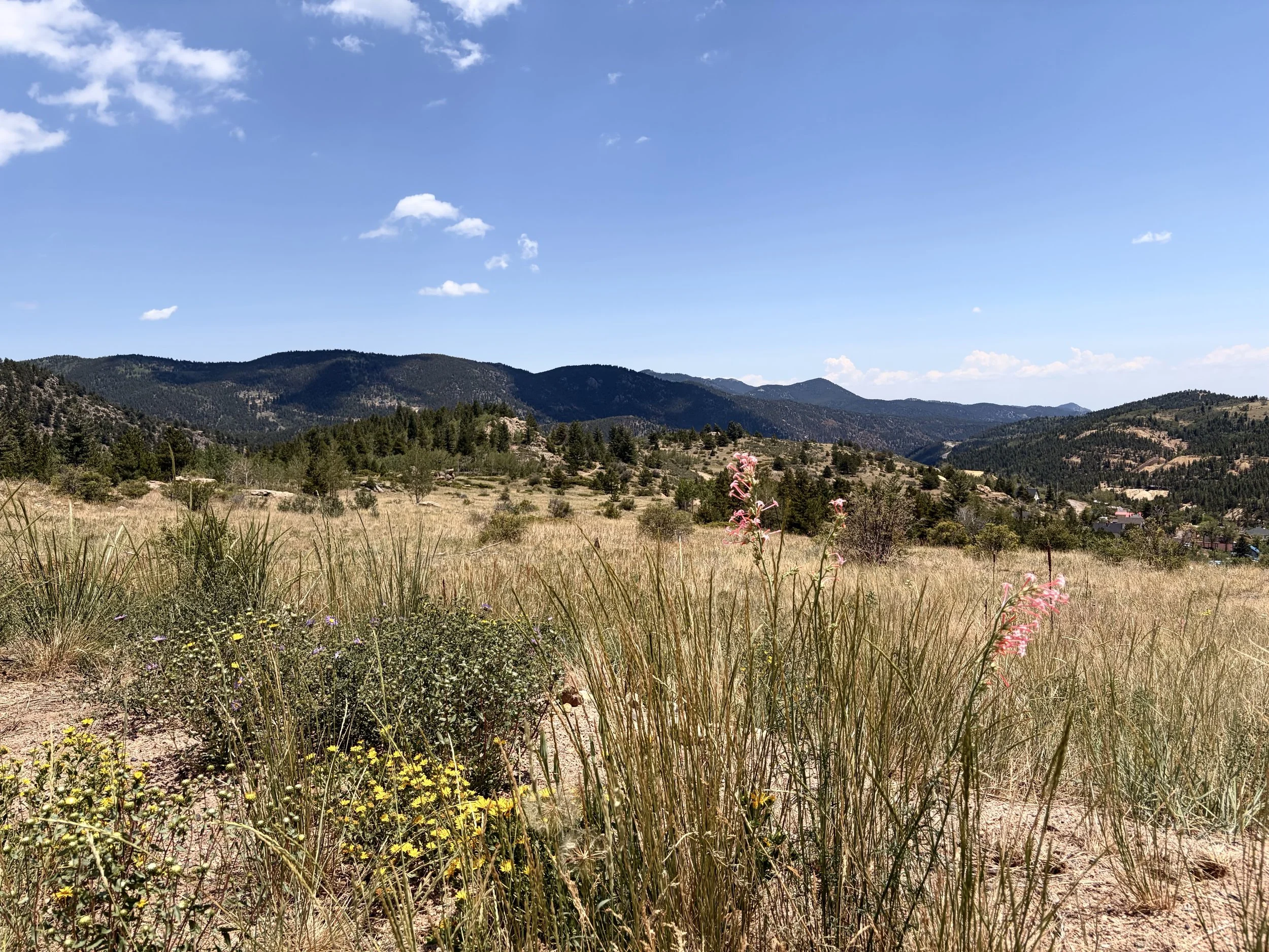
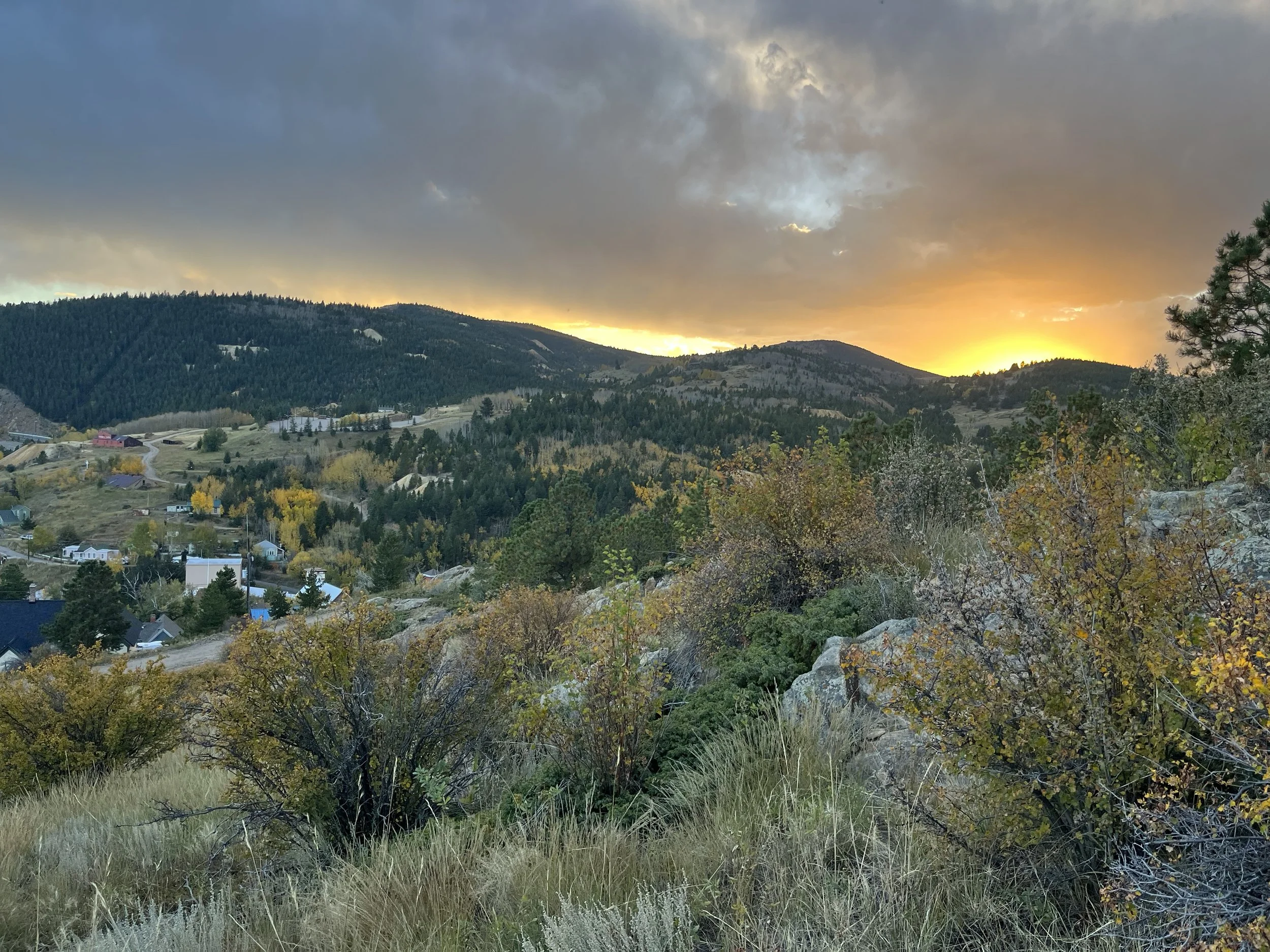
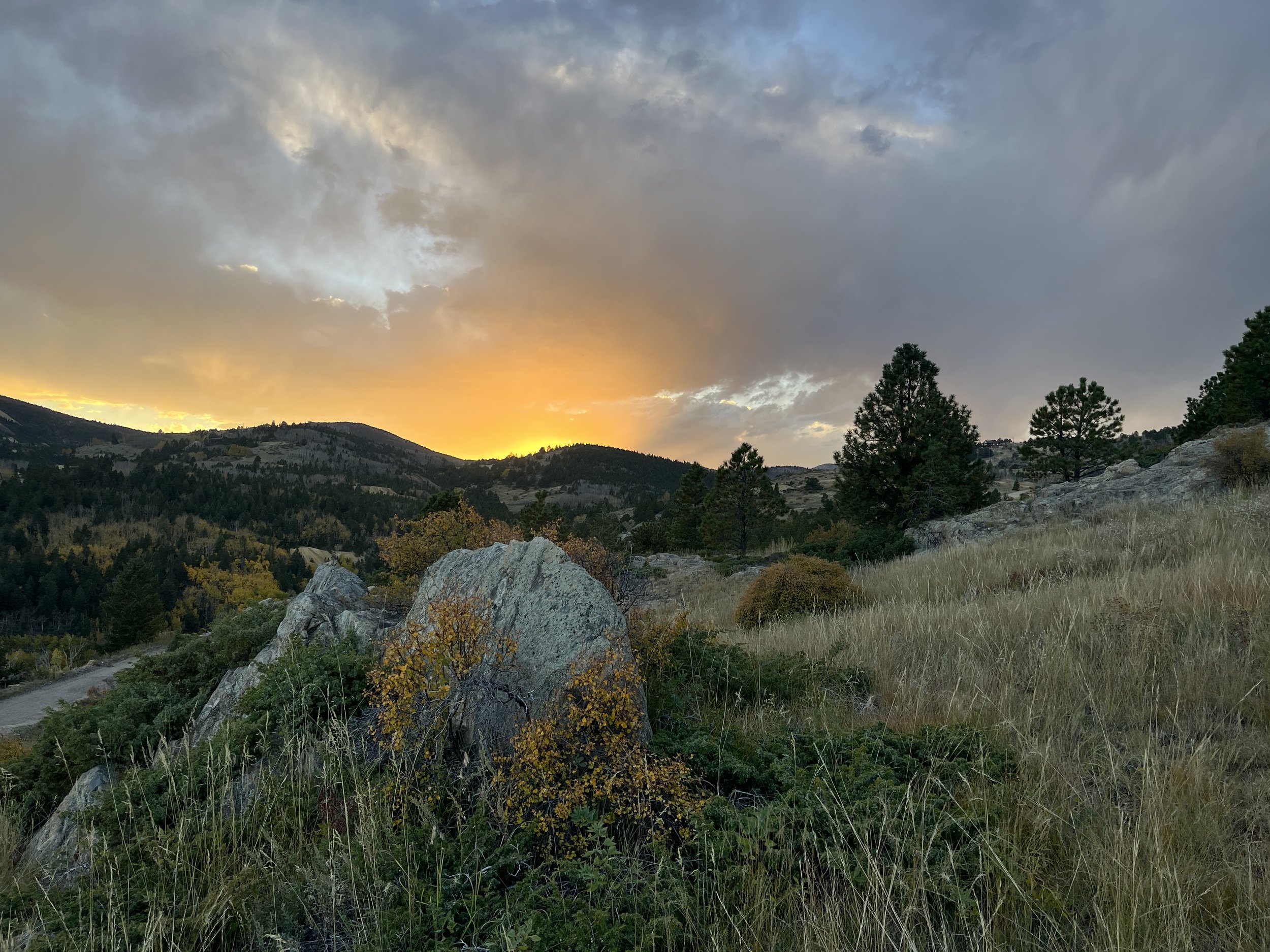
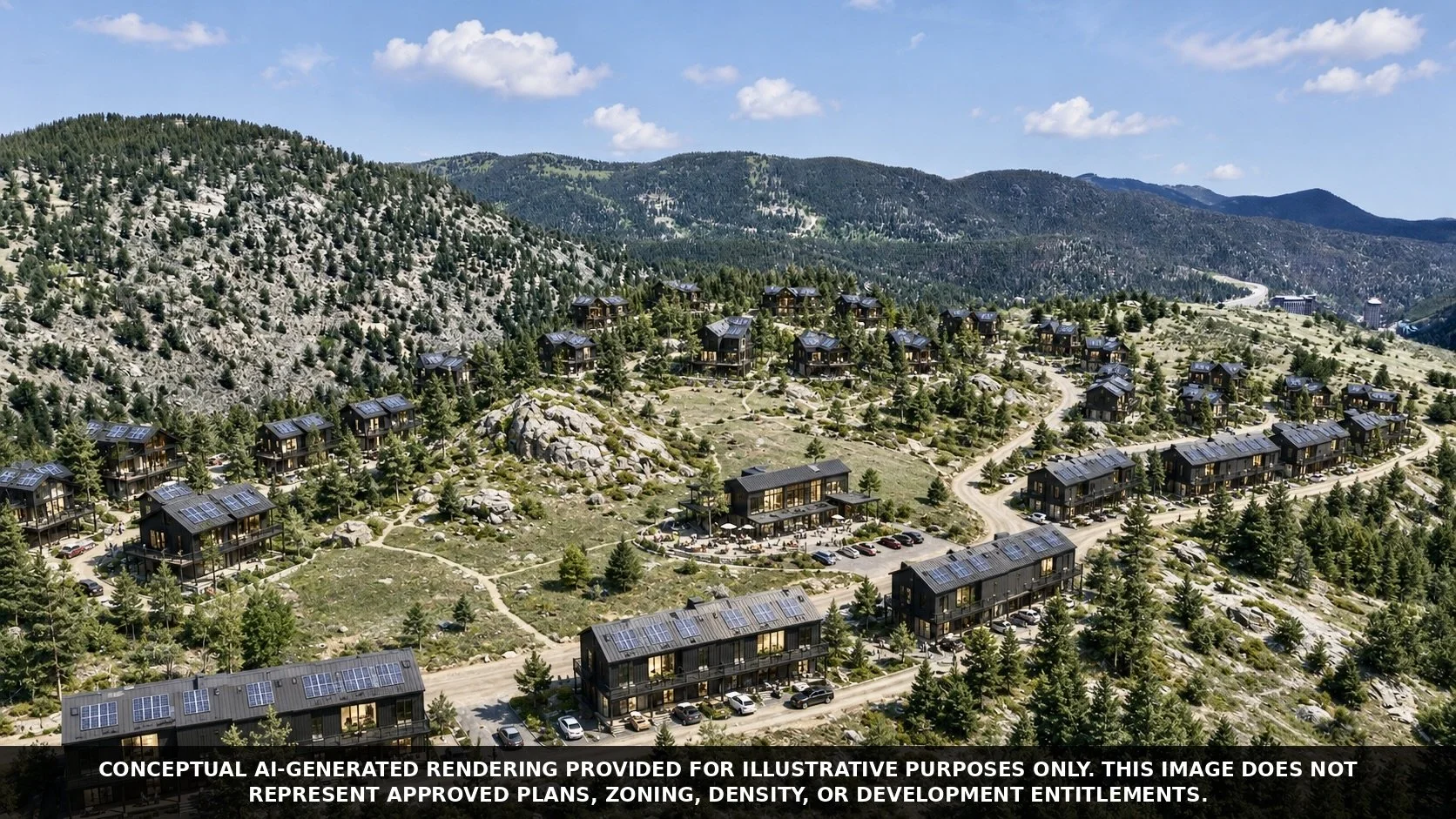
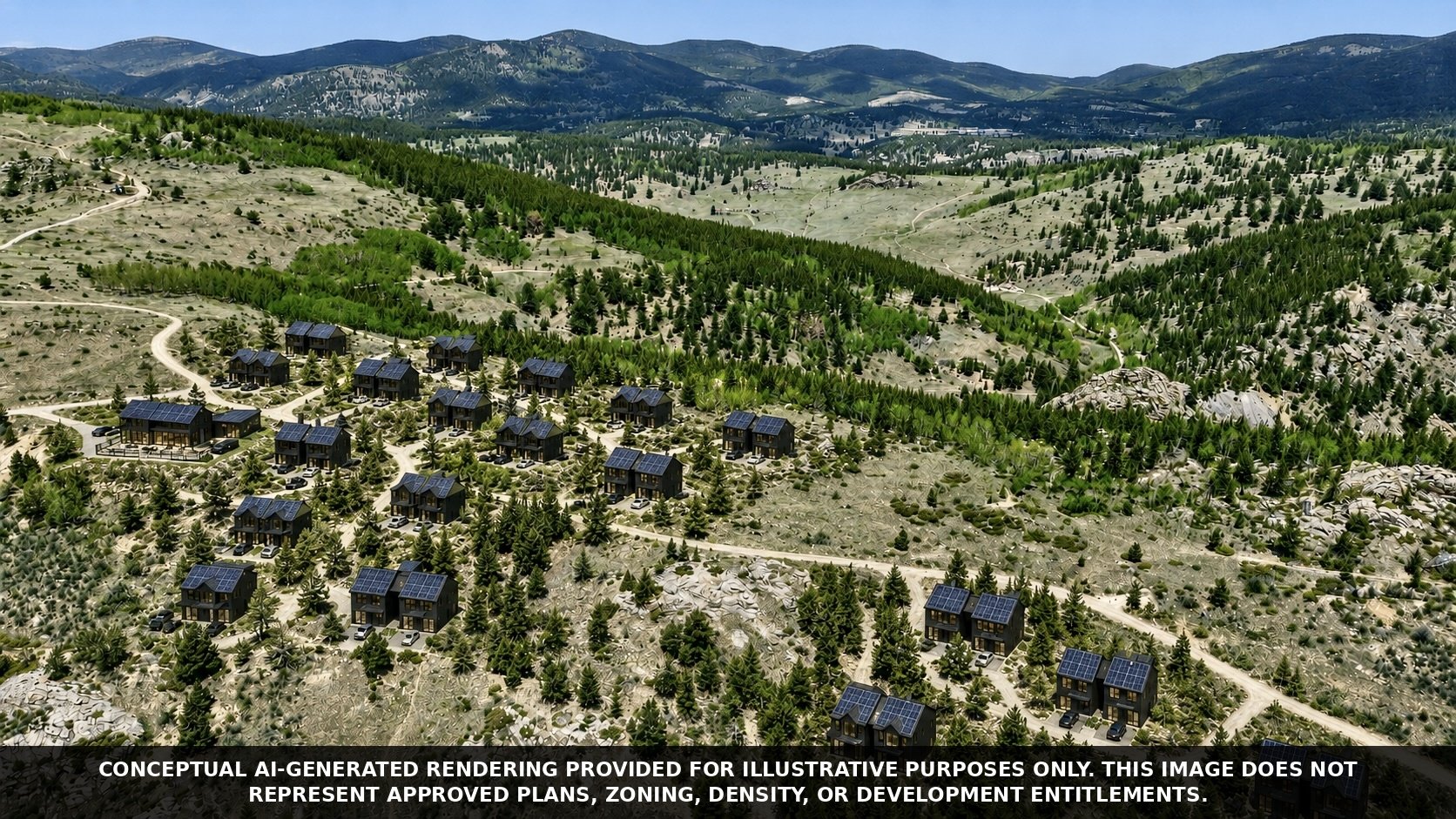
Conceptual Development Scenarios
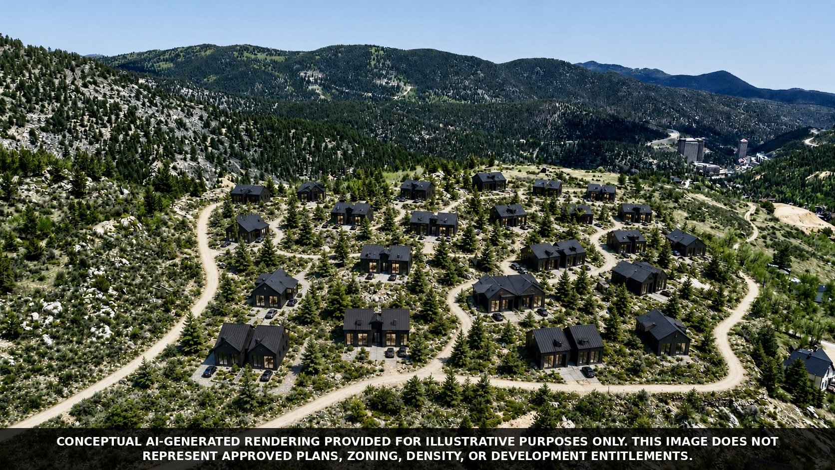
The following conceptual renderings illustrate a range of possible development approaches intended to inspire discussion. They are not proposed plans, approved densities, or representations of zoning entitlements. Rather, they explore how architecture, landscape, and conservation might coexist while respecting the character of Bonanza Ridge.
Roworth Heights
Demonstrating the Path from Vision to Reality
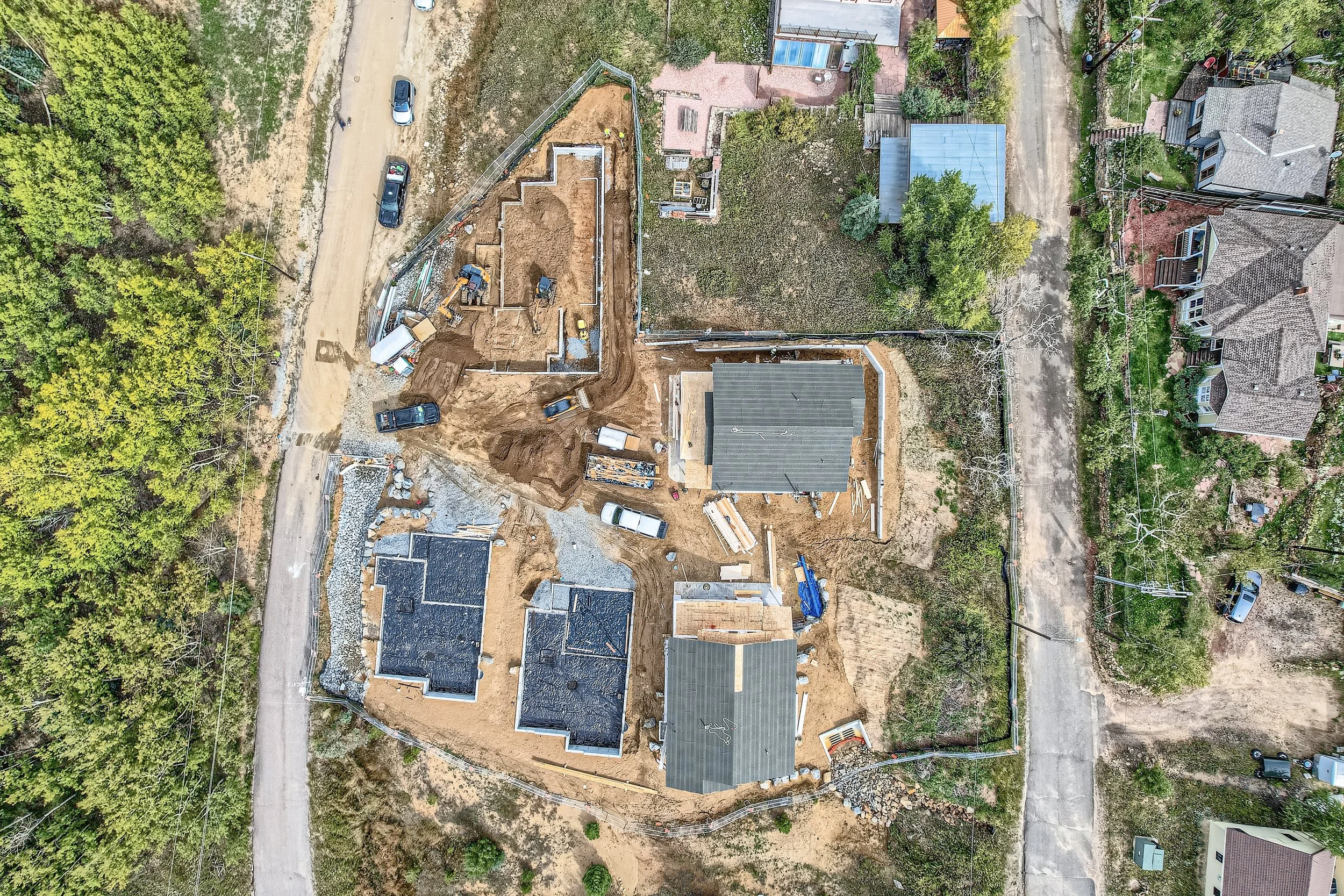
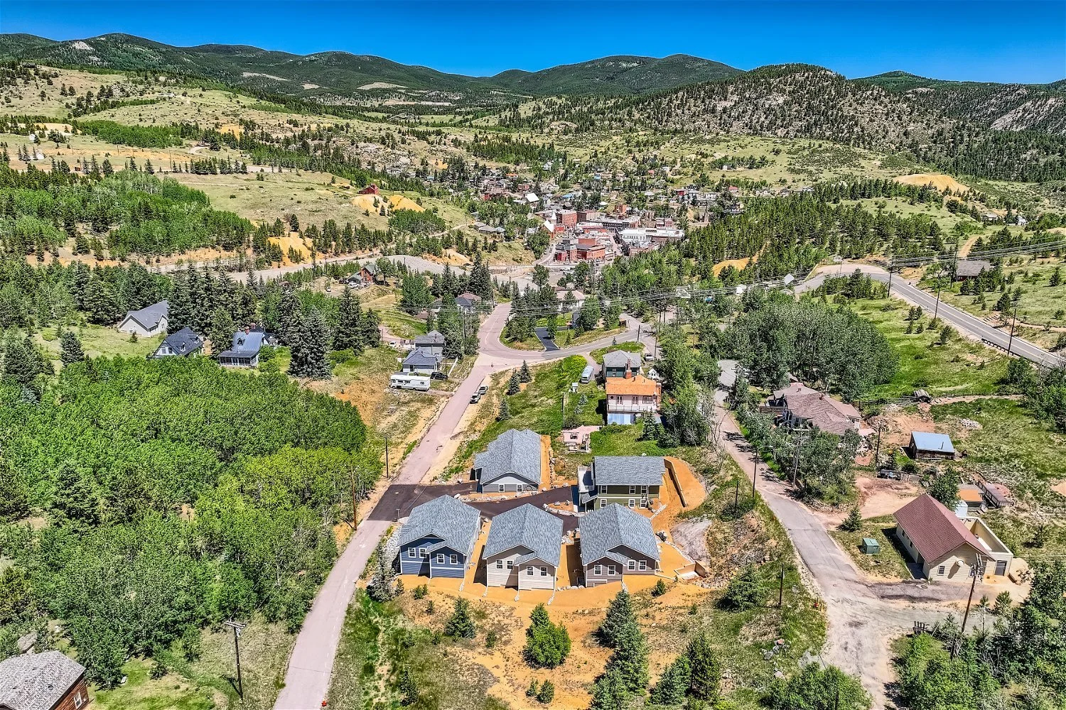
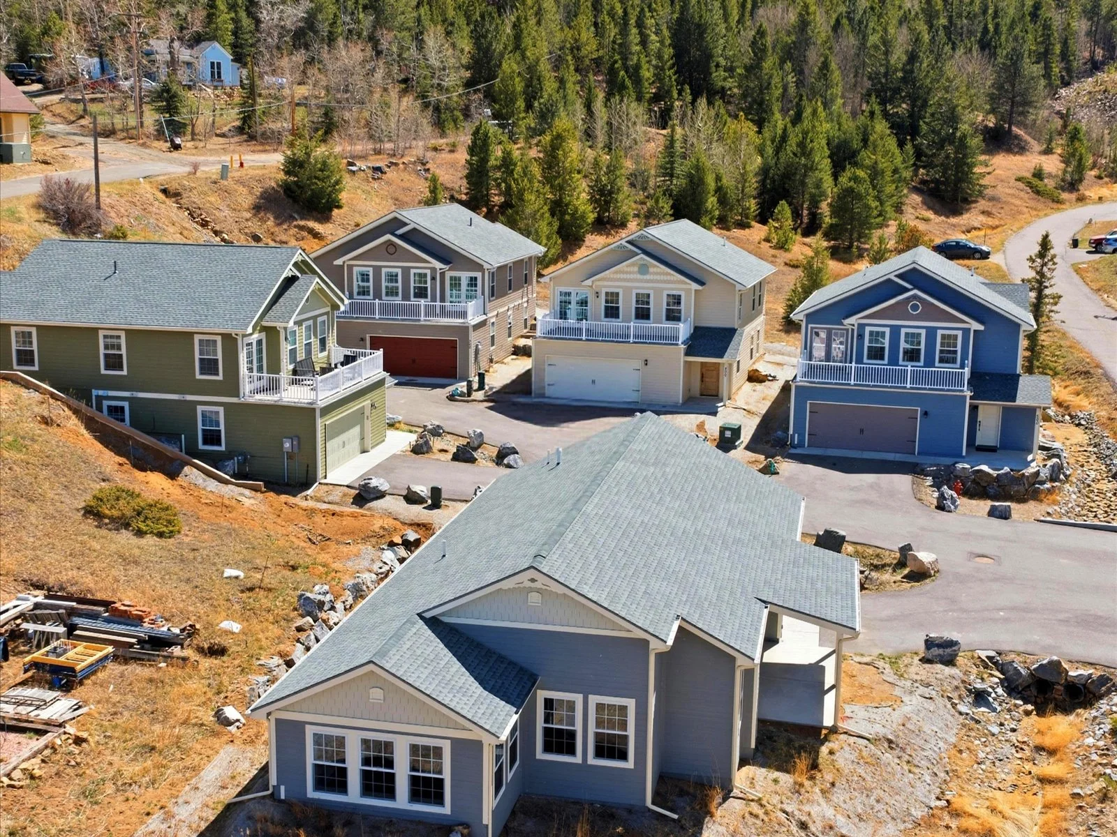
The successful completion of Roworth Heights represents more than the construction of five homes. It demonstrates the successful navigation of one of Colorado's most demanding development environments, requiring subdivision approval, historic preservation review, municipal planning, engineering, and construction within the Central City National Historic District.
Conceived as a deliberately modest neighborhood, Roworth Heights was intended as a proof of concept-a demonstration that thoughtful residential development could be achieved while respecting the architectural character and regulatory requirements of one of Colorado's most historically significant communities. The project ultimately became the first new subdivision approved within the City of Central in more than a century.
While intentionally limited in scale, the experience gained through Roworth Heights established a practical foundation for considering the broader planning, entitlement, and development opportunities presented by the Bonanza Ridge Assemblage. It demonstrates that VEDA MODERN successfully guided a complex project from vision through approvals, infrastructure, construction, and completion within one of Colorado's most highly regulated historic environments.
A Proven Demonstration Within a National Historic District
Because Roworth Heights was located within the Central City National Historic District, the homes were intentionally designed in a Carpenter Gothic–inspired architectural vocabulary to comply with the design standards of the Central City Historic Preservation Commission. While distinct from the contemporary design language of VEDA MODERN, the project demonstrates the ability to successfully navigate the entitlement process, design, and construct within one of Colorado's most demanding historic review environments.
The photographs that follow document the progression from vision to reality-from subdivision and infrastructure, through active construction, to the completed neighborhood. More importantly, they demonstrate that VEDA MODERN successfully guided a complex development through municipal approvals, historic preservation review, engineering, and construction within the City of Central.
Roworth Heights serves as tangible evidence that ambitious development concepts can become successful built projects when supported by thoughtful planning, perseverance, and disciplined execution.
Regional Context
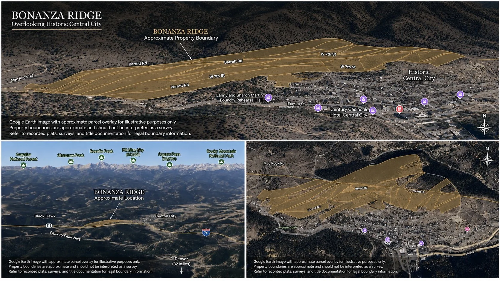
Bonanza Ridge is best understood not as an isolated property, but as part of a much larger landscape assembled through decades of patient acquisition, research, and stewardship.
The following Google Earth perspectives illustrate the relationship between Bonanza Ridge and the broader Bonanza Land LLC portfolio, placing the assemblage within the historic mining districts of Gilpin County and demonstrating its proximity to Central City, Black Hawk, Denver, and the Colorado Front Range.
Together, these maps reveal the scale of the opportunity and the remarkable continuity of a landscape assembled over more than thirty years.
Legacy & Stewardship
For more than three decades, Bonanza Land LLC has assembled and carefully stewarded one of the most remarkable collections of patented mining properties in Colorado. Bonanza Ridge represents one chapter within that larger story-a landscape where history, ecology, and future opportunity continue to intersect.
We do not believe we own these mountains.
We become their stewards for a brief chapter in a story that began long before us and will continue long after we are gone.
Every decision made today has the potential to influence the character of this landscape for generations to come. Whether preserving open space, restoring historic features, creating new neighborhoods, or introducing contemporary architecture, the measure of success is not simply what is built, but how thoughtfully it belongs to the land.
Bonanza Ridge offers the rare opportunity to shape the future of a remarkable mountain landscape while honoring the history that defines it. Responsible stewardship means understanding the land before changing it, respecting its ecology as deeply as its heritage, and recognizing that the greatest developments are those that leave the landscape stronger than they found it.
The legacy of Bonanza Ridge will ultimately be measured not by the buildings it contains, but by the landscape it continues to preserve.
Looking Forward
Bonanza Ridge offers the uncommon opportunity to steward a significant mountain landscape while thoughtfully shaping its future. Whether envisioned as a legacy family holding, a collection of private alpine retreats, a conservation initiative, or a carefully planned mountain community, the assemblage possesses the scale, diversity, and location to support a broad range of thoughtful possibilities.
Whatever form that future may take, it should be guided by the qualities that make Bonanza Ridge exceptional today-its forests, granite ridgelines, wildlife habitat, expansive views, and enduring sense of place. The most successful mountain communities are those that respond to the landscape rather than compete with it, allowing architecture, infrastructure, and open space to exist in lasting balance.
In an era when large, contiguous mountain landscapes are increasingly rare, Bonanza Ridge offers more than an opportunity to acquire land. It offers the privilege of becoming a steward of one of Colorado's remarkable high-country environments-and the responsibility of helping shape its next chapter.
CHAPTER II
________________________________________
NEVADAVILLE •
QUARTZ HILL • PROSSER GULCH
Colorado's Living Mining Landscape
Overview
Few places in the American West possess the historical depth and physical integrity of Nevadaville, Quartz Hill, and Prosser Gulch. Among the richest gold-producing landscapes in Colorado, this remarkable assemblage encompasses historic mining claims, surviving townsites, prominent ridgelines, and forested mountain terrain that collectively tell the story of Colorado's earliest Gold Rush.
Today, these landscapes present an uncommon opportunity to steward one of the state's most historically significant mining districts while thoughtfully exploring preservation, adaptive reuse, recreation, residential development, and heritage tourism. Together, they represent far more than a remarkable collection of land-they offer the rare opportunity to help shape the future of one of Colorado's defining historic places.
THE LANDSCAPE
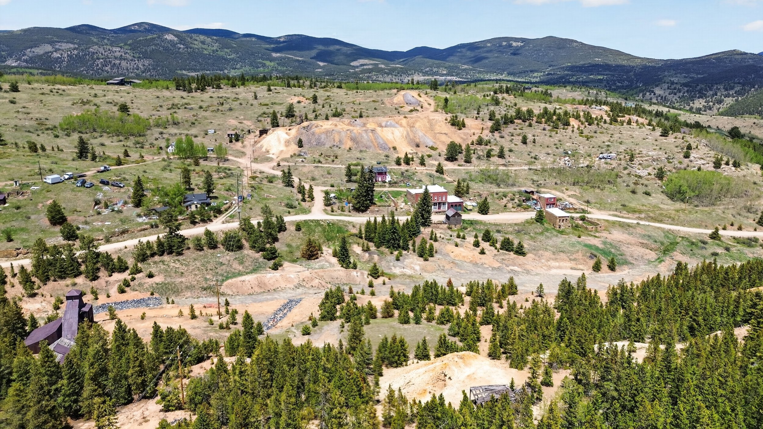
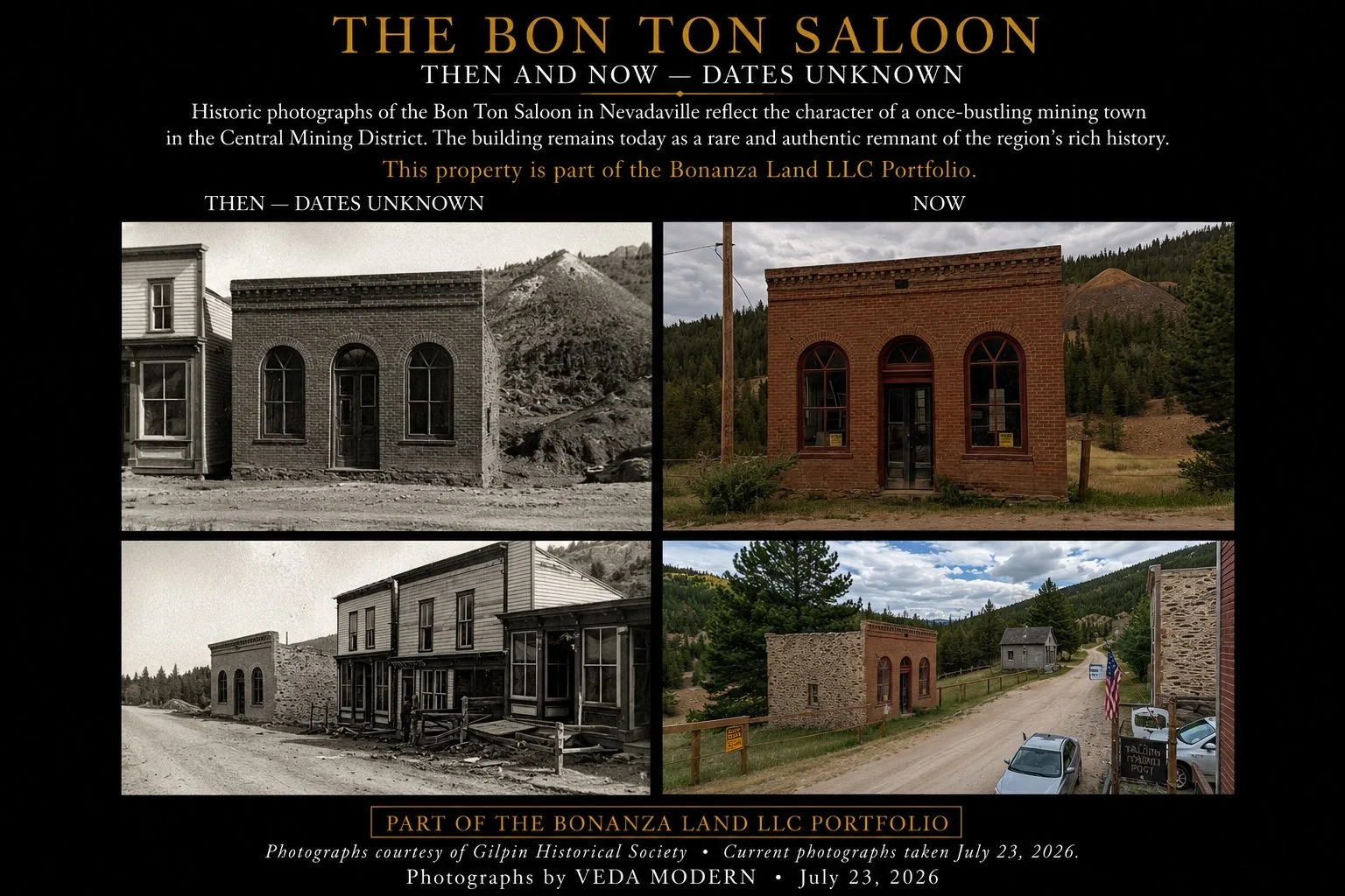
Nestled within a high mountain basin, the historic townsite of Nevadaville remains one of Colorado's most authentic mining landscapes. Once home to thousands of miners and their families, the community is still defined by surviving buildings, stone foundations, mine workings, and historic roads that reveal the enduring fabric of one of the state's earliest gold camps.
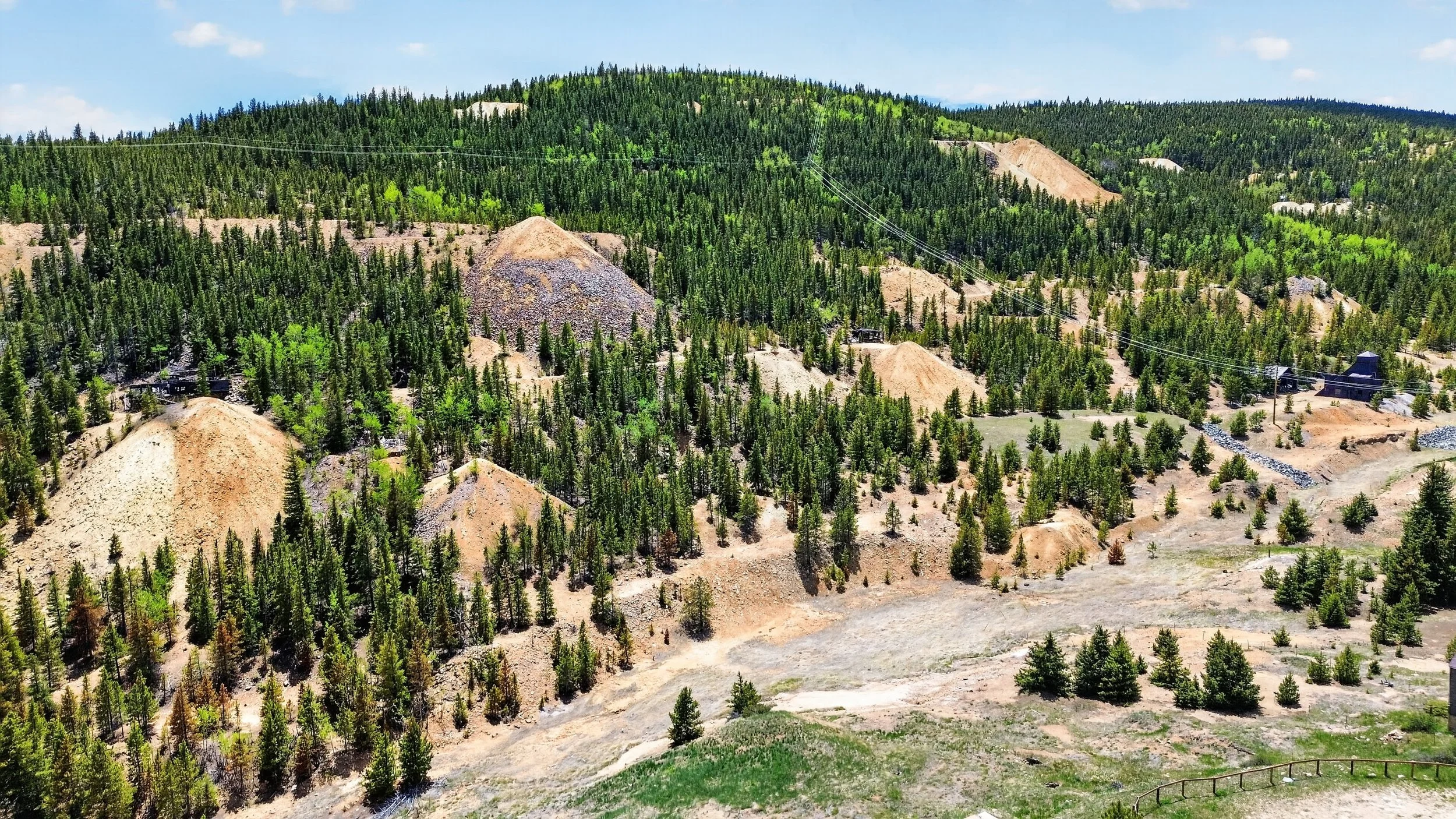
Quartz Hill became synonymous with some of Colorado's richest hard-rock gold discoveries, producing extraordinary wealth that helped define the Central Mining District. Today, regenerating forests weave through historic workings, creating a landscape that feels as much archaeological preserve as mountain wilderness-a place where the story of Colorado's gold rush remains etched into the land.
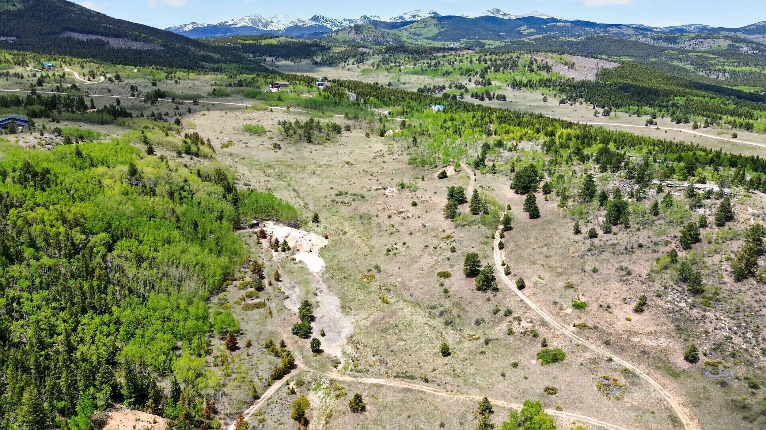
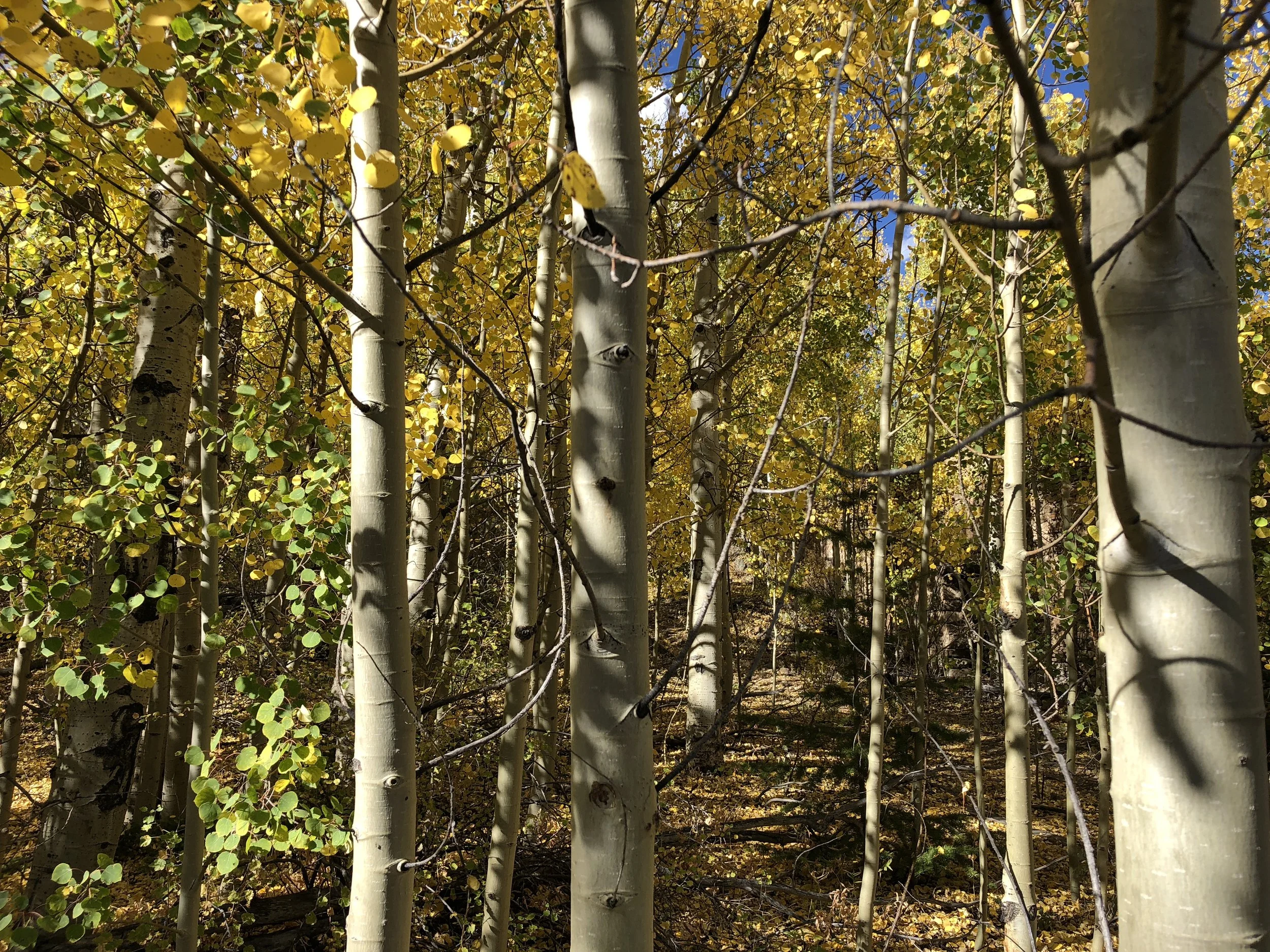
Stretching west from the historic townsite of Nevadaville, Prosser Gulch unfolds as a broad mountain landscape of open meadows, aspen groves, and forested hillsides. Rich in history yet remarkably serene, it offers a rare opportunity to preserve its historic character while thoughtfully shaping its next chapter through conservation, recreation, and carefully integrated future development.
The History of Nevadaville
Following the course of Nevada Gulch, the community of Nevadaville emerged during the earliest years of Colorado's Gold Rush and quickly became one of the Territory's most prosperous mining settlements. As exceptionally rich hard-rock discoveries were made on nearby Quartz Hill, miners, engineers, merchants, families, and entrepreneurs established a thriving mountain community whose influence extended far beyond the Historic Central Mining District.
During the latter half of the nineteenth century, Nevadaville became home to thousands of residents drawn by the extraordinary mineral wealth of Quartz Hill. Immigrants-particularly from Cornwall, England-brought generations of mining knowledge that shaped both the character of the community and the remarkable productivity of its mines. Churches, schools, businesses, boarding houses, and civic institutions transformed a rugged mountain valley into one of Colorado's most important mining communities.
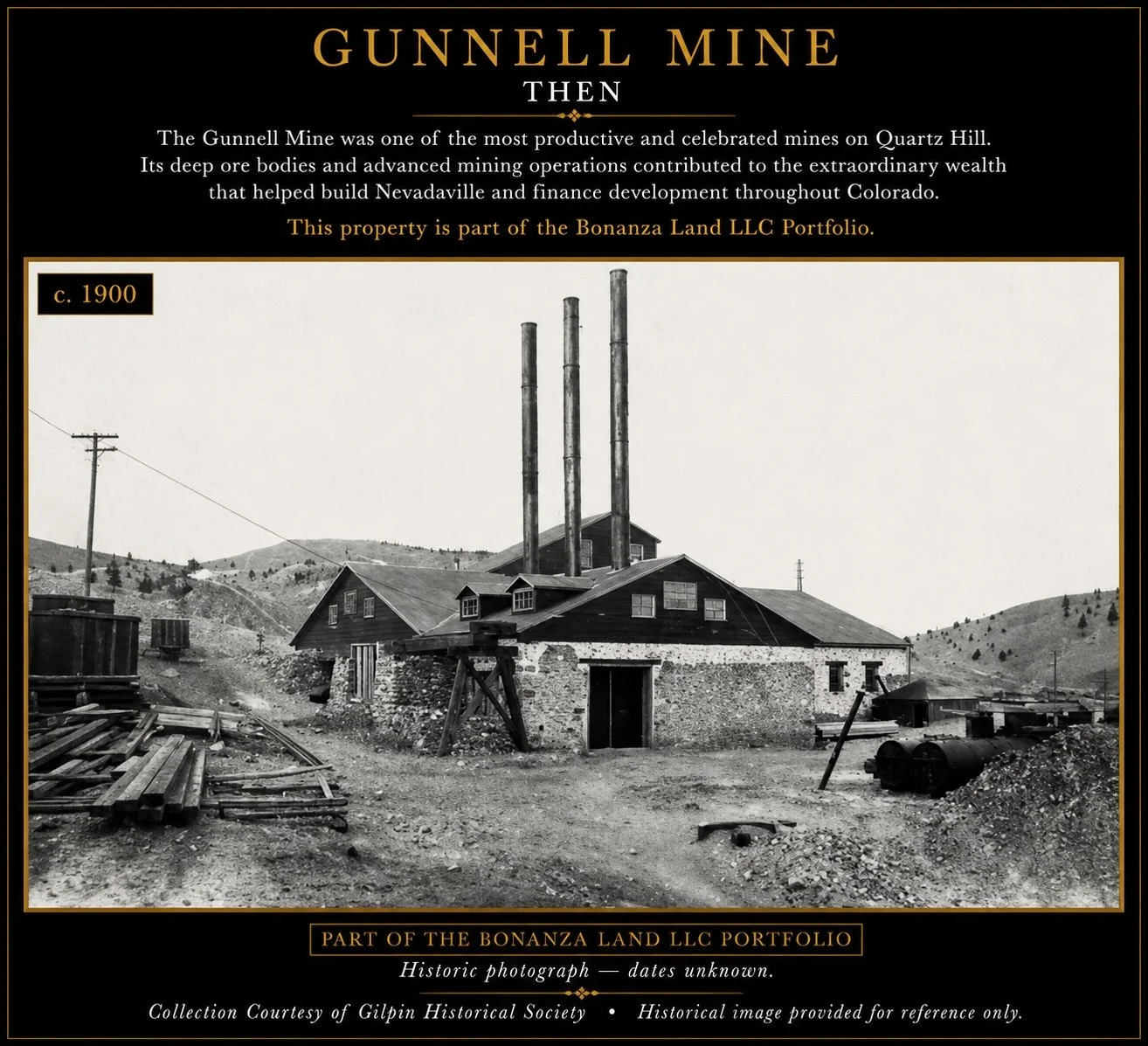
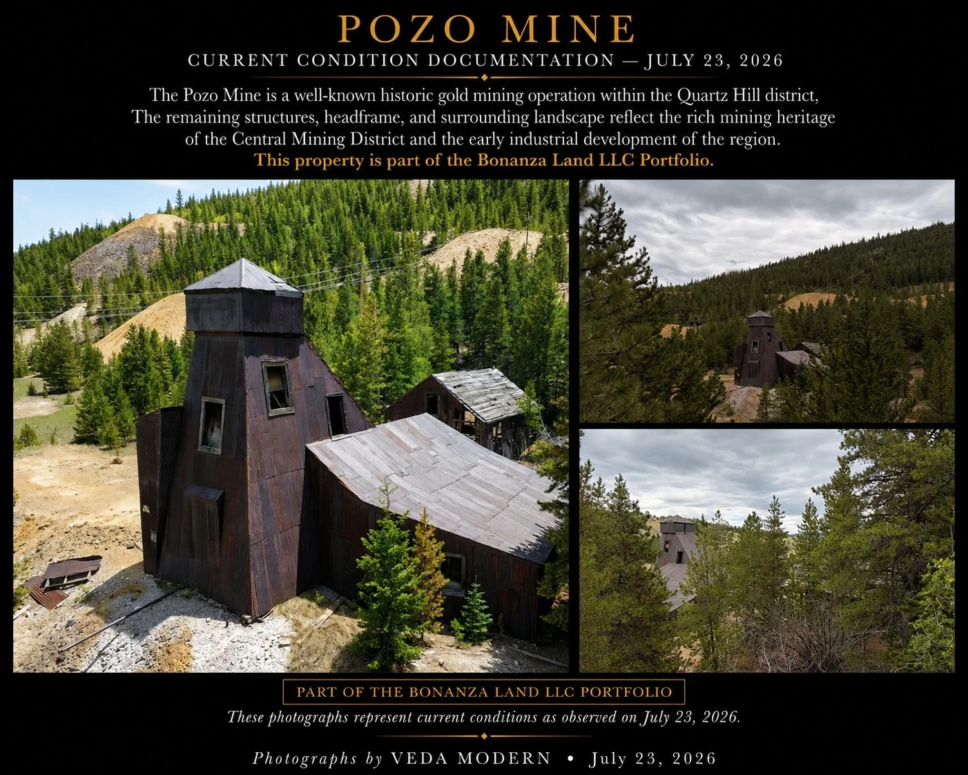
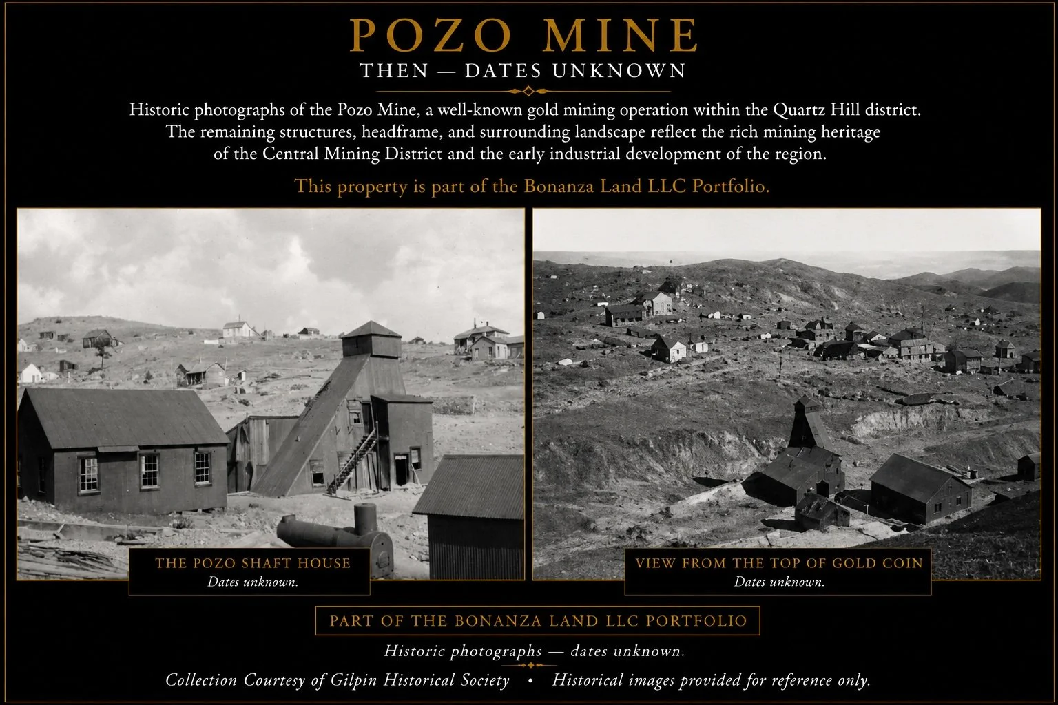
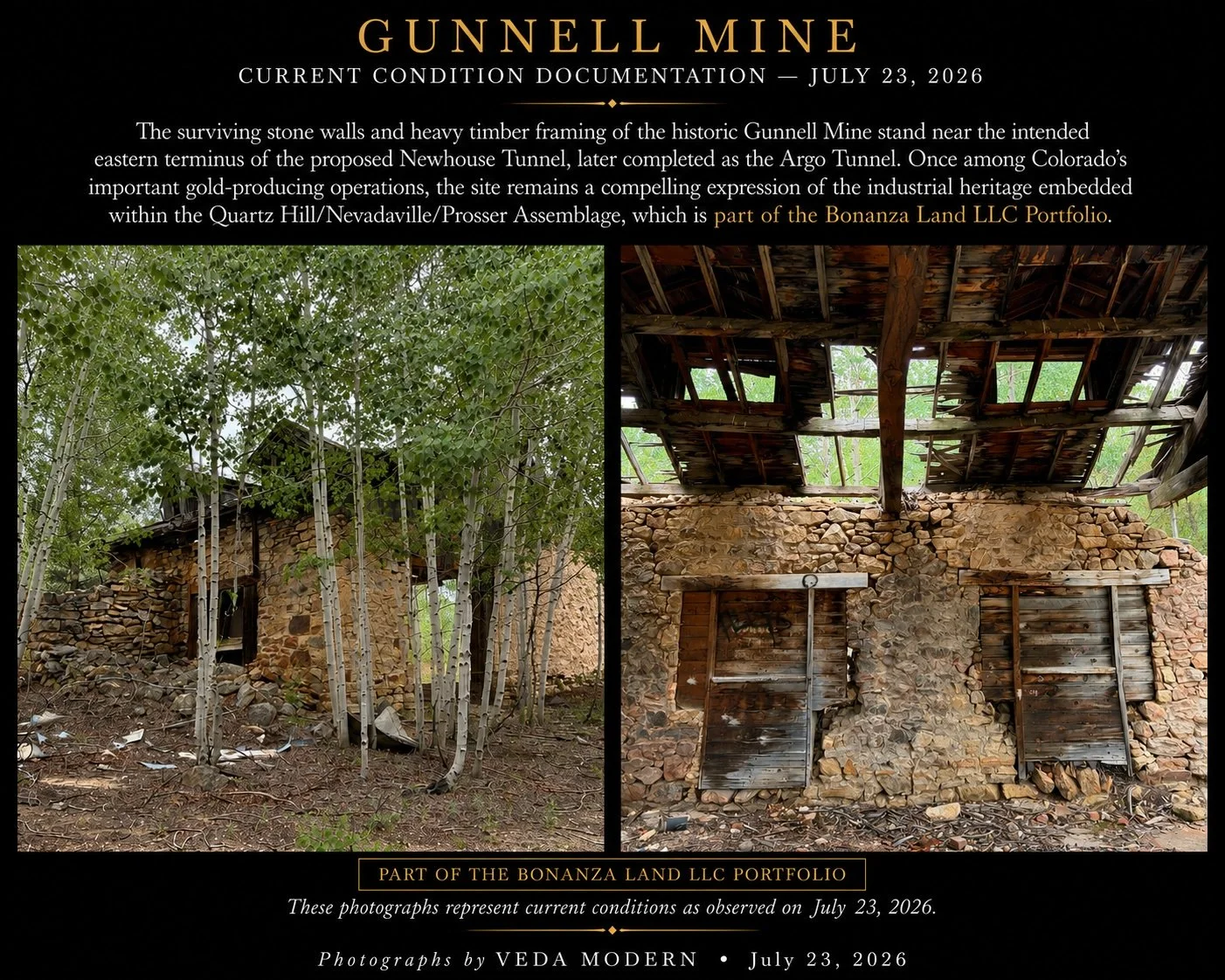
The exceptional gold-bearing veins of Quartz Hill yielded some of Colorado's richest hard-rock discoveries, generating extraordinary wealth that helped finance railroads, banks, businesses, and industries during the Territory's formative years. Legendary mines-including the Gunnell, Kansas, Burroughs, Hidden Treasure, and many others—became synonymous with the remarkable productivity of the district, establishing Nevadaville among the most celebrated hard-rock mining communities in the American West.
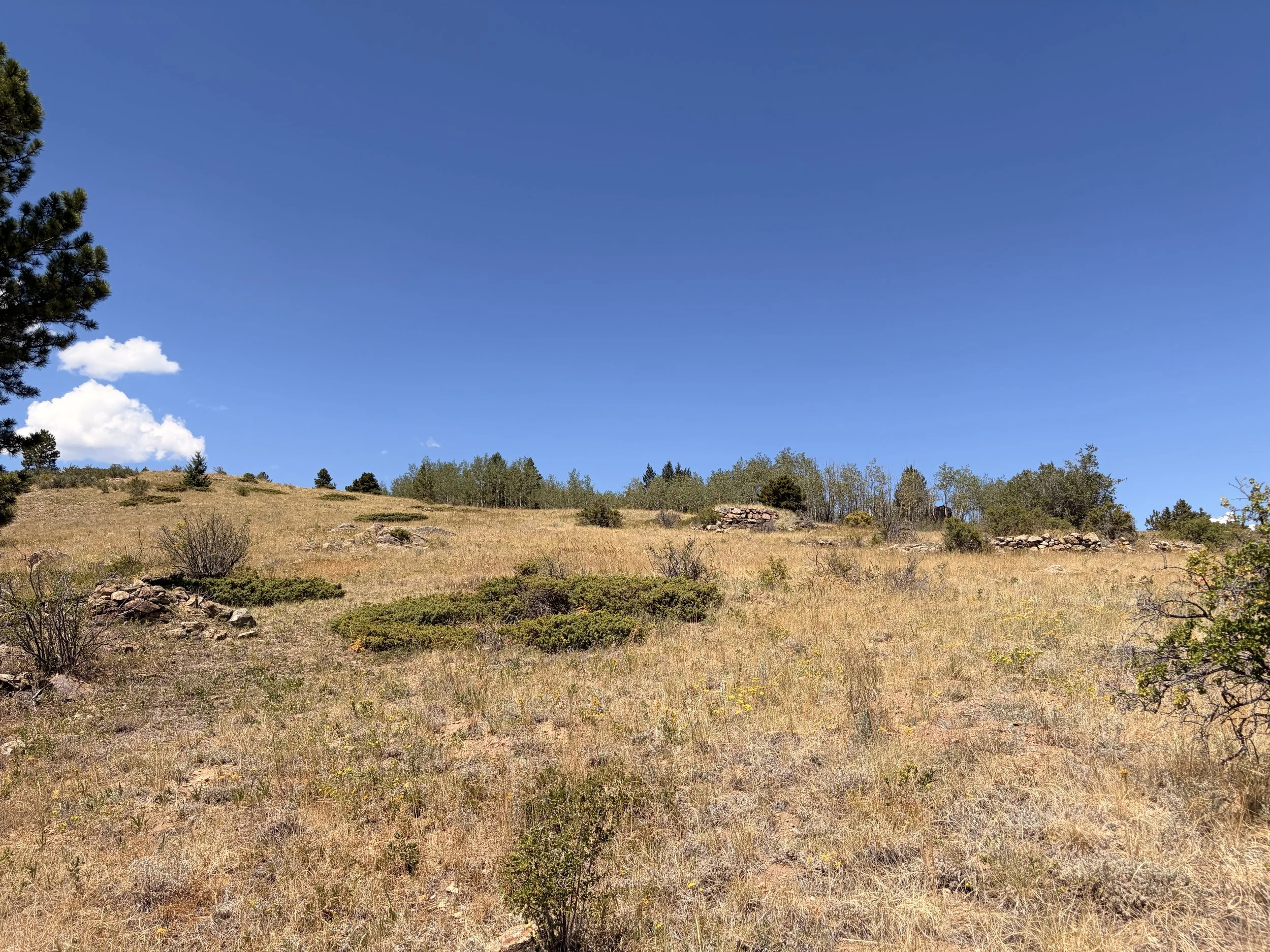
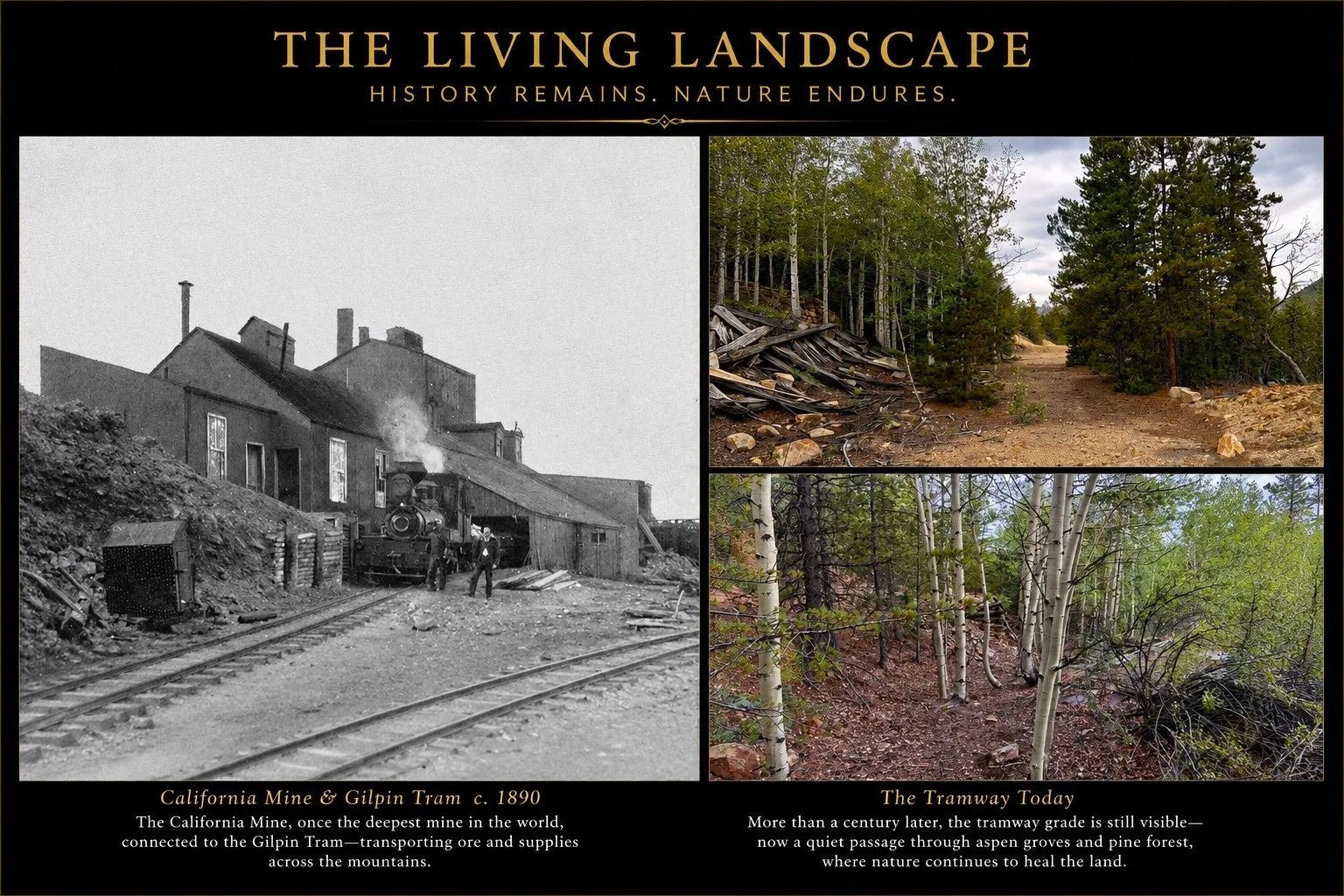
As mining gradually declined, the landscape entered a new chapter. Forests reclaimed the hillsides, historic roads continued to follow their original alignments, and the physical fabric of the mining district remained remarkably intact. Stone foundations, surviving structures, and subtle traces of nineteenth-century industry continue to emerge throughout the landscape, creating an extraordinary cultural setting where Colorado's Gold Rush can still be experienced rather than simply remembered.
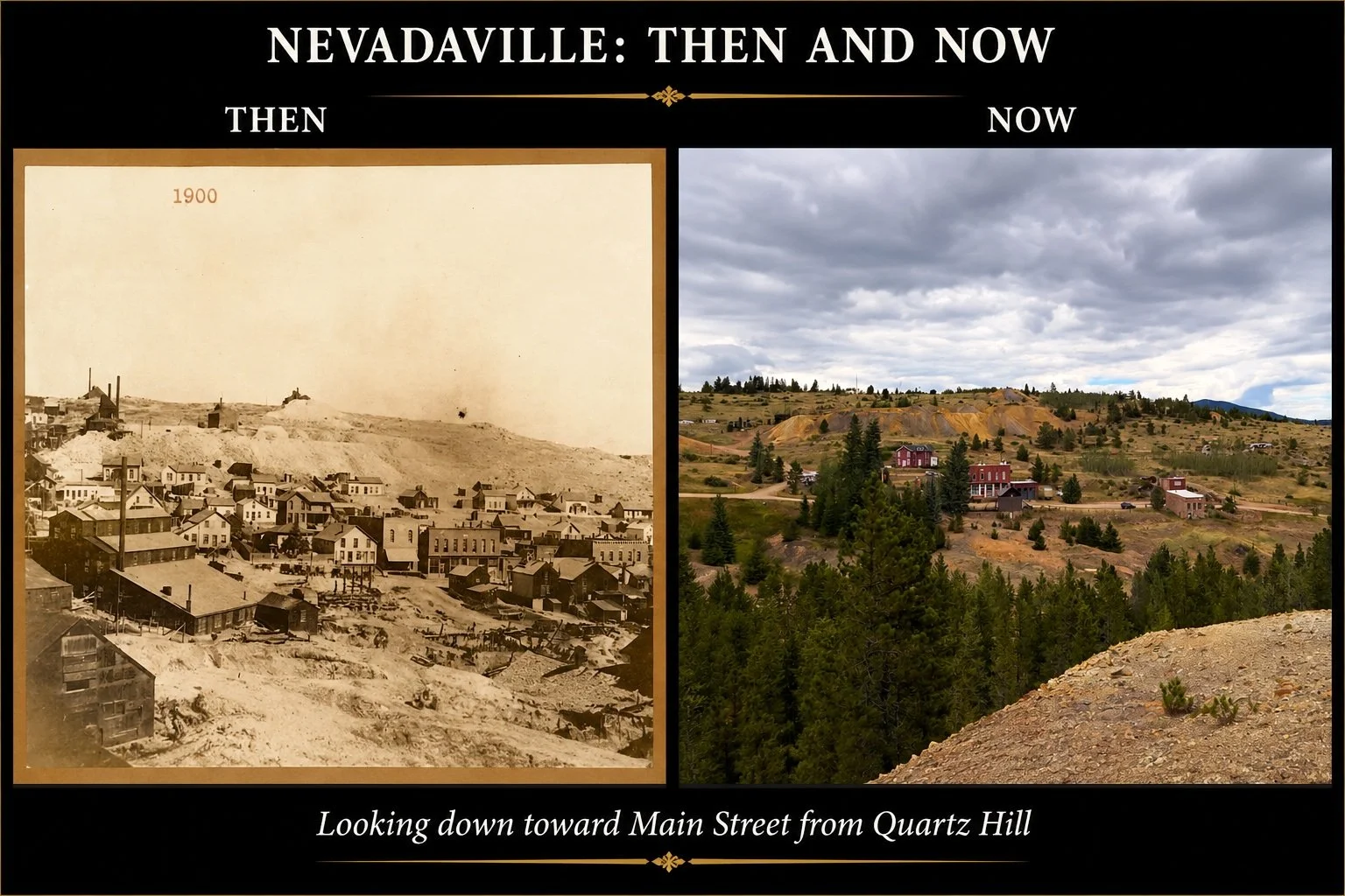
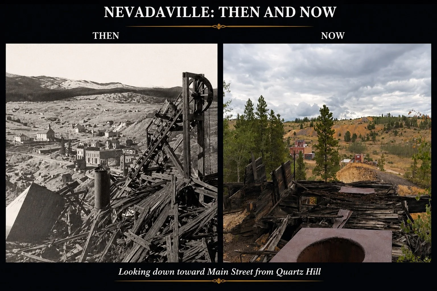
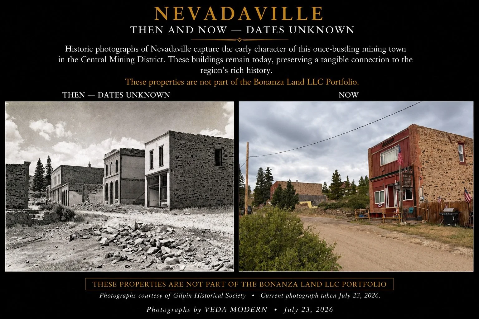
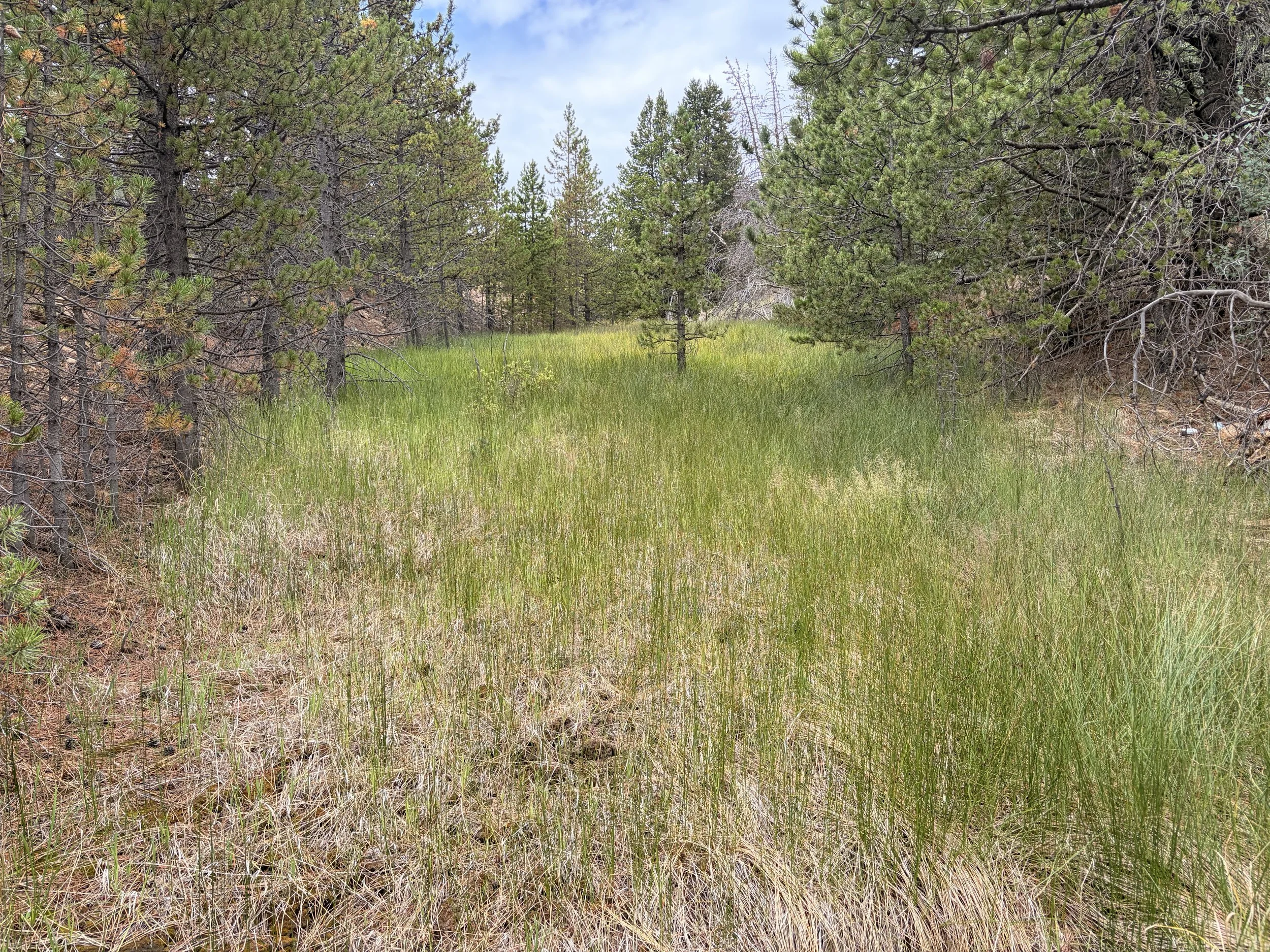
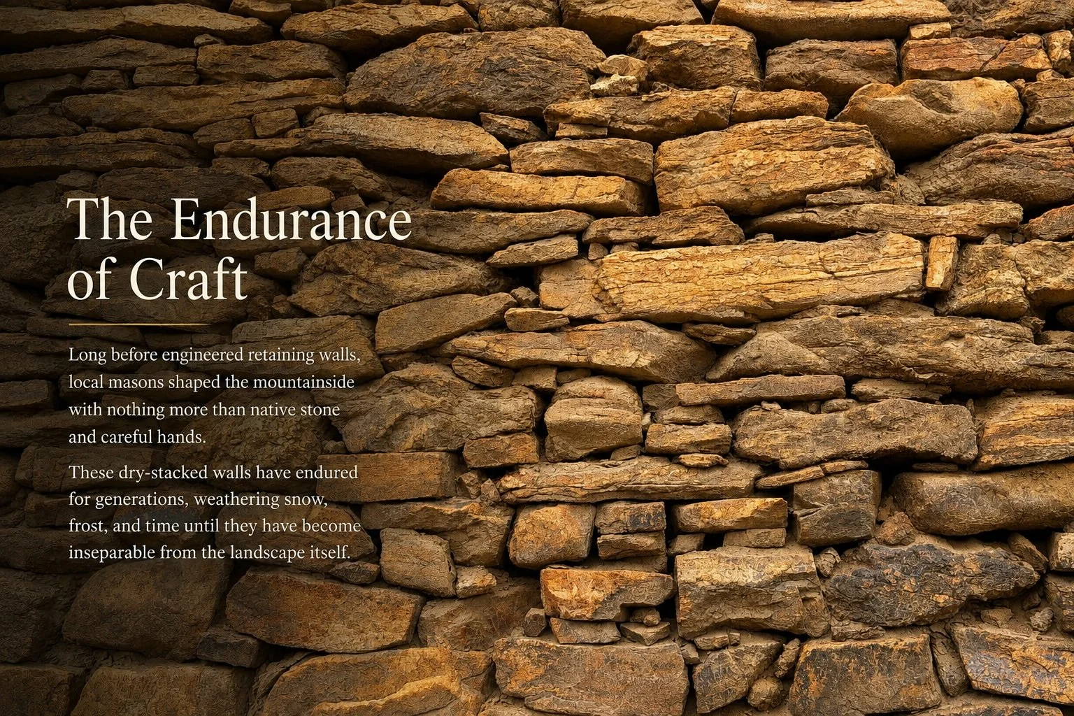
A Landscape Through Time
Stewardship
We become their stewards for a brief chapter in a story that began long before us and will continue long after we are gone.
The Bonanza Land LLC Portfolio represents a carefully assembled collection of Colorado's historic mining properties-land that witnessed the Gold Rush, contributed to the settlement of the American West, and has since been quietly reclaimed by forests, meadows, wildlife, and time. Each patented parcel carries both a remarkable history and an enduring responsibility: to preserve its heritage while thoughtfully stewarding its future.
Our philosophy is simple:
Understand the land before changing it.
That means respecting its geology, preserving its historic character, protecting its ecological recovery, and designing with humility rather than dominance. Whether restoring a historic structure, creating a contemporary mountain retreat, or simply allowing the landscape to remain undisturbed, every decision should strengthen the legacy of the place.
We believe the highest form of development is one that appears inevitable-as though it has always belonged there.
The landscapes entrusted to us today are more than investments or building sites. They are living places that deserve thoughtful stewardship, careful vision, and enduring respect.
Vision
A Future Written Carefully
History should inspire the future-not constrain it.
The conceptual illustrations that follow explore a range of possibilities for adaptive reuse, preservation, and carefully integrated contemporary architecture. They are intended to encourage thoughtful conversation about how one of Colorado's most remarkable historic landscapes might continue to evolve while remaining true to its character.
These images are conceptual in nature and do not represent approved plans, existing conditions, or specific development proposals.
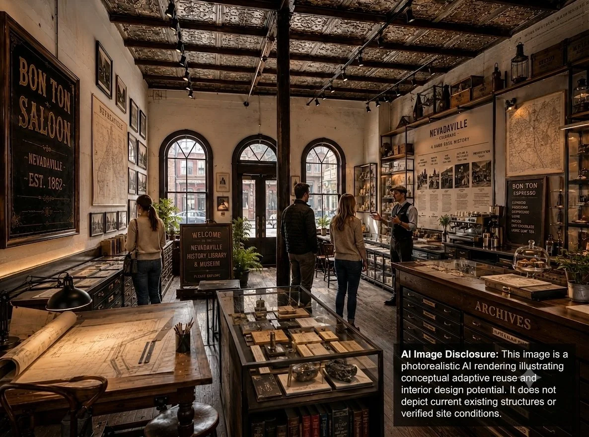

Interpreting History
Historic buildings can become places of learning, gathering, and storytelling.
Places That Bring People Together
Restored spaces can once again become centers of community life.
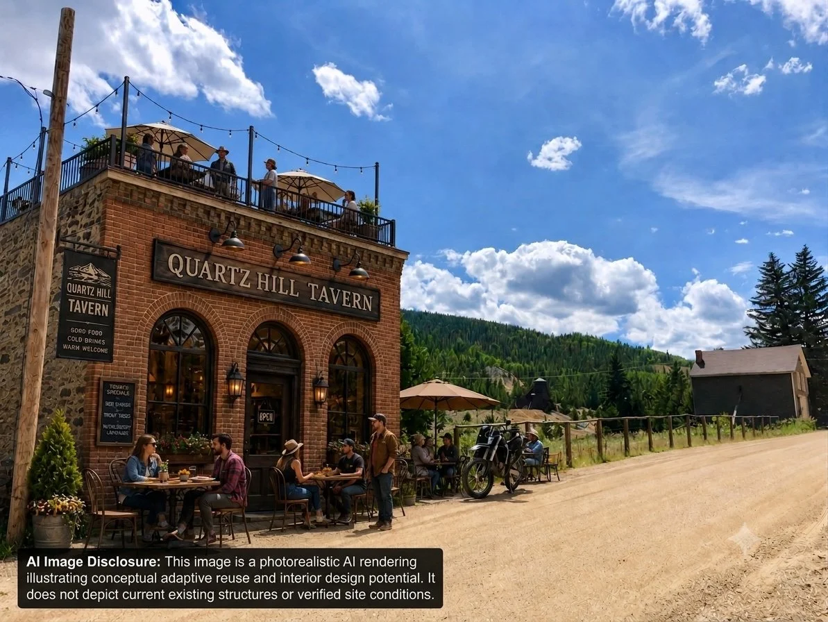
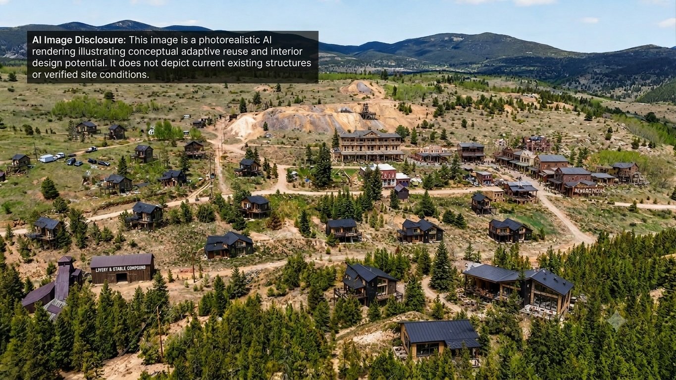
Adaptive Reuse
Historic architecture can accommodate contemporary uses while retaining its character.
A Living Historic District
New construction should complement-not compete with-the existing landscape and historic fabric.
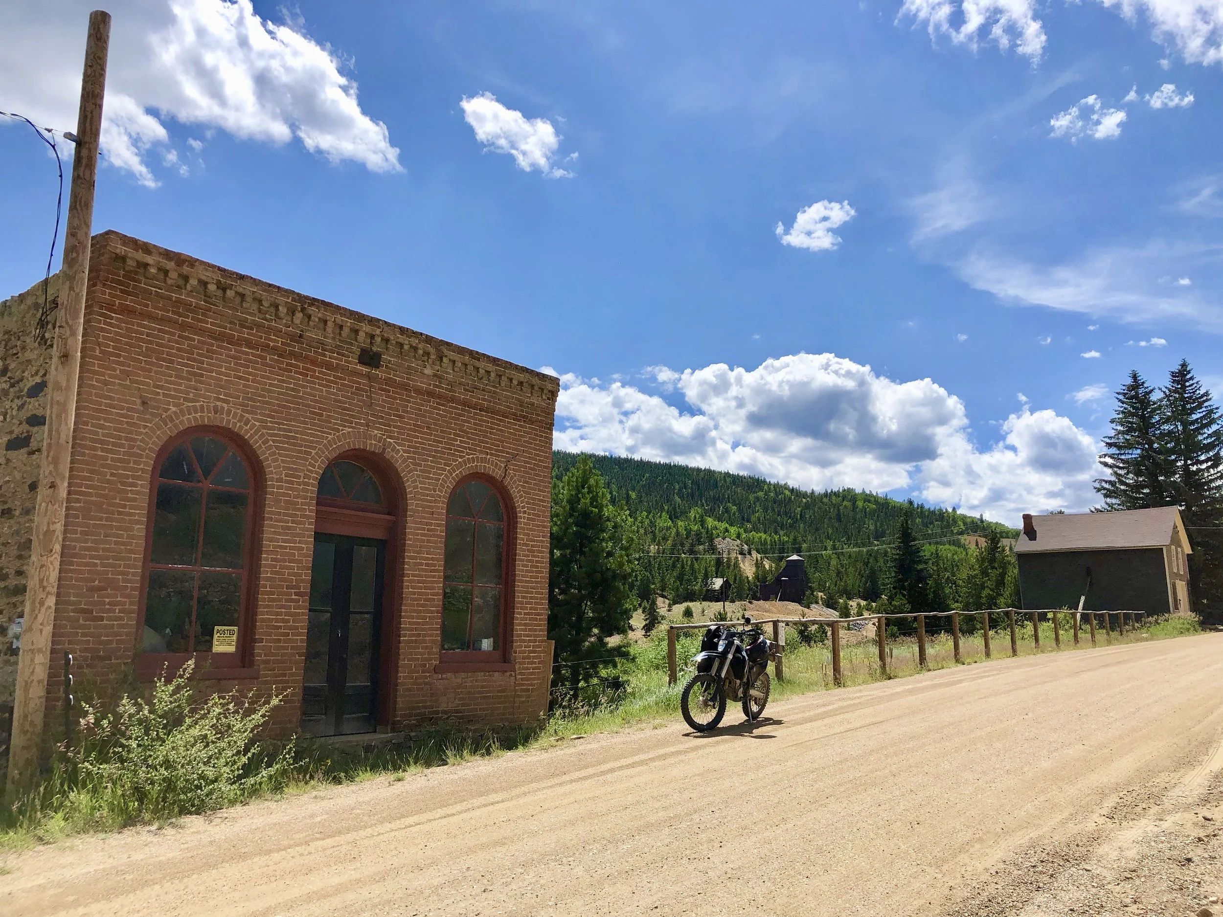
Where Vision Begins
Every future chapter starts with what exists today.
Property Context
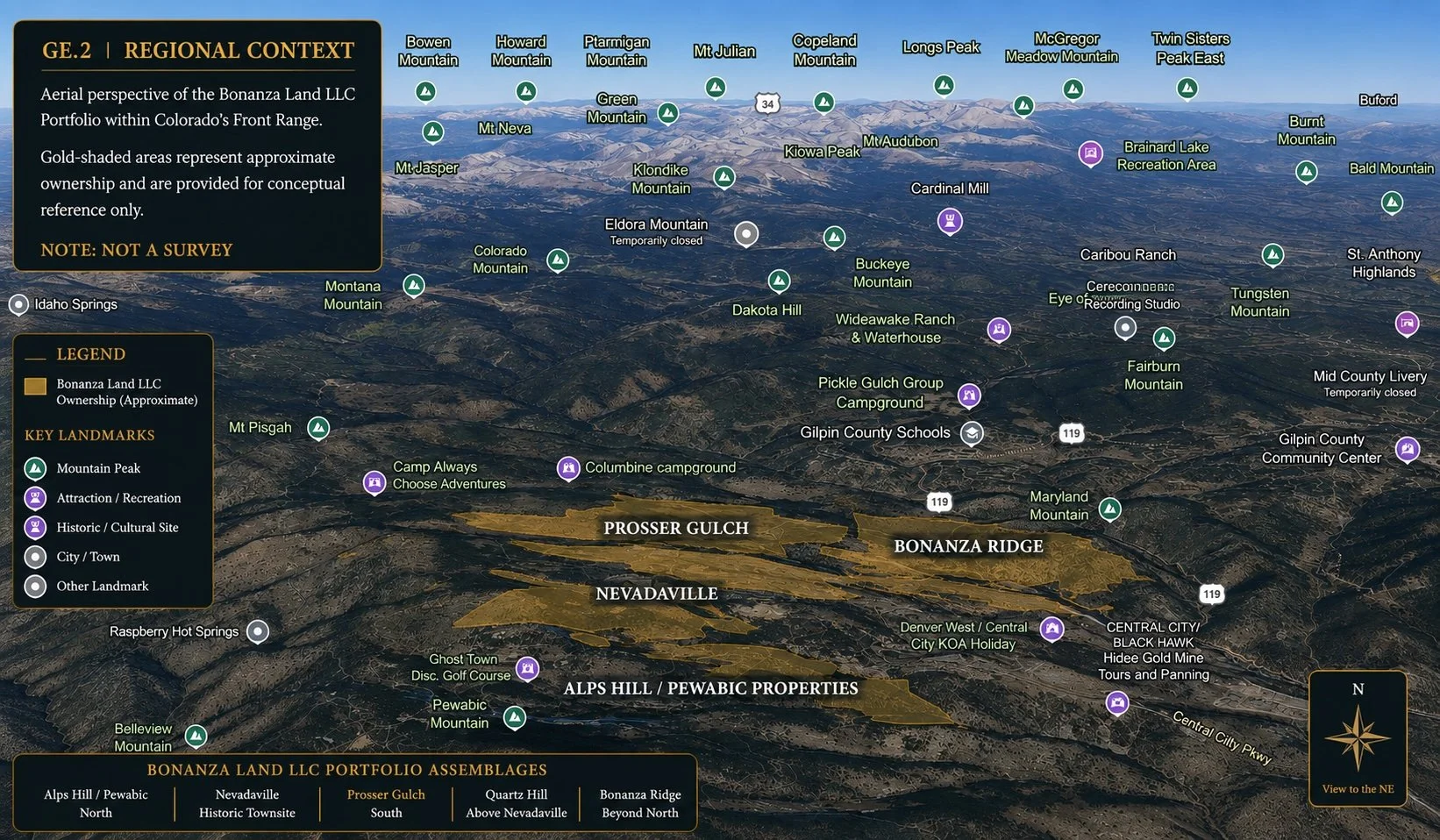
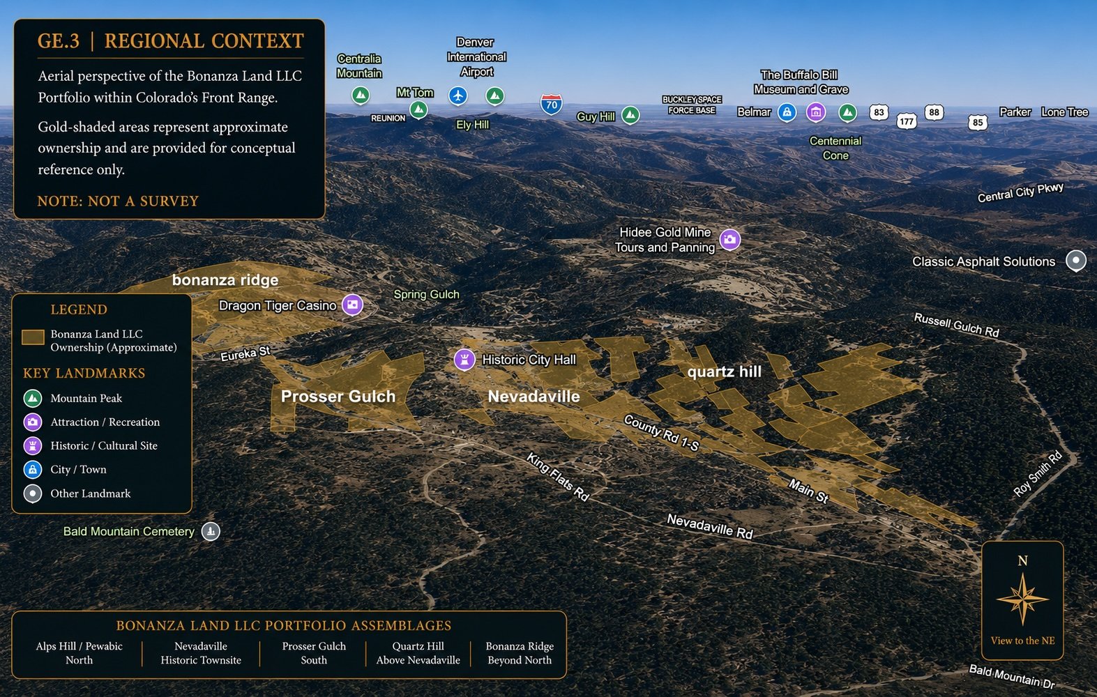
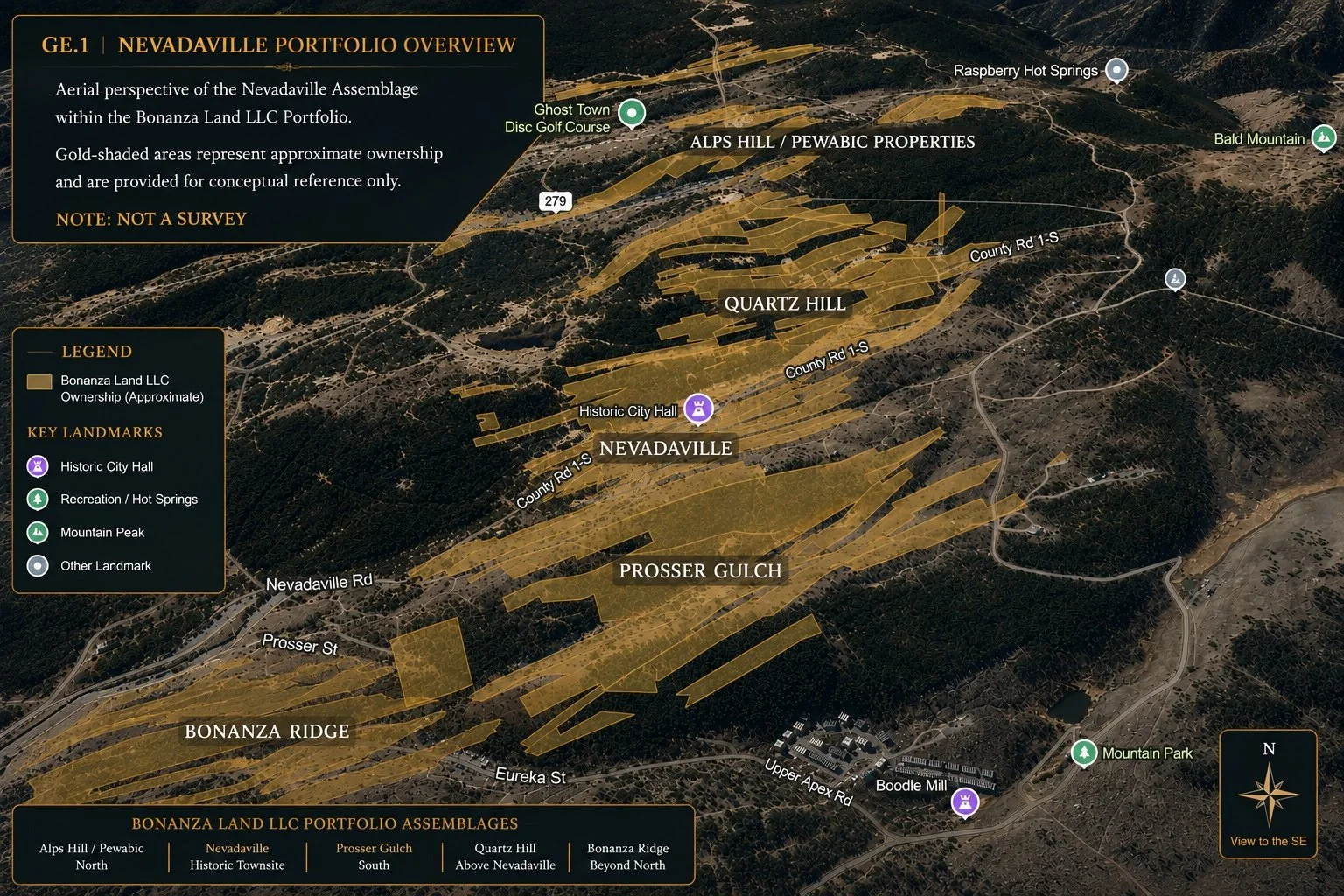
The following aerial perspectives illustrate the Nevadaville, Quartz Hill, and Prosser Gulch properties within the broader Bonanza Land LLC Portfolio and Colorado’s Front Range.
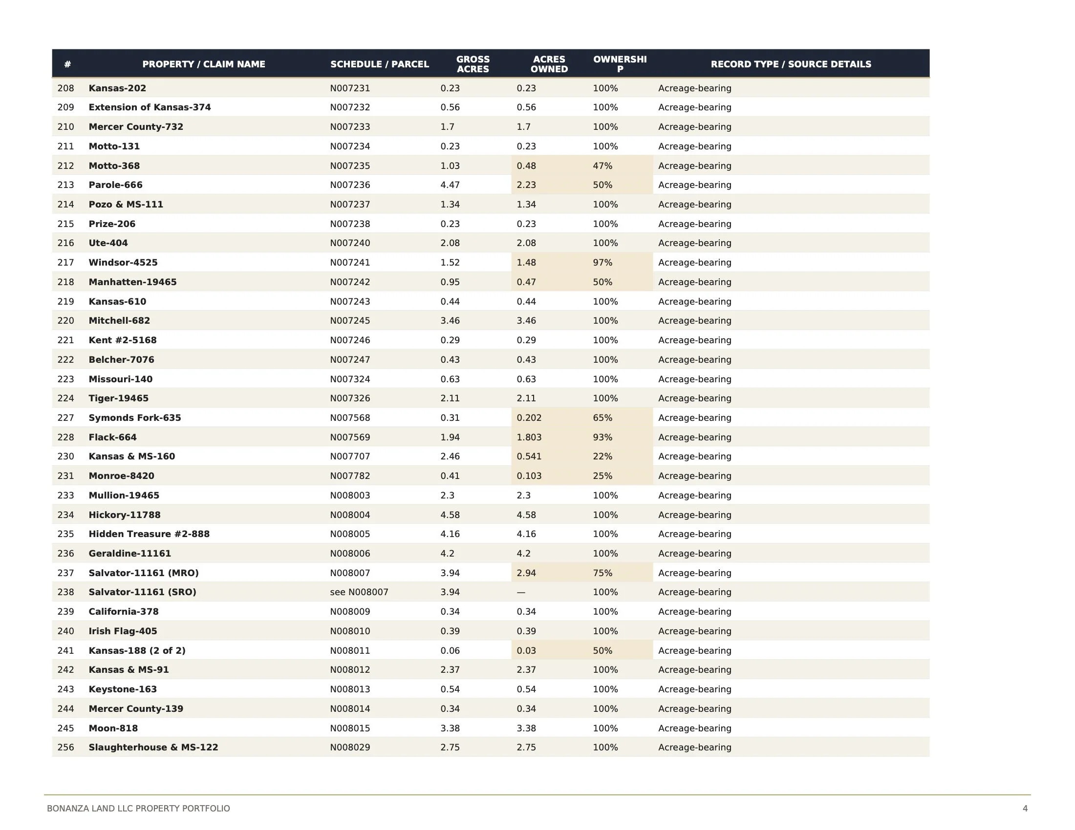
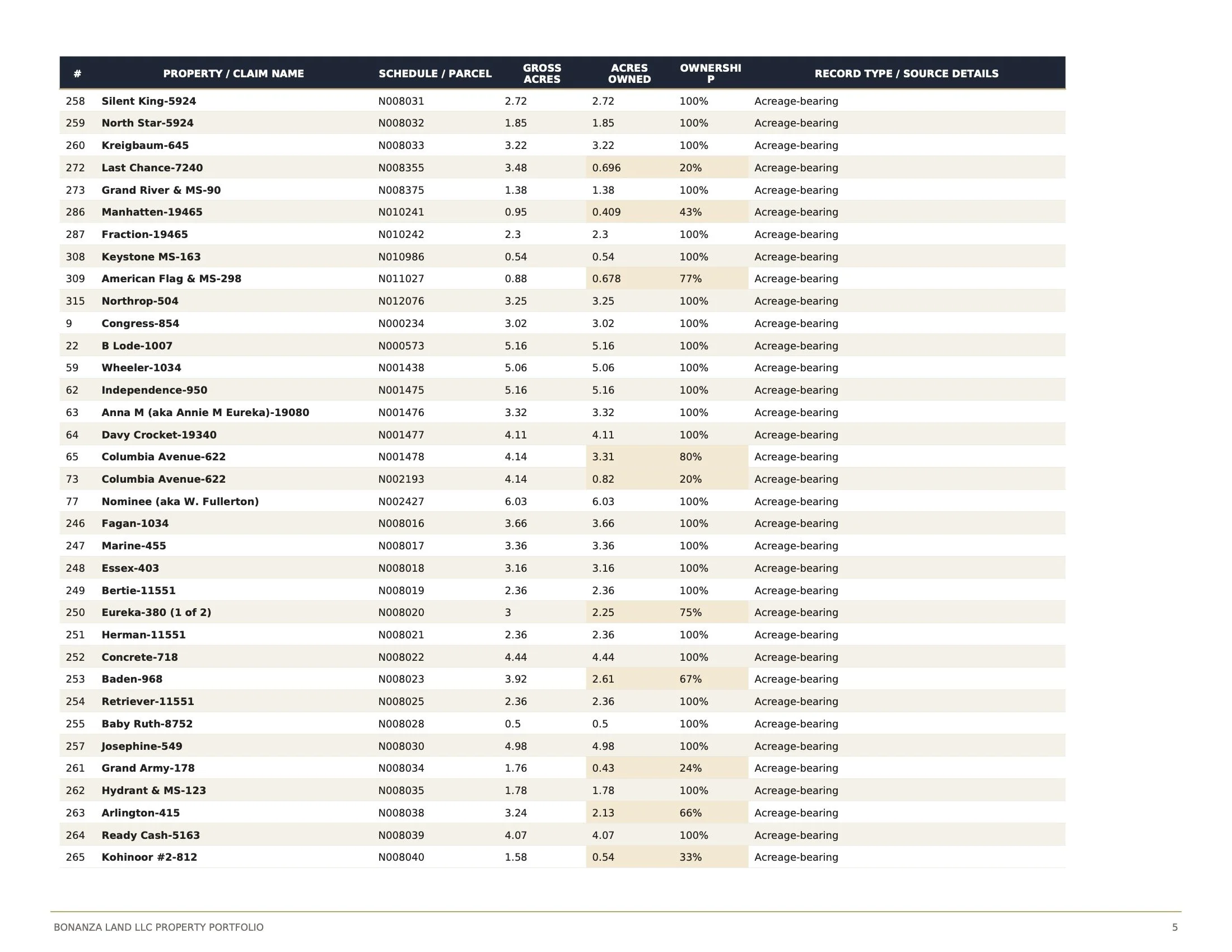
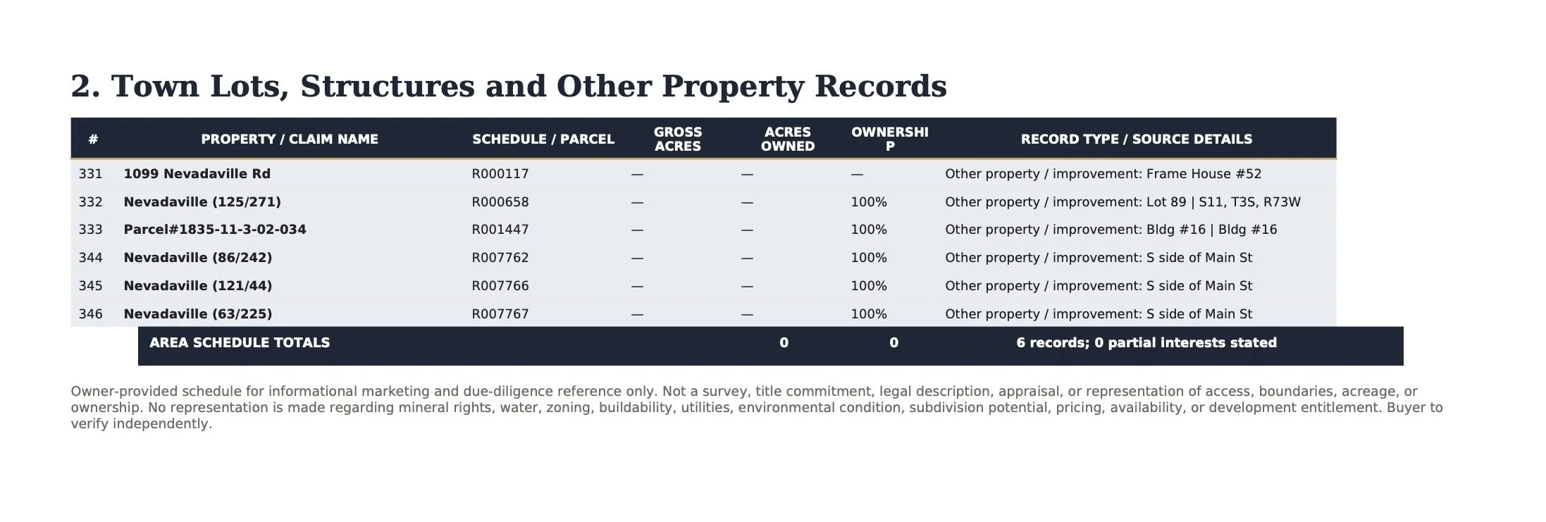
Property Schedule
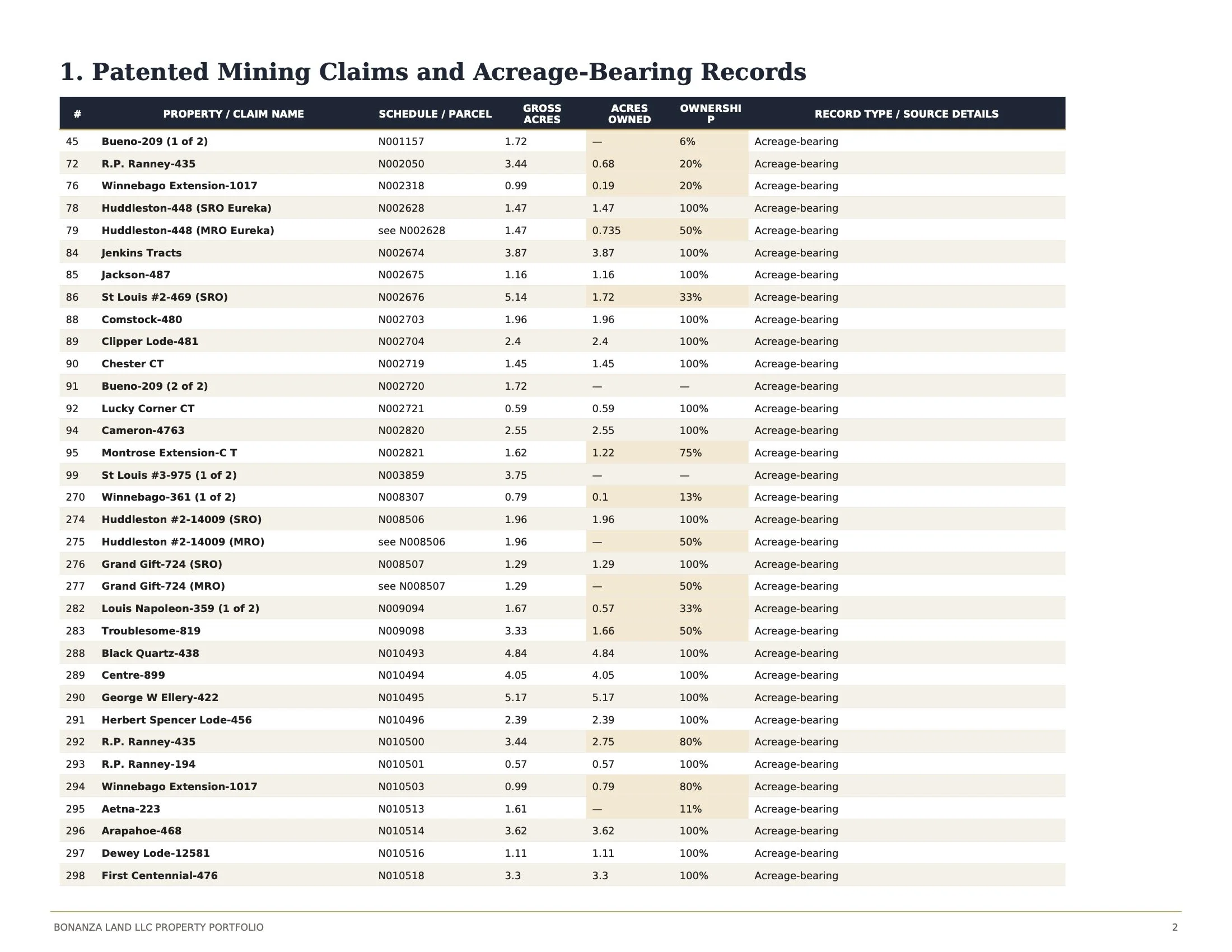
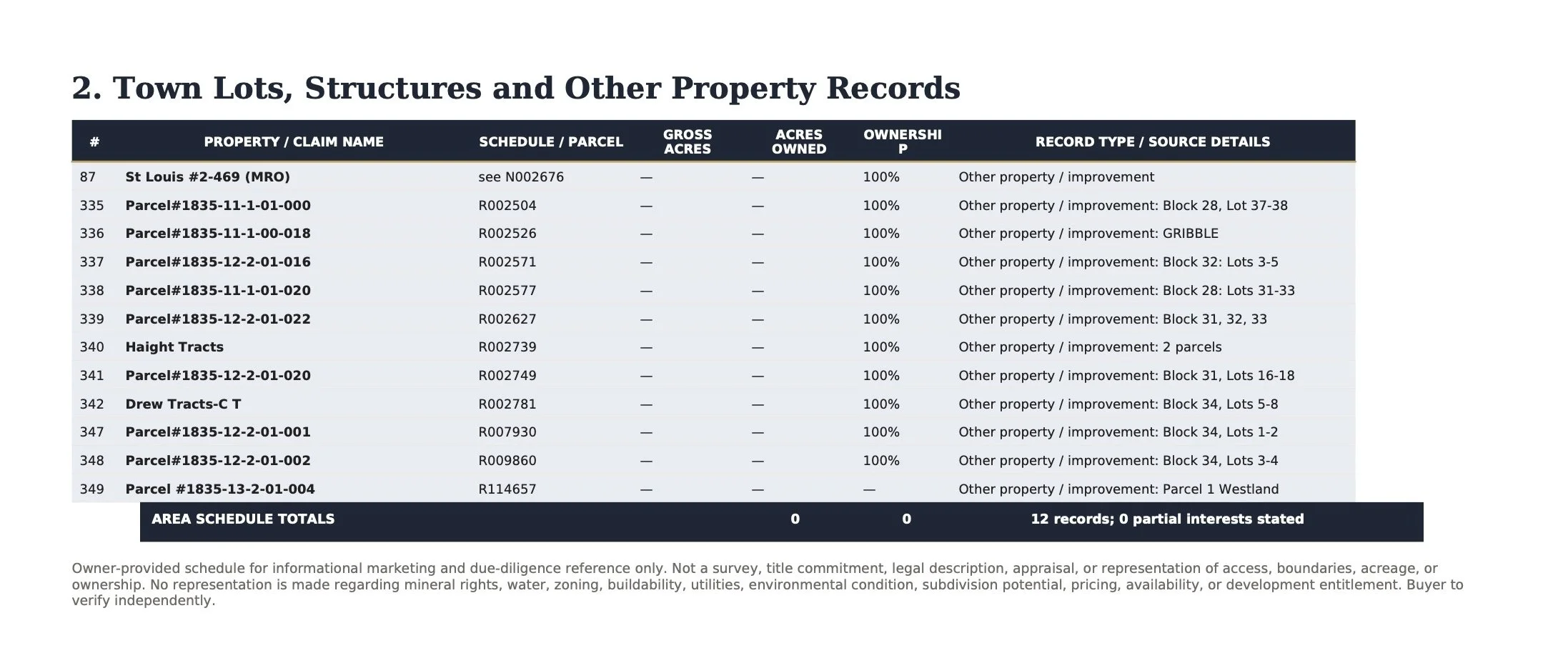
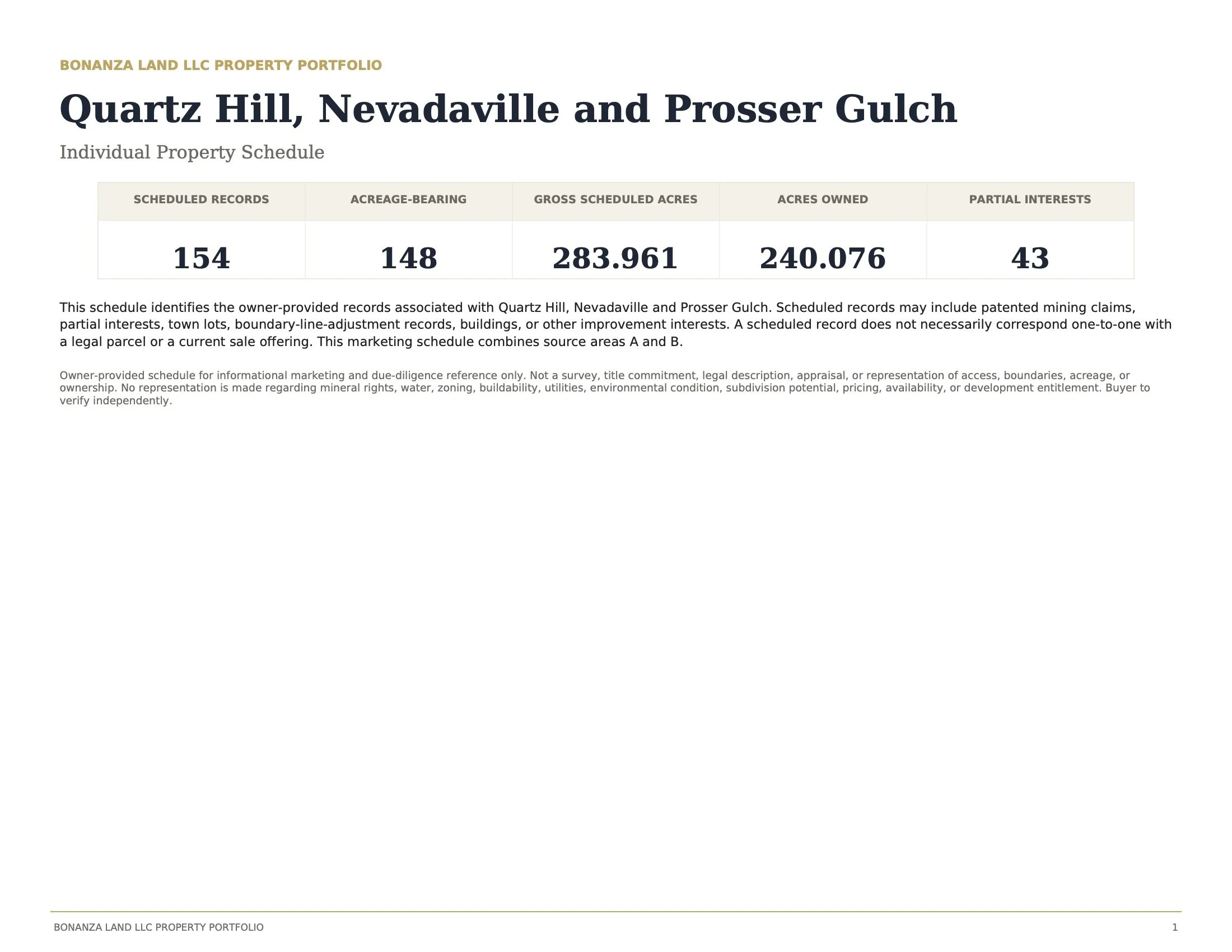
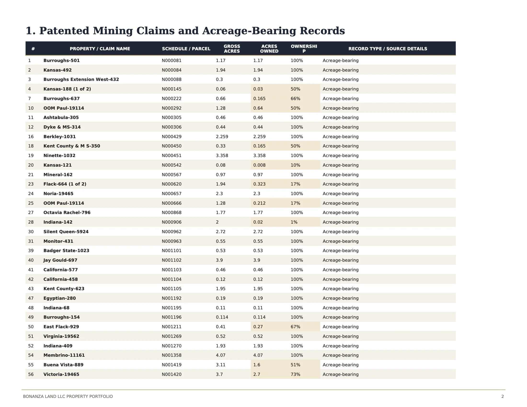
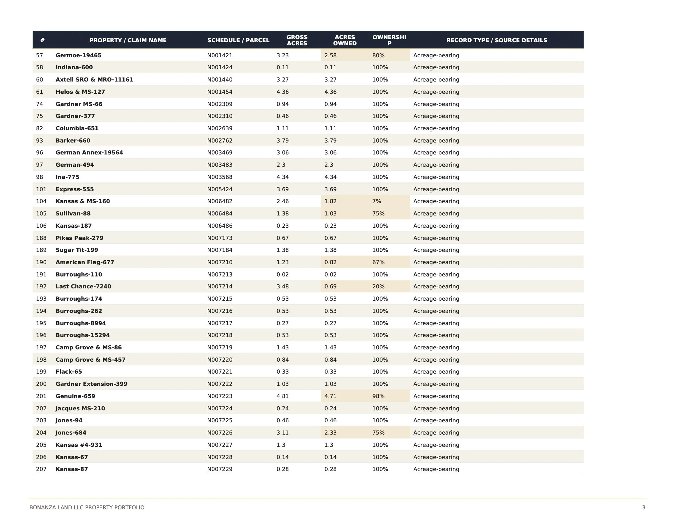
The Quartz Hill, Nevadaville, and Pro Portfolio comprises 147 documented patented mining claims together with six town lots and historic structures, assembled over decades into one of the largest private holdings within Colorado's Central Mining District. The schedule below identifies the individual parcels included within this offering.
Opportunities
The Quartz Hill, Nevadaville, and Prosser Gulch assemblage offers an uncommon opportunity to participate in the next chapter of one of Colorado's most historically significant mining landscapes. From the adaptive reuse of historic structures and the restoration of forgotten townsites to conservation initiatives, recreation, hospitality, housing, and cultural investment, the possibilities are as diverse as the landscape itself.
Whatever form the future may take, it should be guided by the qualities that have endured for more than a century: a profound respect for the land, an appreciation of its extraordinary history, and a commitment to ensuring that every thoughtful intervention contributes positively to the legacy of the place.
CHAPTER III
_______________________________________
APEX
Architecture at the Edge of Wilderness
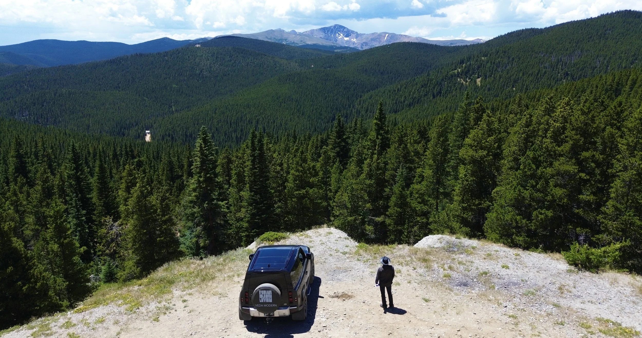
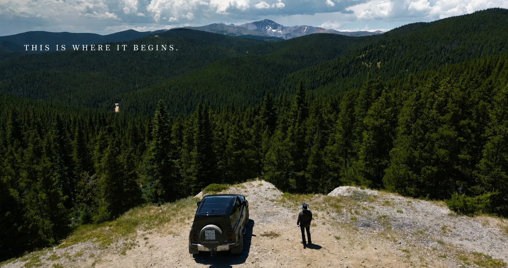
View west from Dakota Hill across the Arapaho and Roosevelt National Forests toward the Continental Divide.
OVERVIEW
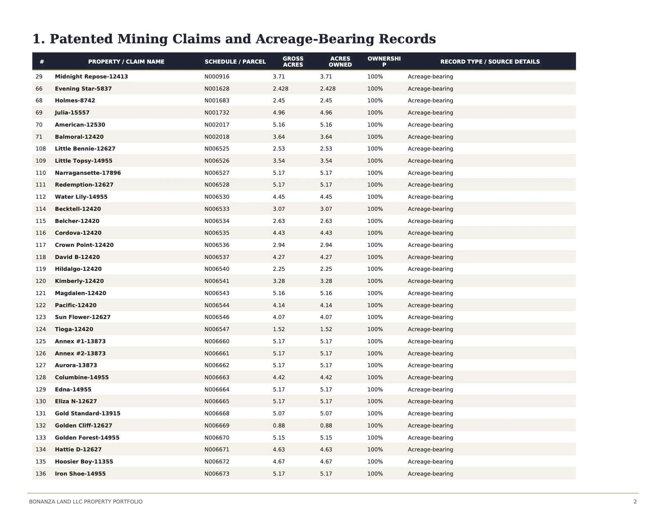
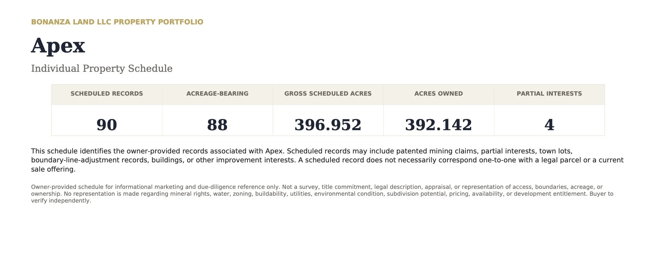
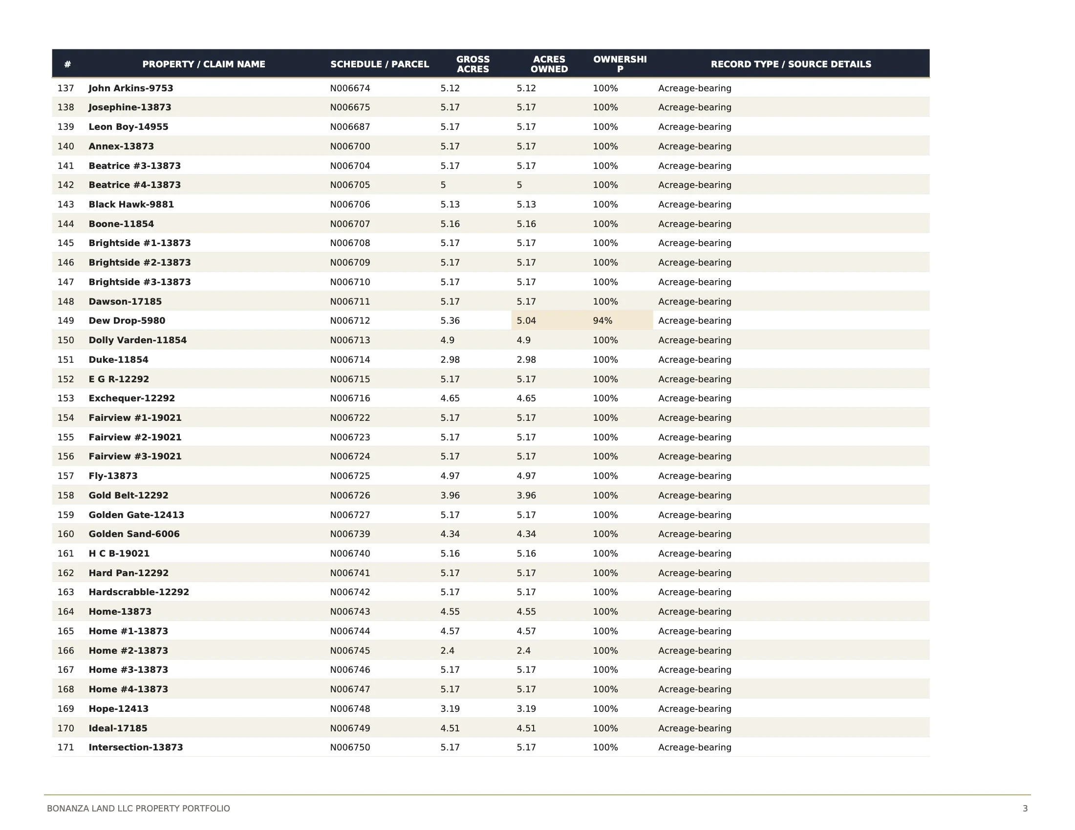
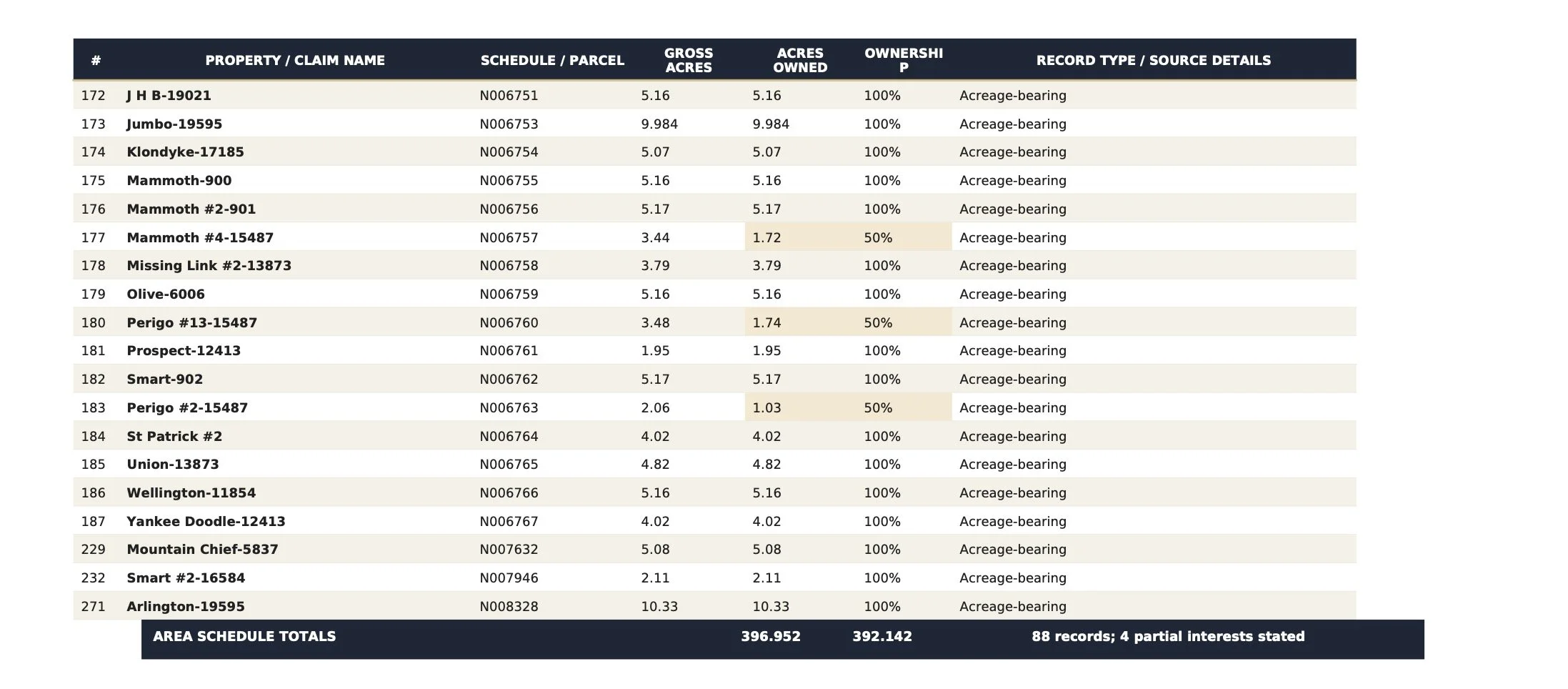
The Apex Assemblage encompasses approximately 375 acres across 84 patented mining claims within the historic Apex–Dakota Hill district, creating one of the most geographically commanding private mountain ownership positions within Colorado's Historic Central Mining District.
Assembled by Bonanza Land LLC over more than three decades, the properties extend across prominent ridgelines, forested slopes, historic mining terrain, and high-elevation landscapes between Nederland and Black Hawk. Much of the surrounding area lies within the Arapaho and Roosevelt National Forests, creating an extraordinary sense of privacy, scale, and connection to the surrounding mountains.
Select properties rise toward Dakota Hill at elevations approaching 11,000 feet, where panoramic views extend toward James Peak, the Continental Divide, Longs Peak, Pikes Peak, and the Great Plains. Mature forests, mountain meadows, exposed granite, historic mining remnants, and ancient bristlecone pines define a landscape shaped by geology, elevation, and Colorado's mining heritage.
Unlike a conventional single-parcel offering, Apex is a collection of historic patented claims whose geography reflects the mining history that created them. Together, they form a remarkable high-country assemblage with opportunities for long-term stewardship, conservation, recreation, legacy ownership, and carefully considered future uses.
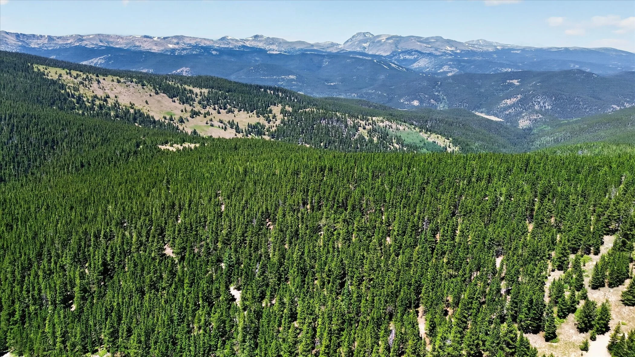
The Apex high country, looking west toward the Continental Divide—an expansive landscape of forested ridgelines, alpine terrain, and distant peaks.
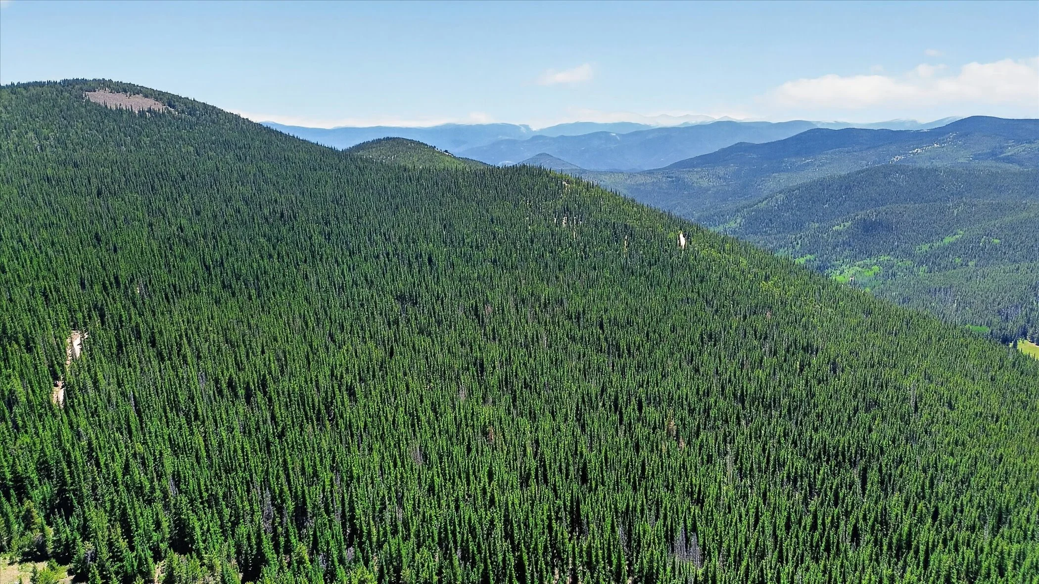
Forested ridgelines extend across the Apex–Dakota Hill landscape, revealing the scale, privacy, and remarkably undeveloped character of the surrounding high country.
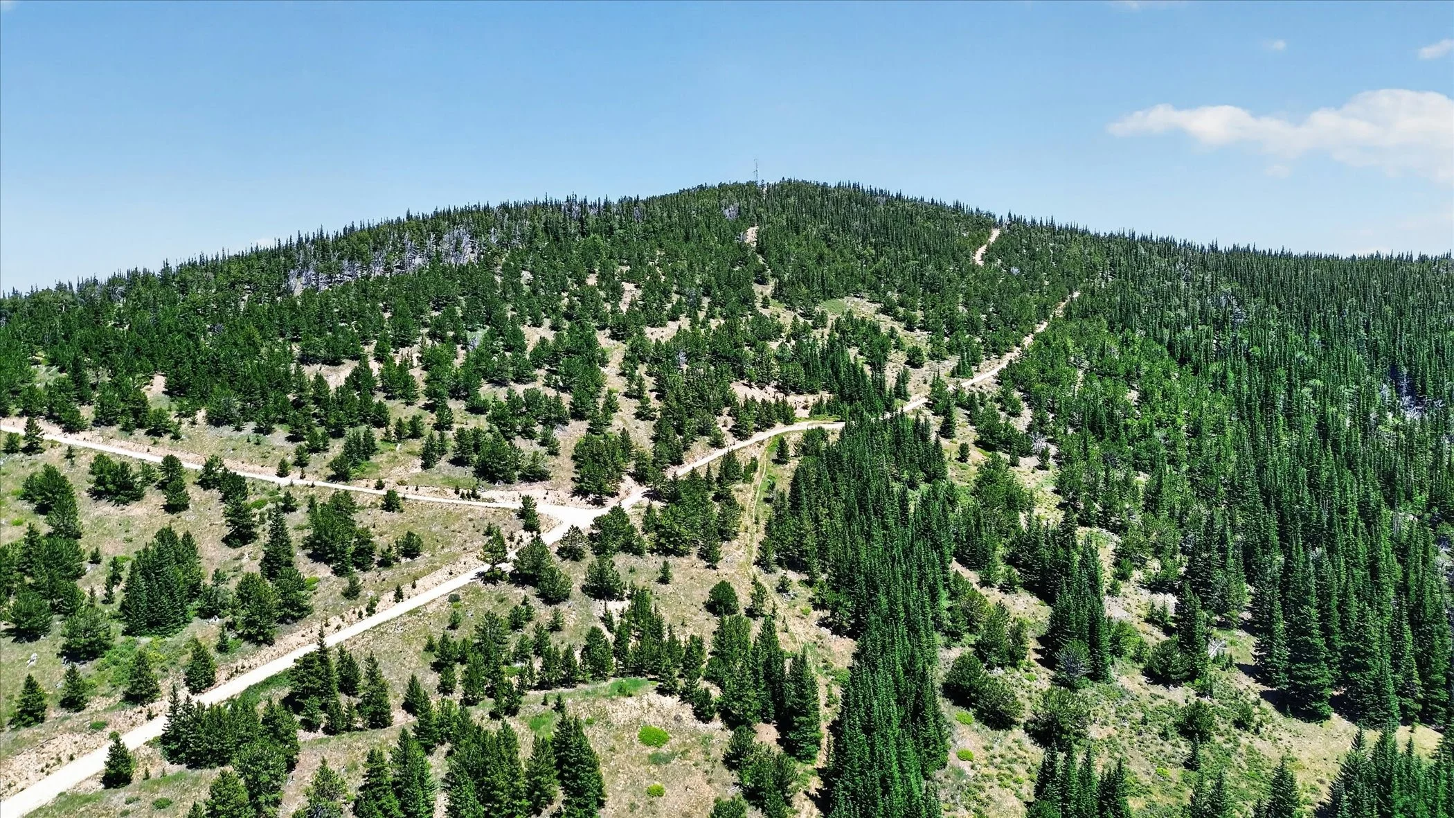
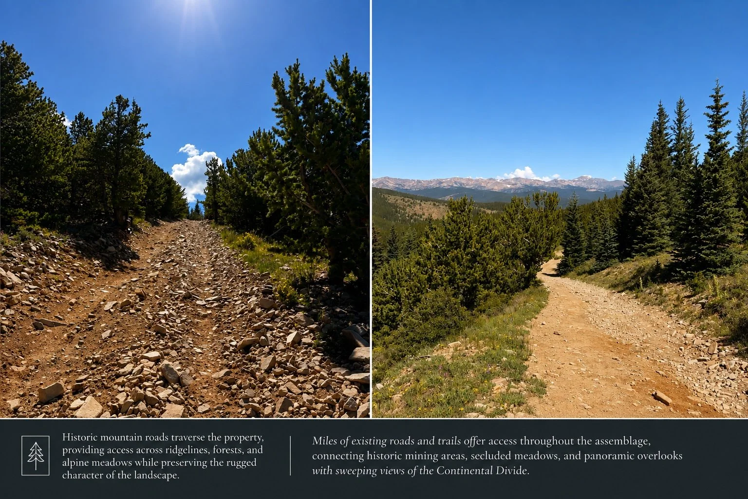
Mountain roads follow the contours of the Apex landscape as they climb toward Dakota Hill, revealing both the scale of the terrain and the remarkable access through the high country.
THE OPPORTUNITY
A landscape measured not simply in acres, but in possibility.
The Apex Assemblage represents one of the largest privately assembled high-country landscapes remaining within Colorado's Historic Central Mining District. Its expansive forests, alpine ridgelines, historic mining roads, and commanding summits create an opportunity unlike traditional mountain real estate-one defined by scale, privacy, and extraordinary flexibility.
Rather than prescribing a single outcome, Apex invites thoughtful vision. Its diverse terrain may support conservation initiatives, legacy ownership, private mountain estates, recreation, wilderness hospitality, ecological research, or carefully integrated retreat experiences. The property's extensive road network and varied topography provide uncommon access while preserving the sense of immersion that defines the landscape.
Perhaps most compelling is the opportunity to imagine new ways of experiencing the mountains. Places for solitude. Reflection. Creativity. Wellness. Conservation. Landscapes where architecture becomes secondary to the experience of nature itself.
Whether preserved largely as it exists today or thoughtfully evolved over time, Apex offers the rare chance to shape the future of an authentic Rocky Mountain landscape while honoring the history, ecology, and enduring character that have defined it for generations.
"Some properties are developed. Others are discovered. Apex offers the opportunity to do both."
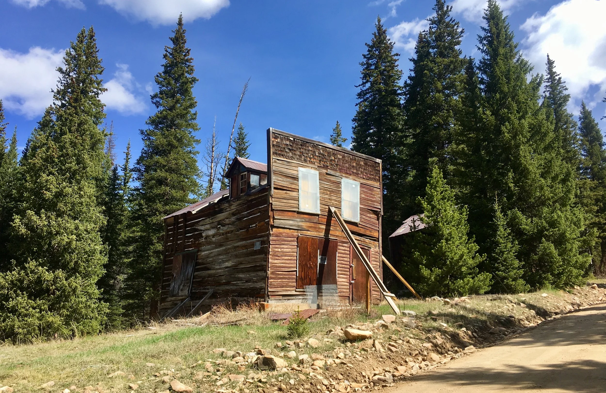
"Before these forests returned, an entire mountain town stood here."
THE LOST TOWN OF APEX
Established during the earliest years of Colorado's Gold Rush, the town of Apex emerged along the western slopes of Dakota Hill as one of the highest and most ambitious mining settlements in Colorado's Historic Central Mining District. Drawn by exceptionally rich mineral discoveries, miners, merchants, engineers, and their families built a thriving mountain community whose fortunes rose alongside the remarkable productivity of the surrounding mines.
Though the town has largely disappeared, its story remains woven into the landscape. Historic wagon roads continue to follow their original alignments across the mountainside, abandoned mine workings emerge quietly from the forest, and scattered foundations still mark the locations of homes, businesses, and gathering places that once formed the heart of the settlement.
The building shown above was among the last surviving commercial structures in the former town of Apex. Standing for well over a century before the collapse of its historic front façade, it served as a tangible reminder of the community that once overlooked these forests—a poignant example of Colorado's mining heritage gradually yielding to time and nature.
Today, the forest has reclaimed much of what people once built. The mountains feel wild once again, yet they are far from untouched. Every ridgeline, weathered structure, and forgotten trail reflects a landscape where history and nature have become inseparable.
The next chapter of Apex will not be written by recreating the past, but by understanding it. Any thoughtful future should begin with the recognition that this is more than a remarkable mountain property—it is a place where Colorado's earliest story continues to shape the landscape we experience today.
A Vision for Solitude
One possible expression of this philosophy is SPIRITUS-a contemporary mountain retreat conceived not as a resort or subdivision, but as an architecture of solitude.
Designed to disappear into the landscape rather than dominate it, SPIRITUS explores how thoughtful architecture can deepen our relationship with nature while preserving the character of the mountains themselves.
Introducing VEDA SERIES 01 — SPIRITUS.
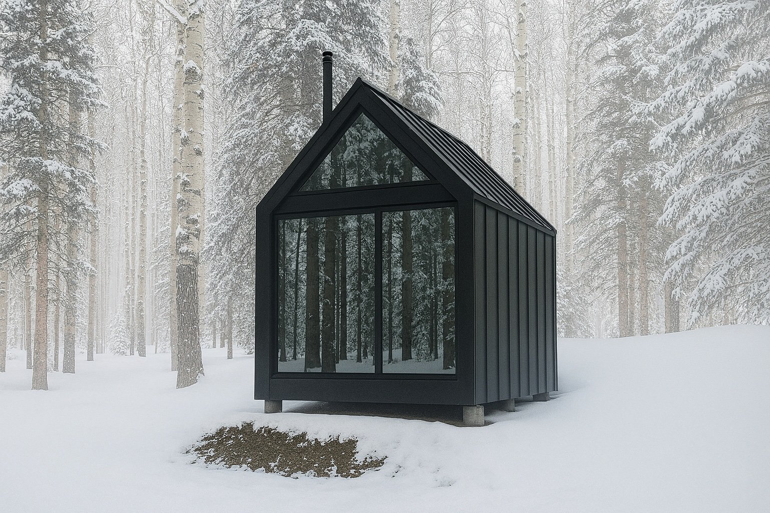
SPIRITUS
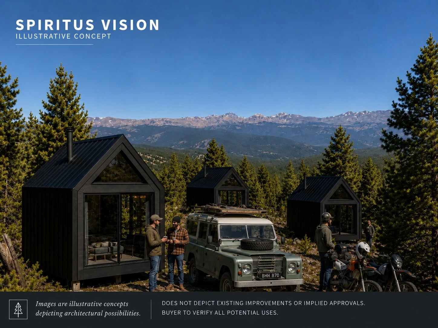
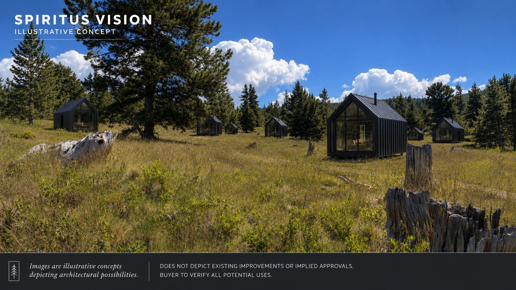
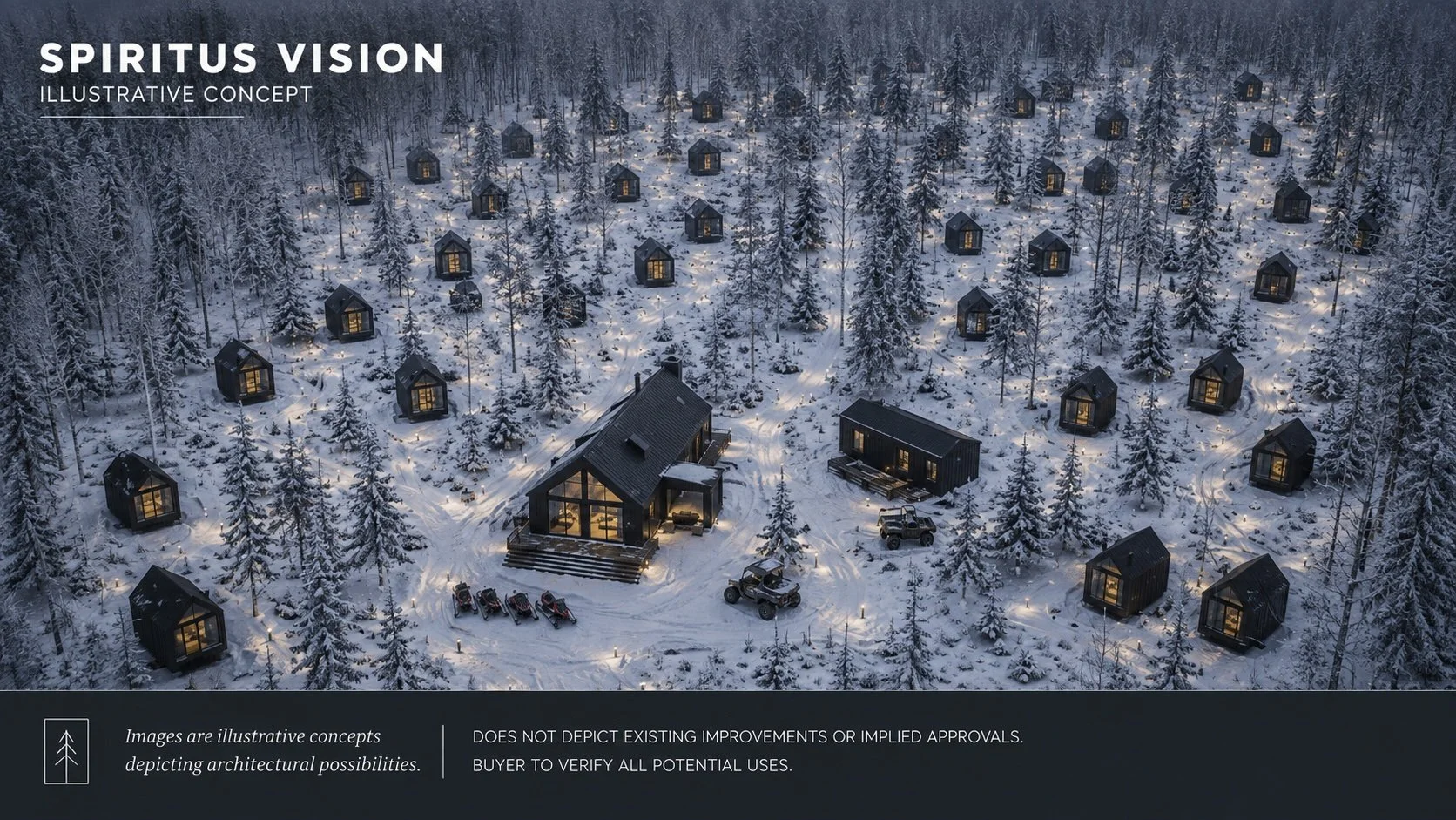
SPIRITUS is conceived as a compact architectural retreat for extraordinary mountain landscapes. Its restrained form, minimal footprint, and dark material palette allow it to sit quietly within forest, meadow, or snow-covered terrain without competing with the land around it.
Designed for solitude, reflection, and creative renewal, each structure offers a protected interior from which the surrounding landscape remains the primary experience. Large areas of glass frame the forest and distant mountains, while the simple gabled form recalls the enduring practicality of Colorado’s historic cabins and mining structures.
Within APEX, SPIRITUS represents one possible expression of the assemblage’s broader potential: a carefully placed network of private retreats, wellness spaces, or experiential accommodations shaped by the terrain rather than imposed upon it.
The concept remains intentionally flexible. Its value lies not in prescribing a single development outcome, but in demonstrating how contemporary architecture might occupy the high country with restraint, clarity, and respect.
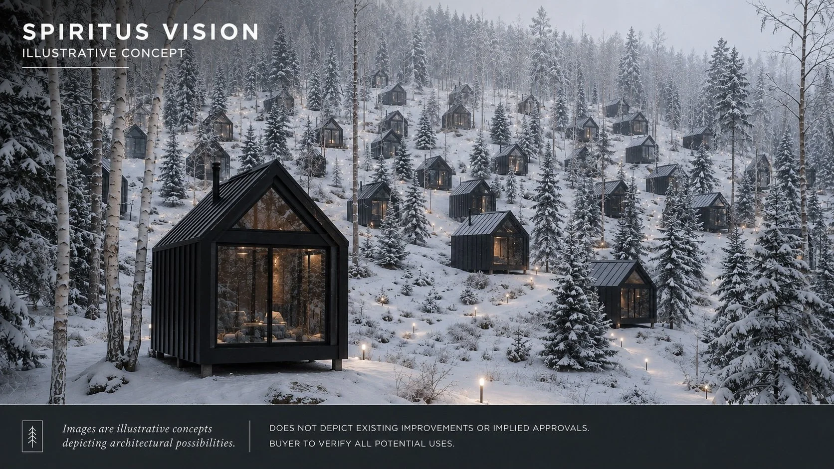
A Contemporary Interpretation
SPIRITUS is not intended to recreate Colorado's mining camps, nor to compete with the landscape that surrounds it. Instead, it offers a contemporary architectural language rooted in simplicity, permanence, and restraint.
The concept demonstrates how thoughtfully designed structures might inhabit Dakota Hill with a light physical footprint while preserving the character, solitude, and expansive mountain setting that define the property.
Whether envisioned as private retreats, wellness accommodations, artist residences, or hospitality cabins, the underlying principle remains the same: architecture that belongs to the mountain rather than dominating it.
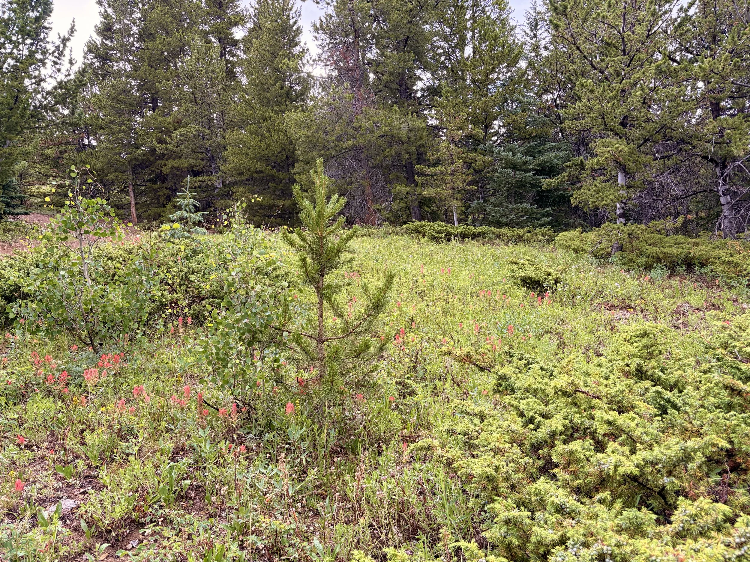
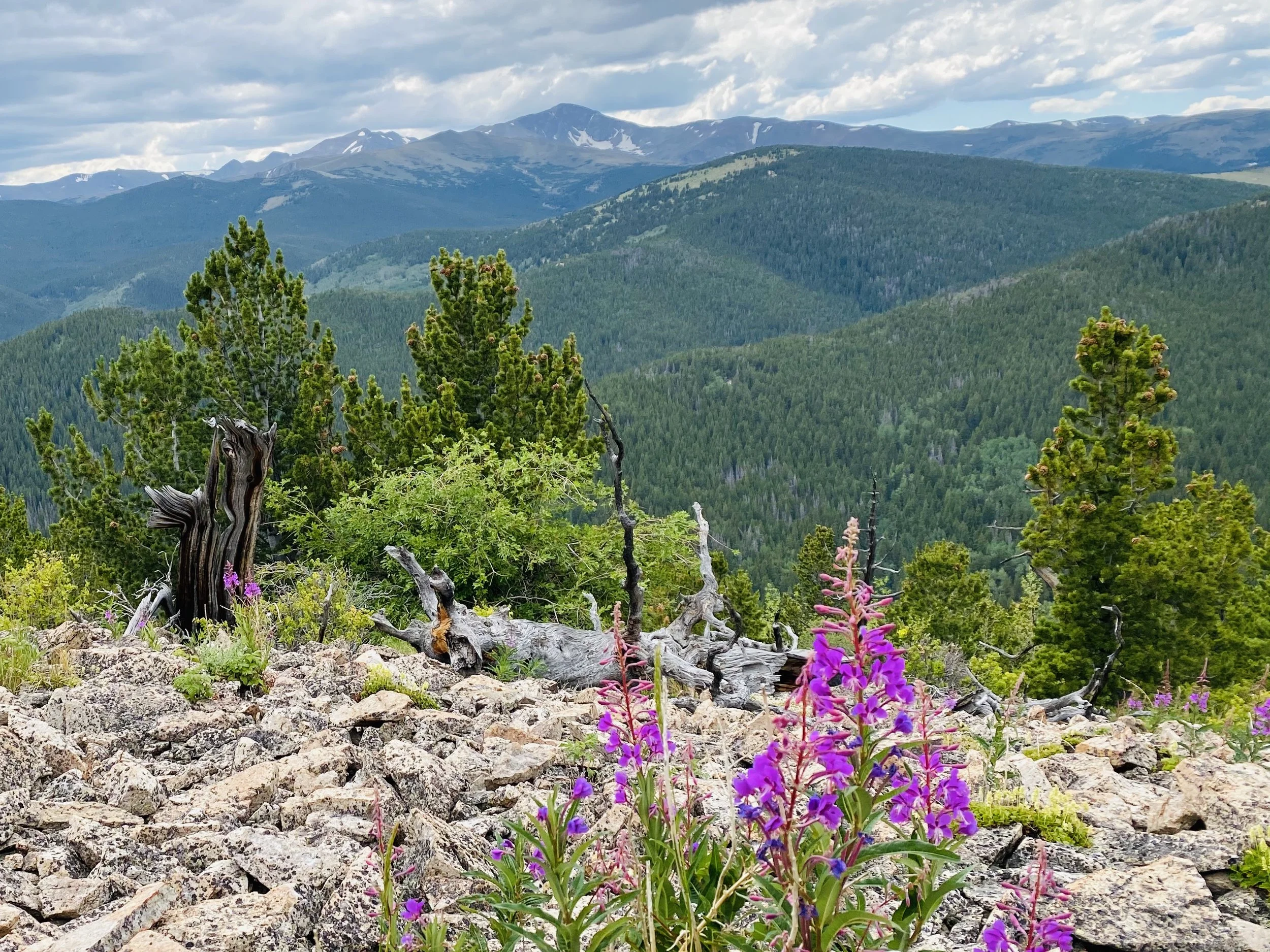
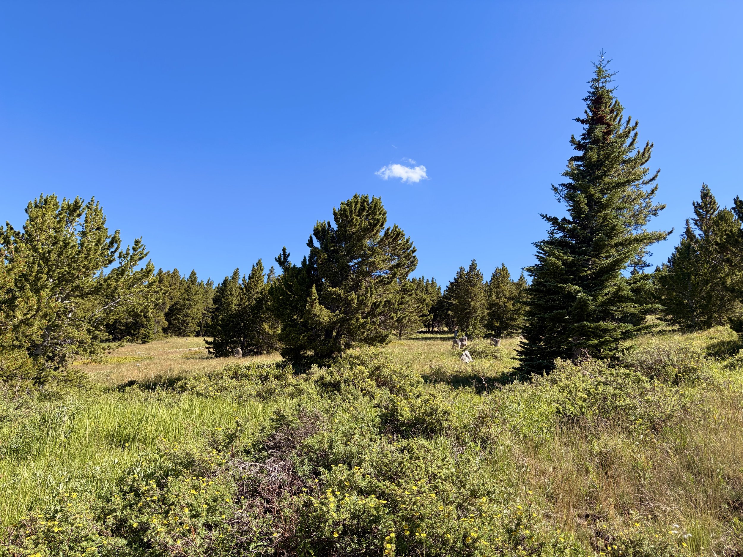
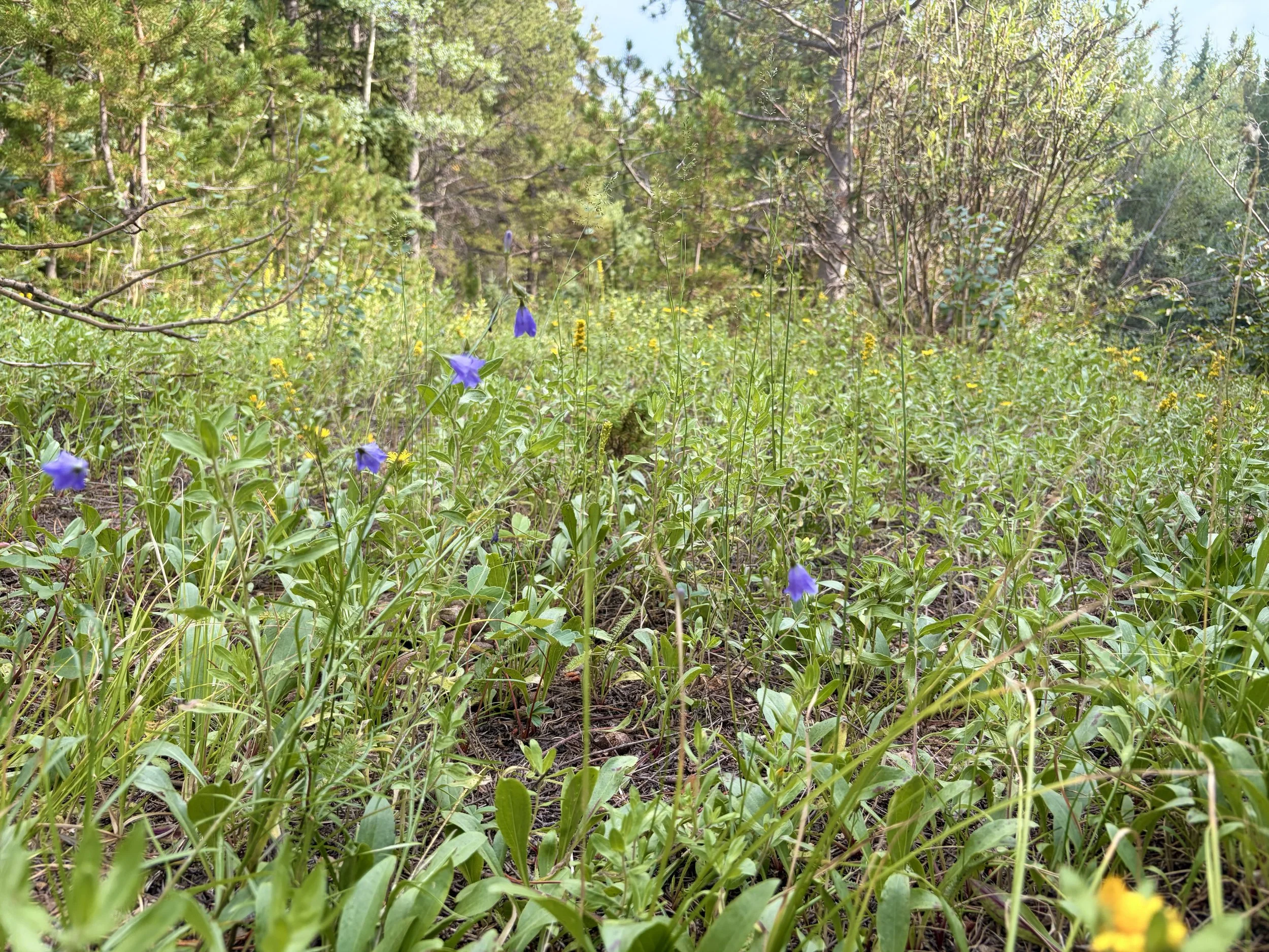
The character of APEX changes with every season. Alpine meadows give way to fields of wildflowers in summer. Aspen forests ignite in autumn before deep winter snow returns the mountain to silence. Throughout the year, miles of historic roads and trails provide access to ridges, overlooks, and secluded forests rarely experienced so close to the Front Range.
The Foundation
Every vision begins with an extraordinary place.
Before considering what Apex might become, it is worth understanding what it already is.
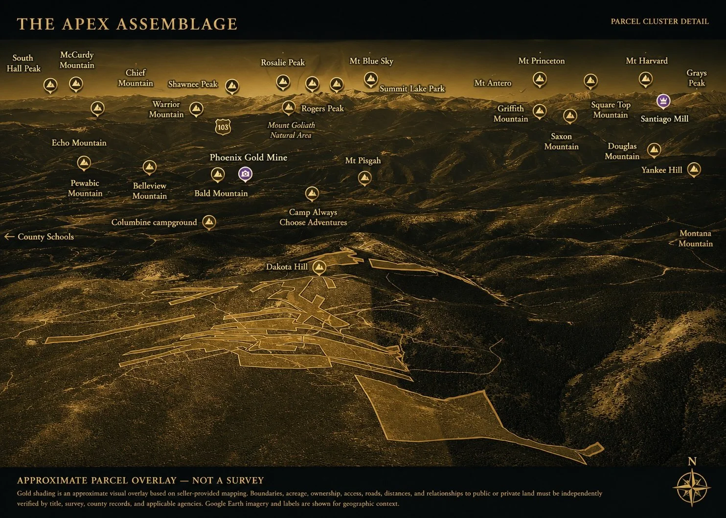
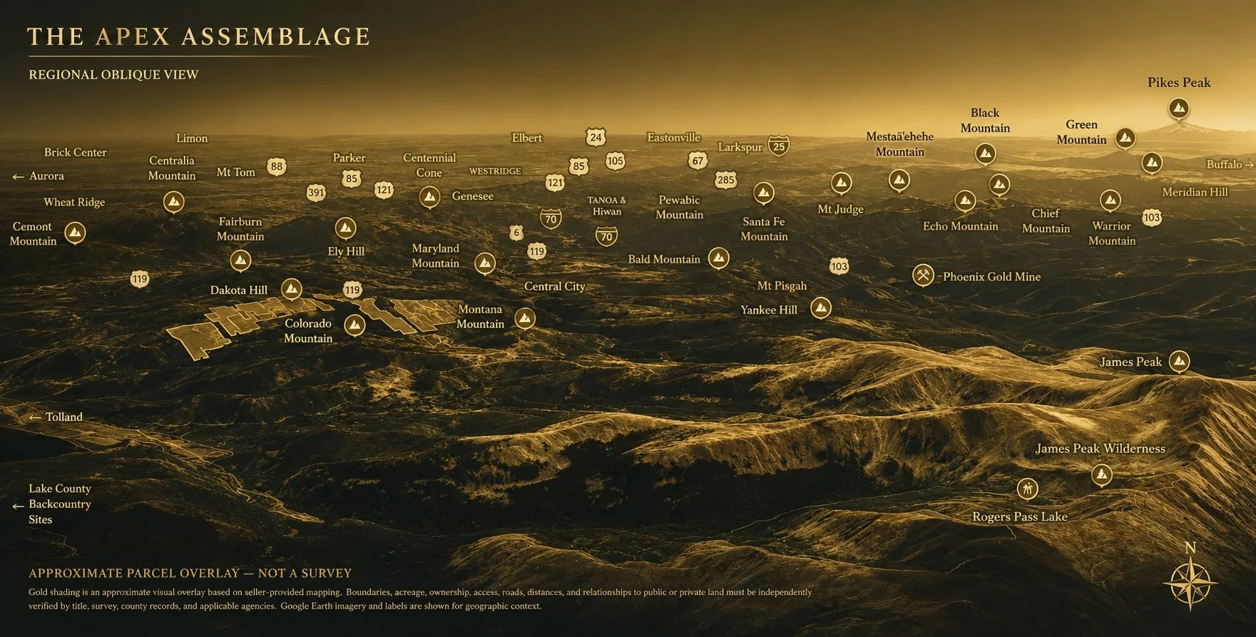
Approximately 375 acres of predominantly contiguous private mountain holdings wrap the summits and upper slopes surrounding Dakota Hill, connected by an extensive network of existing U.S. Forest Service roads. The assemblage encompasses historic mining claims, alpine forests, open meadows, dramatic Continental Divide views, and a landscape that feels increasingly rare in Colorado-a mountain property defined by both accessibility and genuine solitude.
The following pages a parcel composition, and supporting information that define the Apex Assemblage. Together, they provide a comprehensive understanding of the land, its structure, and its unique characteristics.
CHAPTER IV
_____________________________________
THE FOOL’S LUCK PLACER
Where Water Shapes the Wilderness.
A Ribbon of Water Through the Forest
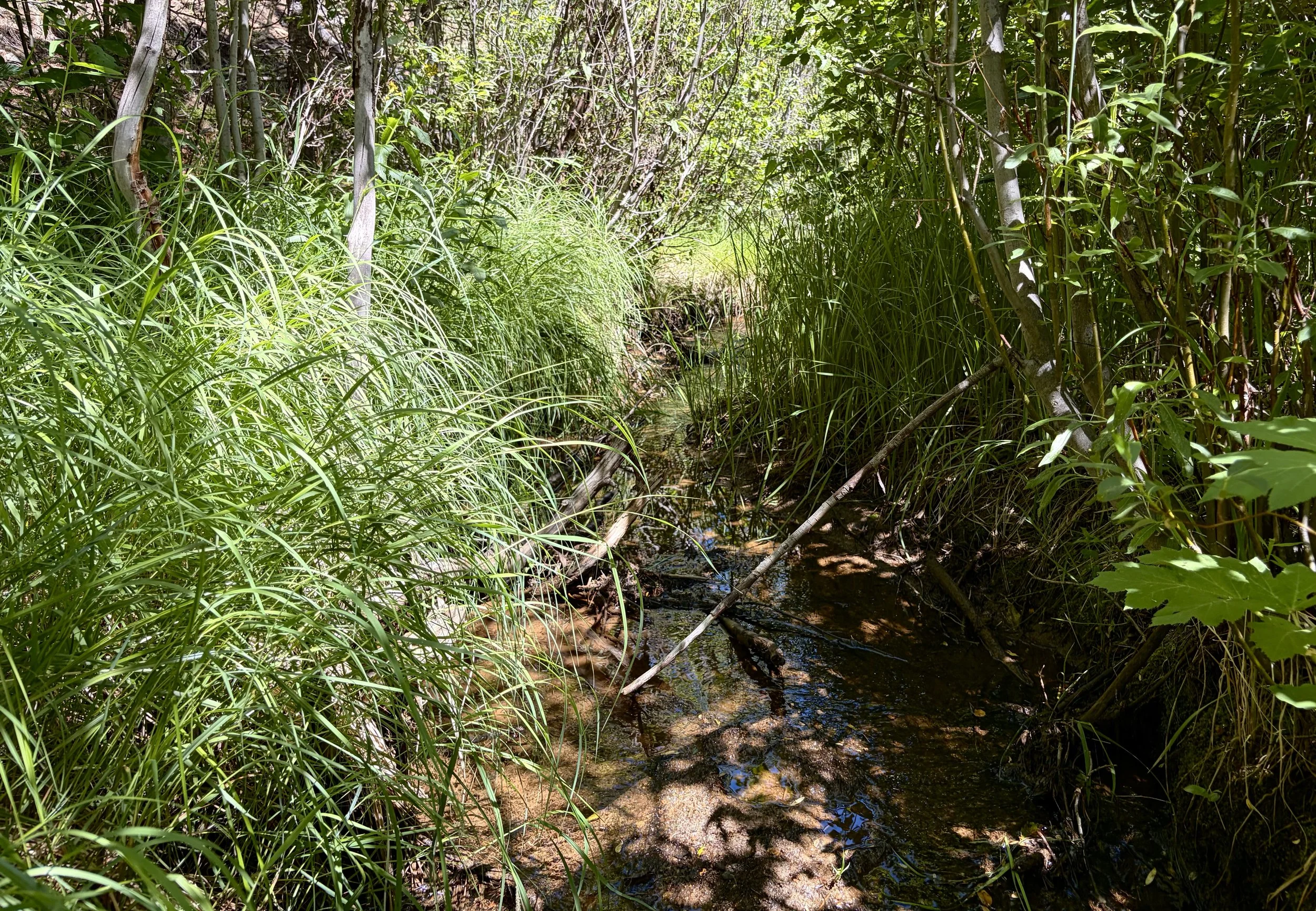
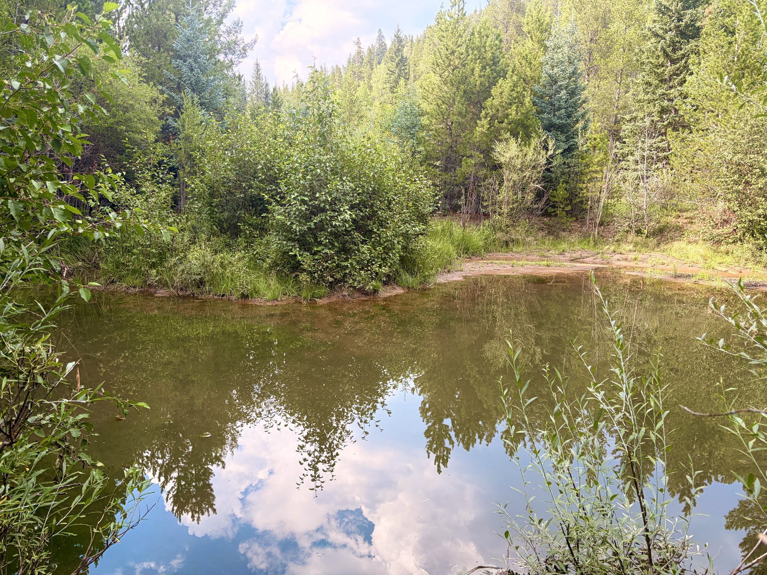
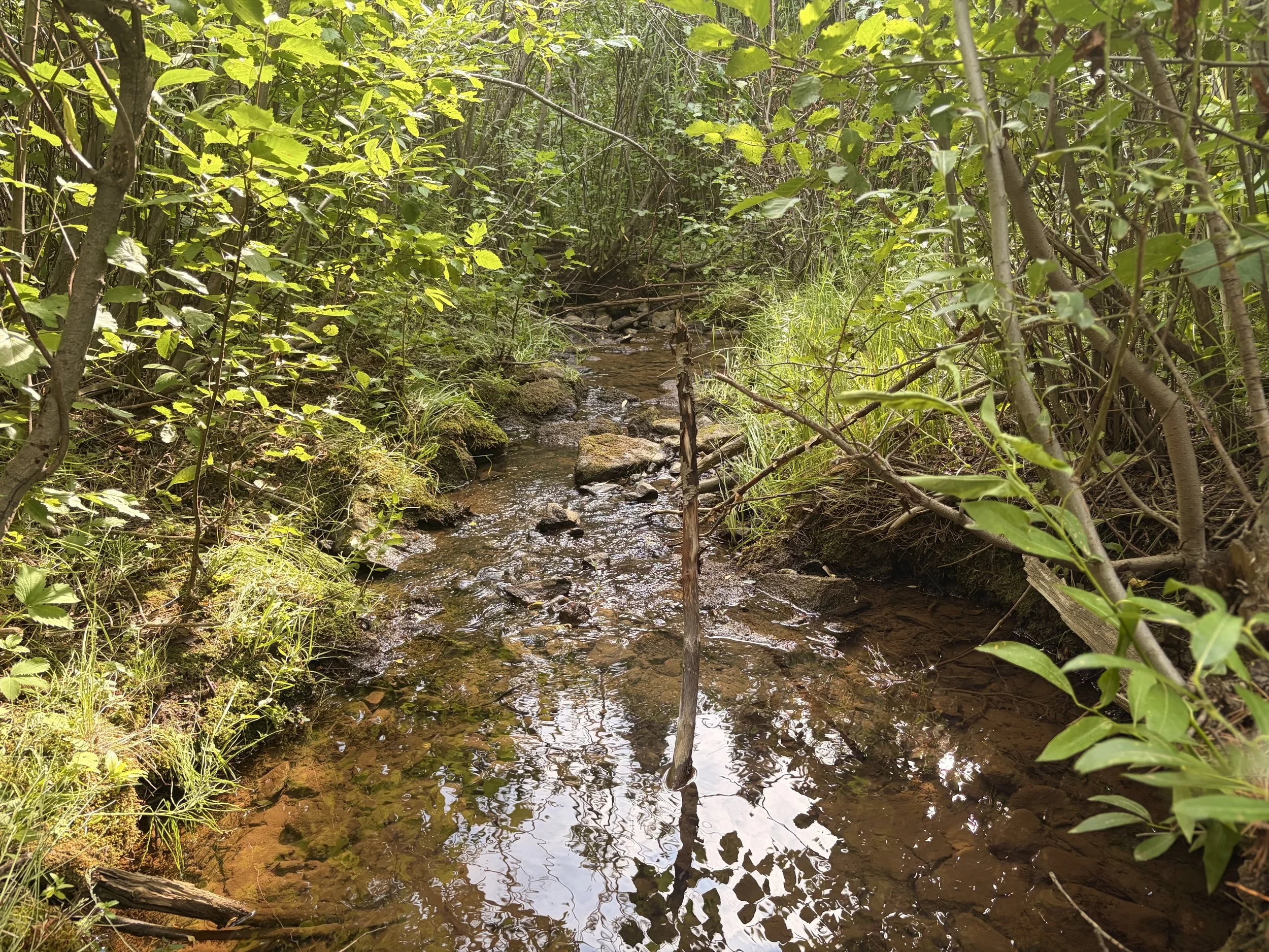
Unlike the alpine ridgelines of APEX, The Fool's Luck Placer follows the quiet course of Missouri Gulch through dense forest and riparian habitat. Here, the experience is defined not by distant horizons, but by flowing water, secluded ponds, and a landscape that reveals itself one step at a time.
The Landscape
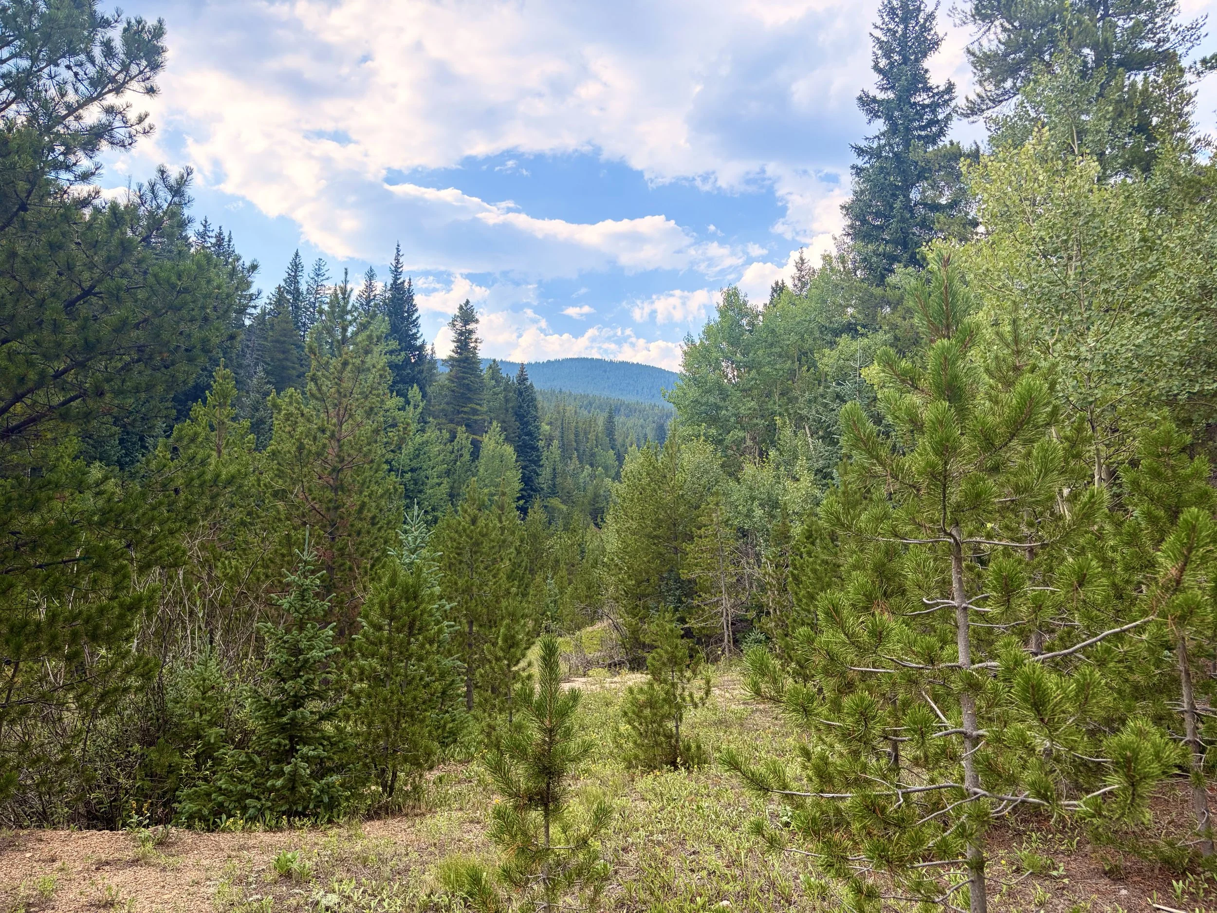
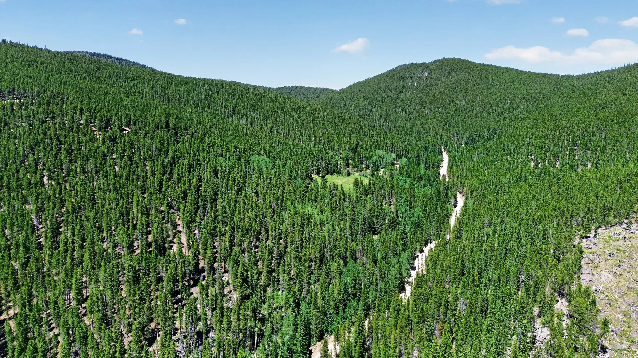
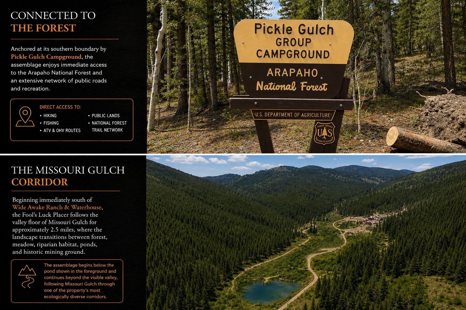
Unlike conventional mountain properties defined by ridgelines or summits, The Fool's Luck Placer follows the quiet course of Missouri Gulch for approximately 2½ miles. This long, slender ribbon of patented land encompasses mature conifer forest, flowing water, secluded ponds, riparian habitat, and historic mining landscapes almost entirely surrounded by Arapaho National Forest.
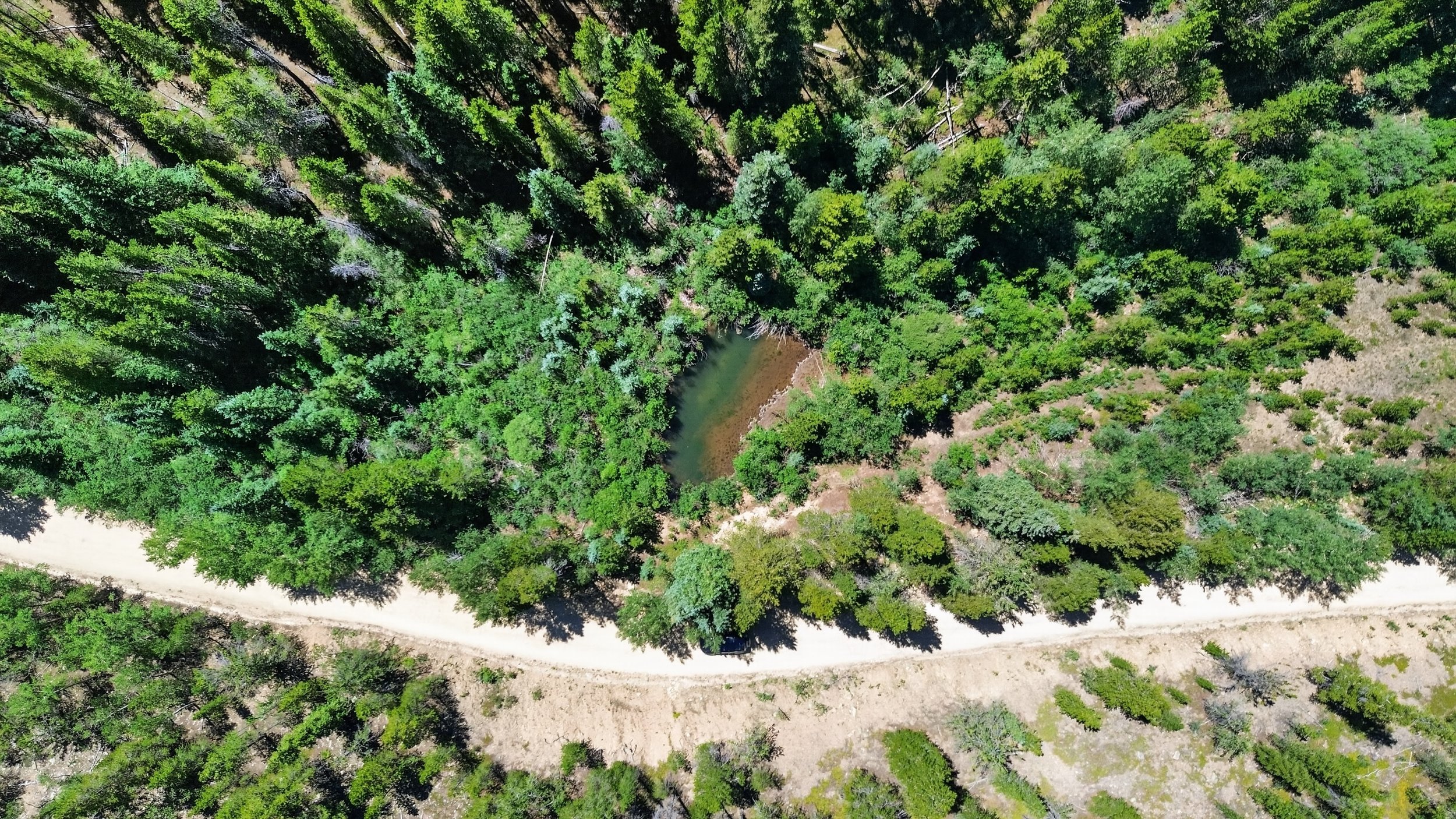
Water shapes the experience throughout the property. Flowing water has been observed within Missouri Gulch, while small ponds, lush vegetation, and dense forest create an ecological richness seldom encountered among privately owned mountain properties in Colorado's Front Range.
A Legacy Written in Water
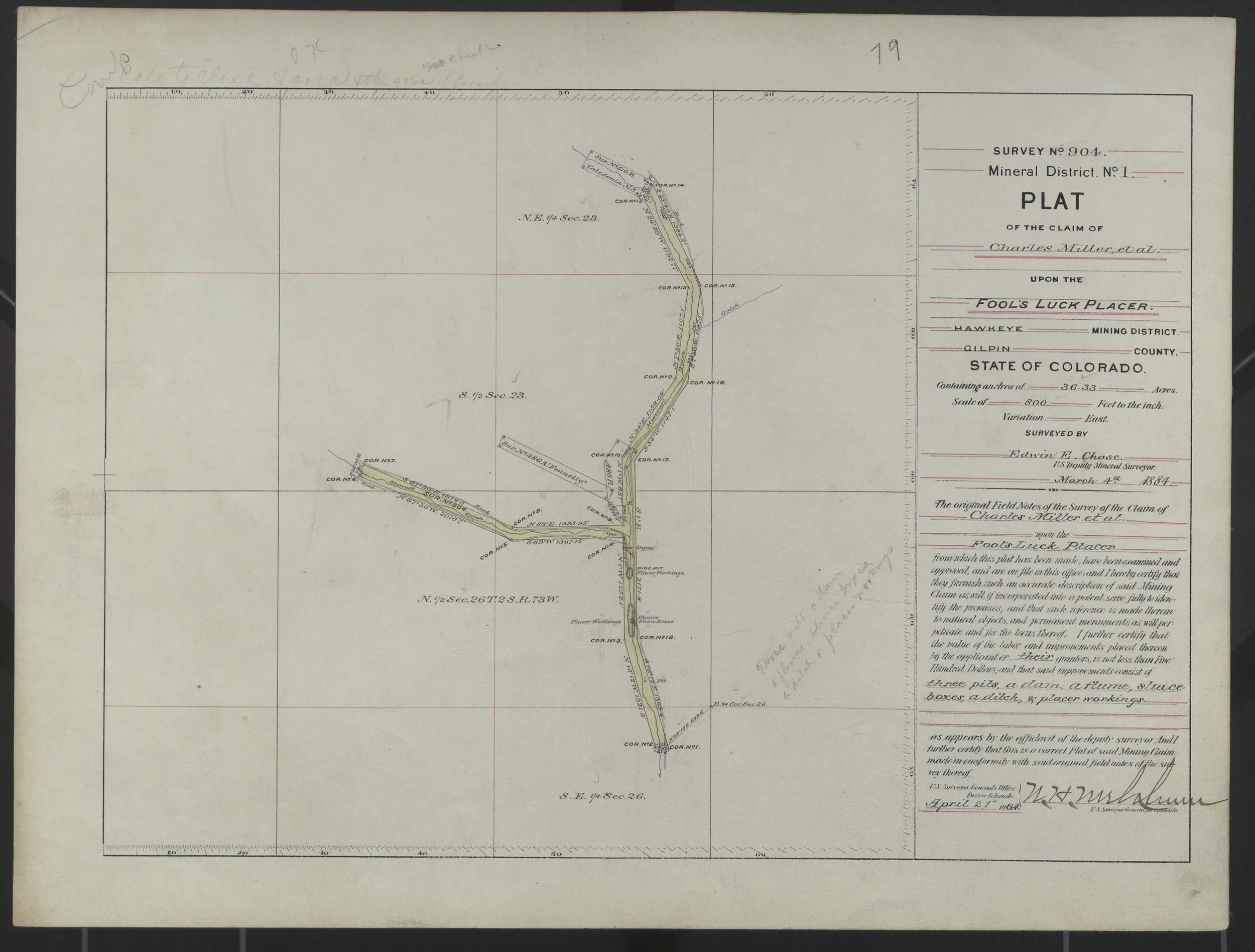
Long before today's network of forest roads and recreational trails, prospectors recognized the value of the waters flowing through Missouri Gulch. In 1884, the United States General Land Office issued Survey No. 904 for The Fool's Luck Placer, establishing a patented mining claim that closely followed the creek through the Hawkeye Mining District.
Unlike hard-rock mining claims centered on a single vein, placer claims were shaped by the course of water itself. Their long, narrow form reflected the search for alluvial gold carried downstream over countless seasons. More than 140 years later, that same relationship between land and water continues to define the character of the property.
Unlike many historic gulches that were heavily worked, portions of this watershed retain the appearance of an undisturbed mountain stream. Whether its gravels still hold undiscovered placer gold remains part of the property's enduring mystery, while its waters continue to sustain wildlife, recreation, and an uncommon sense of solitude.
THE LAND TODAY
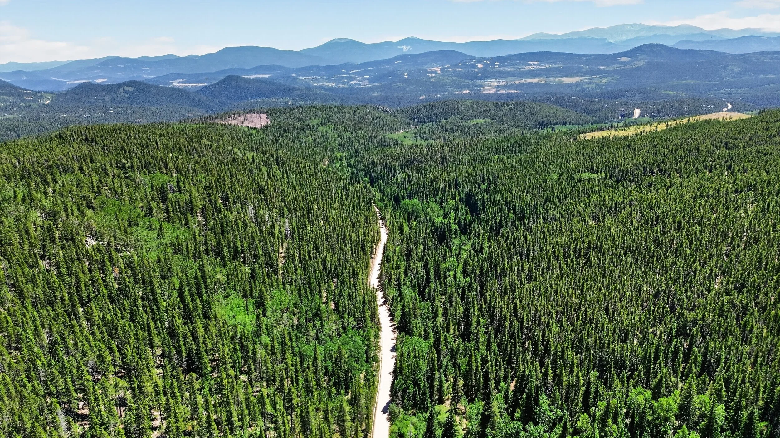
Today, The Fool's Luck Placer and neighboring Buck Horn claim remain remarkably intact, connected by forest roads and surrounded by thousands of acres of National Forest. What once drew prospectors in search of gold now reveals something far rarer—privacy, water, and an enduring mountain landscape.
A RARE MOUNTAIN SETTING
From high ridgelines to protected riparian corridors, the property encompasses a remarkable diversity of landscapes within a compact footprint. Dense forests, historic mining claims, flowing water, and expansive mountain views create an environment that is increasingly difficult to assemble today.
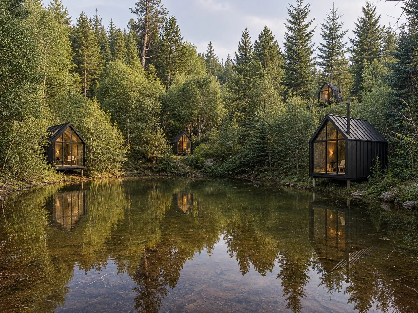
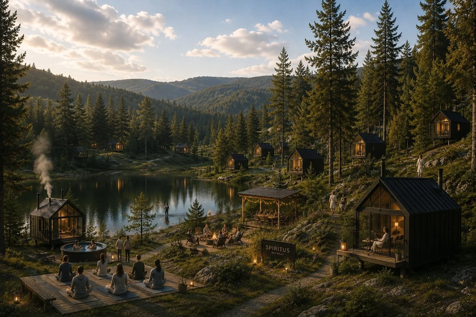
Where Nature Inspires Possibility.
These conceptual studies are intended to explore how thoughtful architecture might respond to the character of The Fool's Luck Placer. They are not proposed improvements or development plans, but visual conversations about stewardship, scale, and the experience of living within the landscape.
EXPERIENCING THE LAND
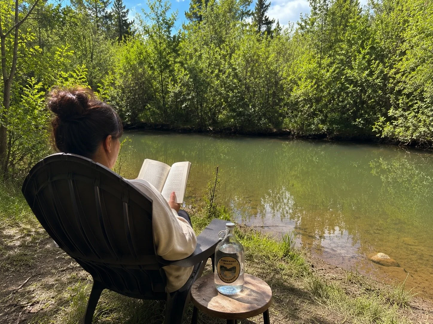
The value of The Fool's Luck Placer lies not only in its history or its setting, but in the experiences the landscape naturally invites. Quiet mornings beside still water. Time to read, reflect, explore, and reconnect with the rhythms of the forest.
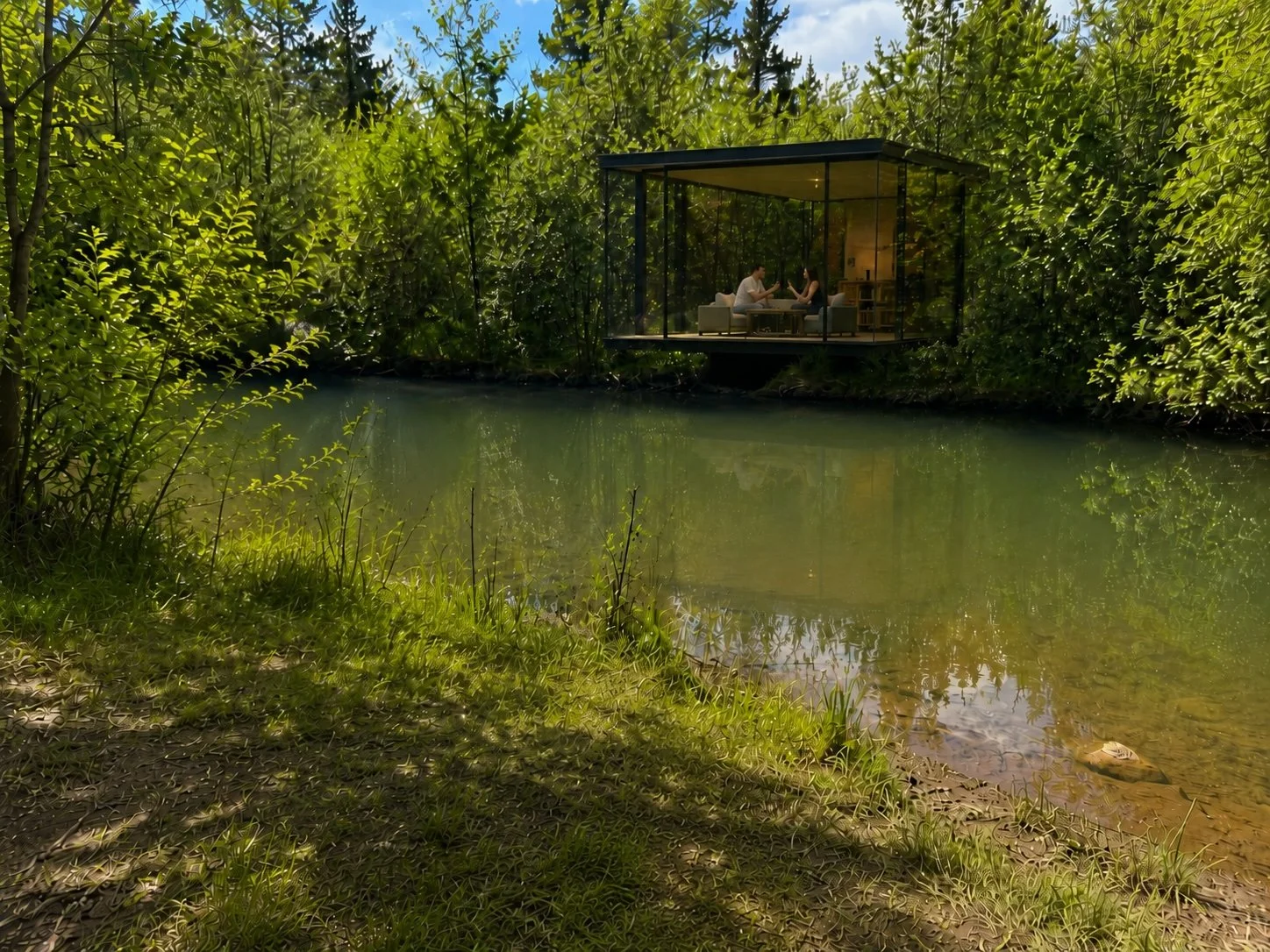
A PLACE FOR REFLECTION
Whether preserved in its natural state or thoughtfully stewarded for future generations, Missouri Gulch offers an increasingly rare opportunity to experience solitude, clean water, and uninterrupted connection with the surrounding National Forest.
REGIONAL CONTEXT
Connected to Colorado's High Country
The Fool's Luck occupies a remarkable position in the mountains west of Denver. Although immersed in quiet forests and surrounded by public lands, the property remains easily accessible from the Front Range, making it equally suited for weekend retreats, extended stays, or future hospitality concepts.
The following perspectives place The Fool's Luck within its broader setting-showing its relationship to nearby communities, surrounding open space, the Continental Divide, and several nearby land assemblages. Together they illustrate a property that offers exceptional privacy while remaining connected to one of Colorado's most desirable mountain regions.
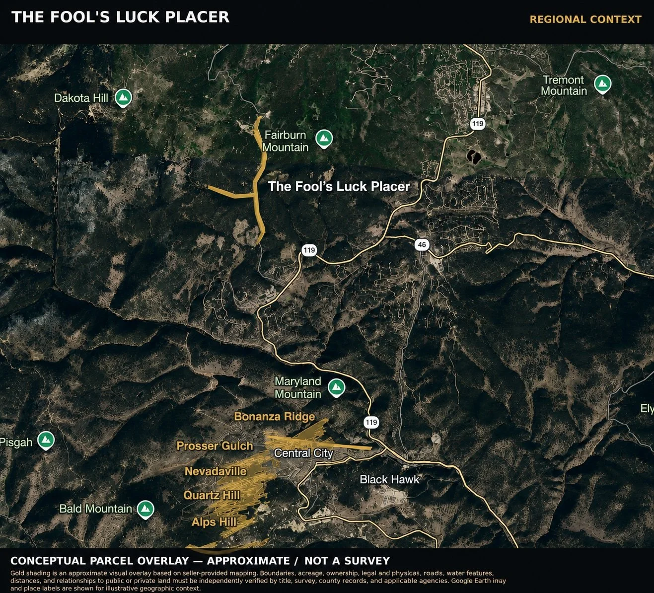
Regional Overview
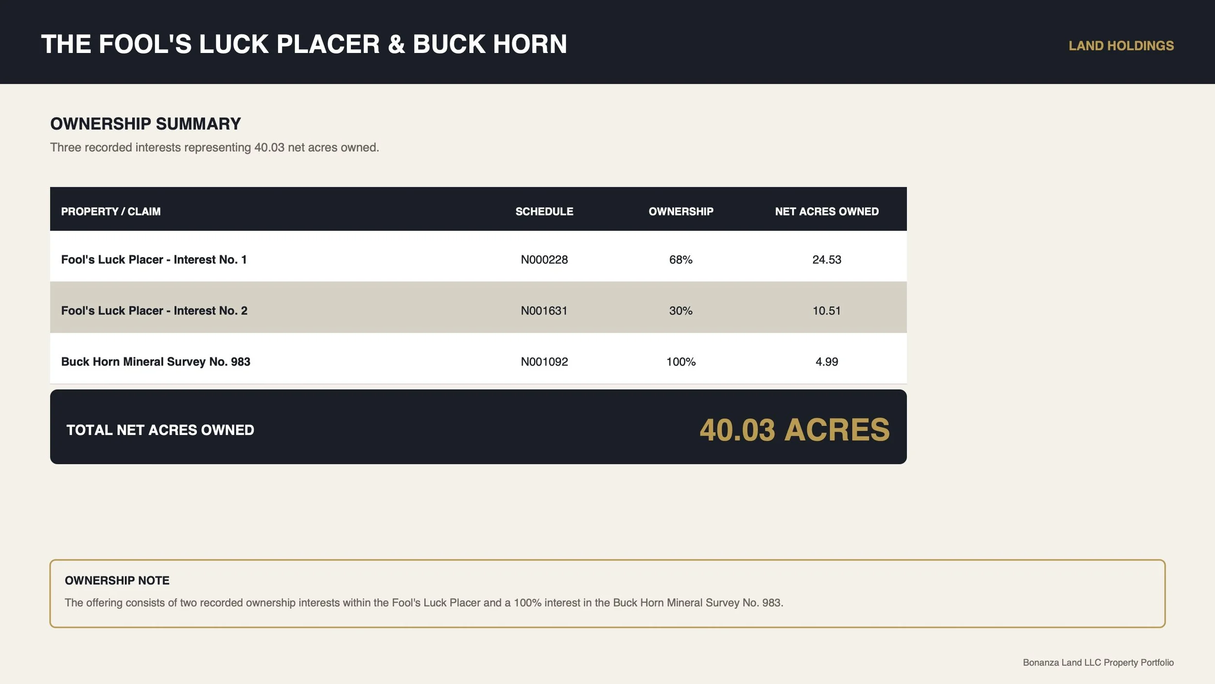
Fool's Luck occupies approximately 36 acres extending through Missouri Gulch and Stewart Gulch, with the Buck Horn mineral survey included as part of the offering. The property forms the northern anchor of a broader collection of mountain land assemblages in the Central City area.
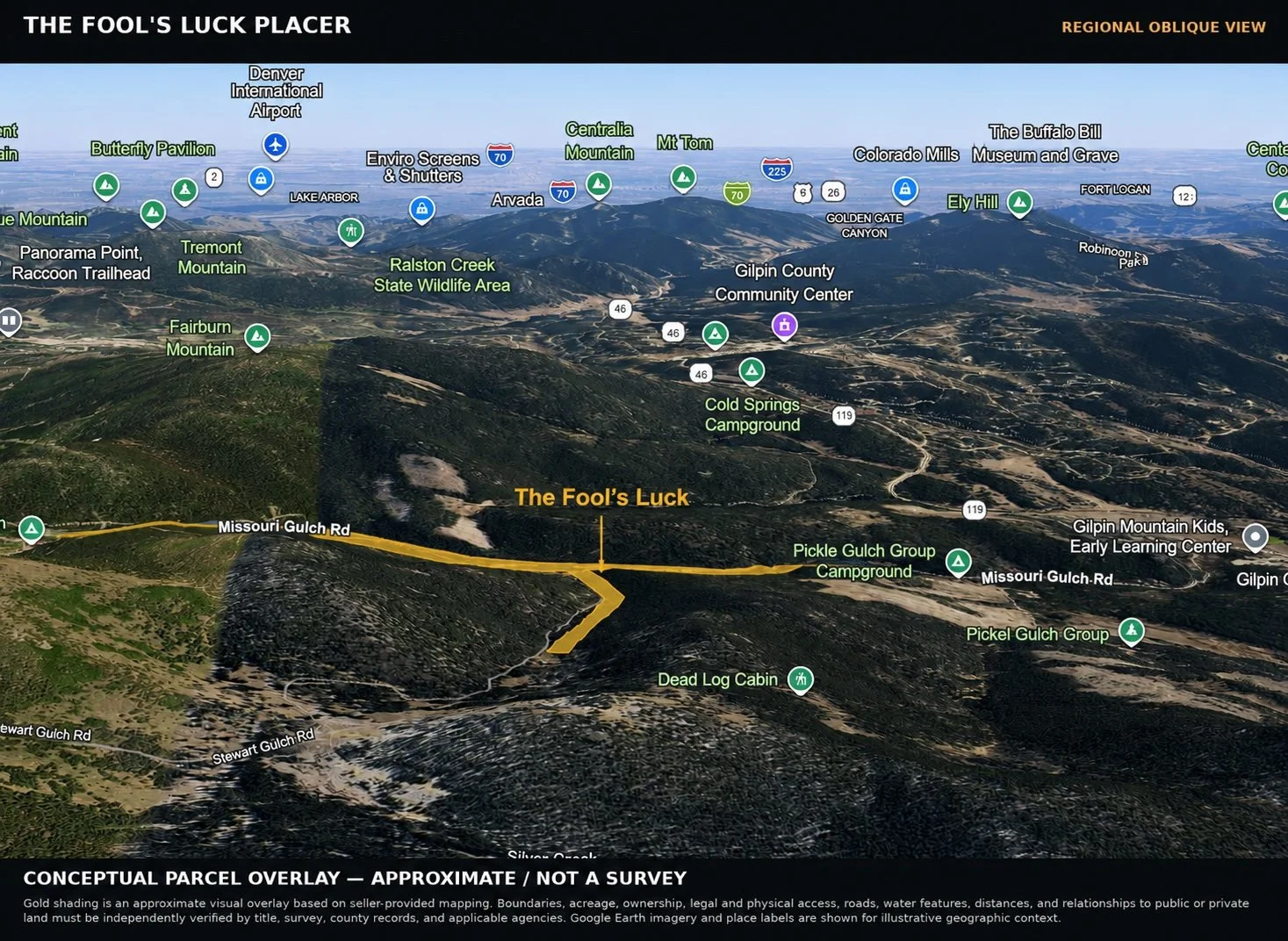
Looking east toward Colorado's Front Range, Denver International Airport lies beyond the distant horizon, underscoring the property's rare combination of mountain solitude and convenient metropolitan access.
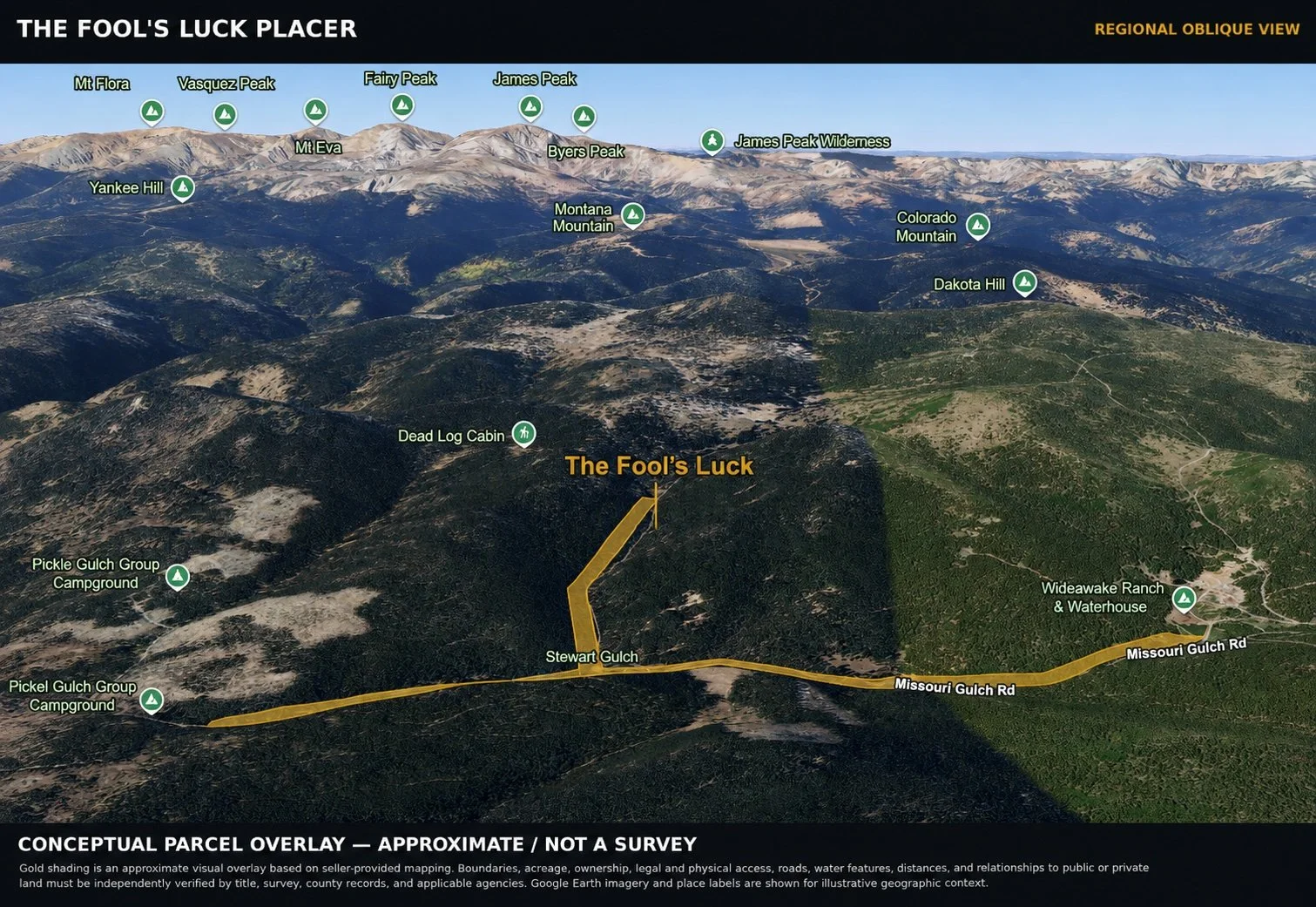
Looking West
Looking west, the terrain rises toward the Continental Divide, where thousands of acres of public lands, alpine forests, and high-country recreation define one of Colorado's most scenic mountain landscapes.
CHAPTER V
____________________________________________________________
THE CREST of ALPS HILL
The Laboratory Where Vision Became Reality.
The Laboratory
Before there was a portfolio, there was a single mountain.
Alps Hill became the proving ground for an idea that many believed could not be accomplished: that forgotten patented mining claims at more than 9,000 feet could become one of Colorado's most compelling modern mountain communities.
Every lesson was learned here.
The first home was built without precedent, relying on persistence more than experience. Each successive residence refined the process-from water exploration and off-grid utility systems to road construction, logistics, architecture, and the realities of building in one of Colorado's most demanding alpine environments. Over time, those lessons evolved into a repeatable model supported by an experienced team that now understands both the vision and the execution required to bring it to life.
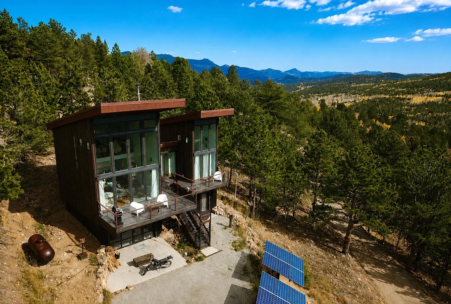
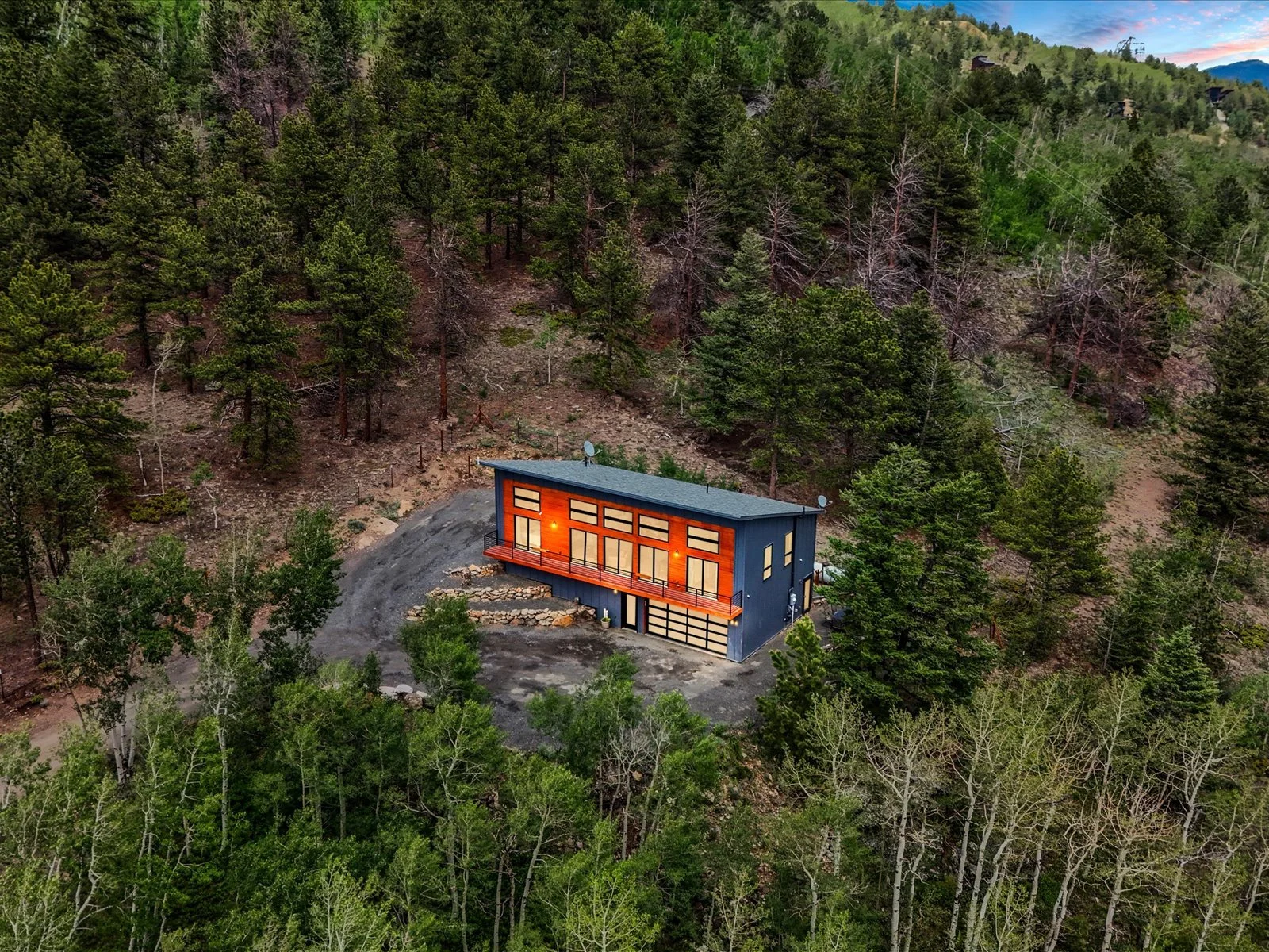
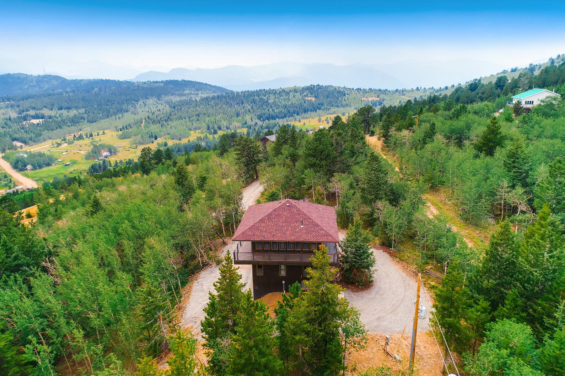
Today, sixteen completed VEDA residences stand across Bonanza Land LLC's holdings, each demonstrating that modern architecture, sustainable infrastructure, and sensitive land stewardship can coexist with historic mining landscapes.
These are not simply mountain homes. They represent a different way of living-smaller by intention, technologically sophisticated, remarkably self-sufficient, and deeply connected to the surrounding landscape. State-of-the-art off-grid systems, carefully developed water resources, and resilient infrastructure have transformed remote mountain properties into comfortable year-round residences without sacrificing the character of the land.
Alps Hill is more than a collection of homes. It is demonstrated vision.
Stewardship Before Development
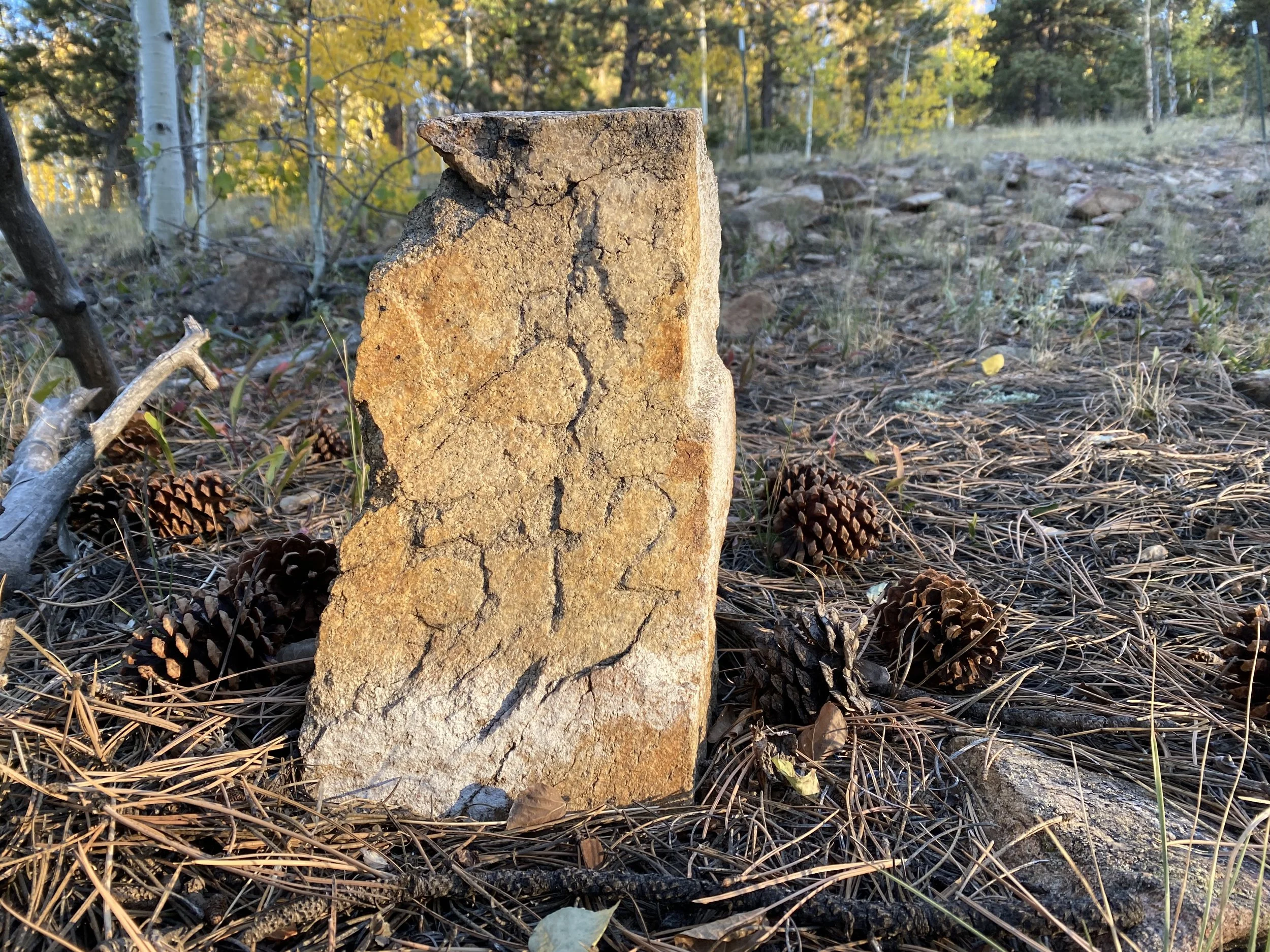
Researching the Mountain
Original government survey monuments remain exactly where they were placed more than a century ago, marking patented mining claims that still define ownership today. Understanding these historic boundaries was the first step in responsibly reimagining the land for a new generation.
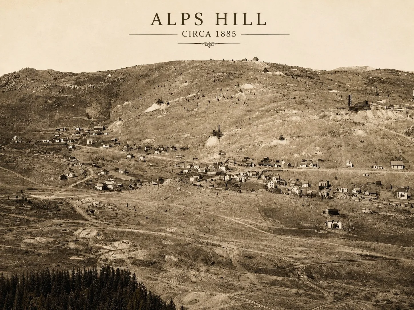
Understanding the Past
The Alps Hill landscape was once an active mining district. While much of the infrastructure has disappeared, traces of that history remain throughout the mountain. Rather than erase the past, Bonanza Land LLC embraced it-preserving its story while imagining a new future.
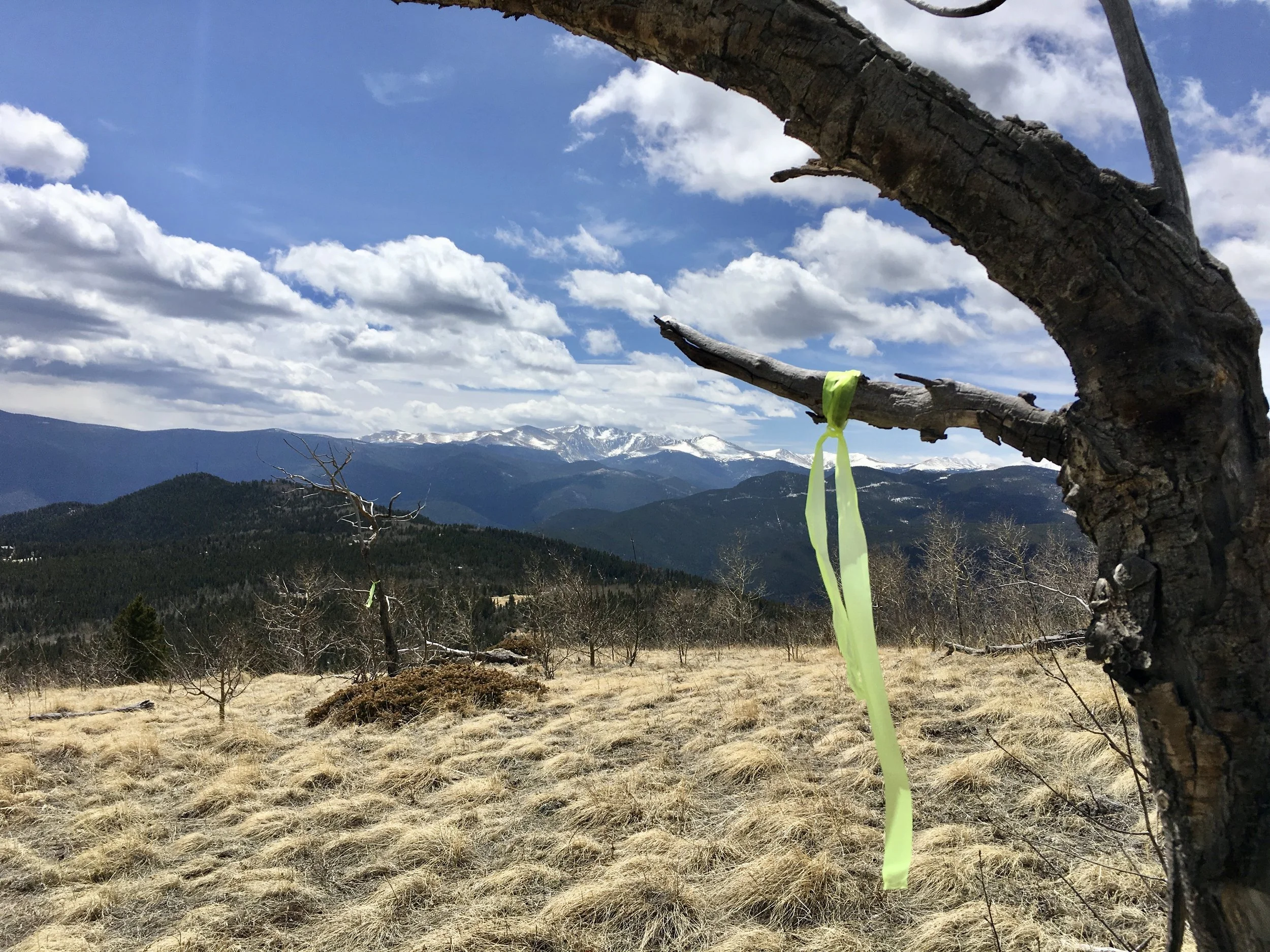
Finding the Vision
Every homesite began with boots on the ground. Countless hours were spent walking ridgelines, studying drainage, evaluating solar exposure, and identifying view corridors. The mountain revealed itself through exploration, not speculation.
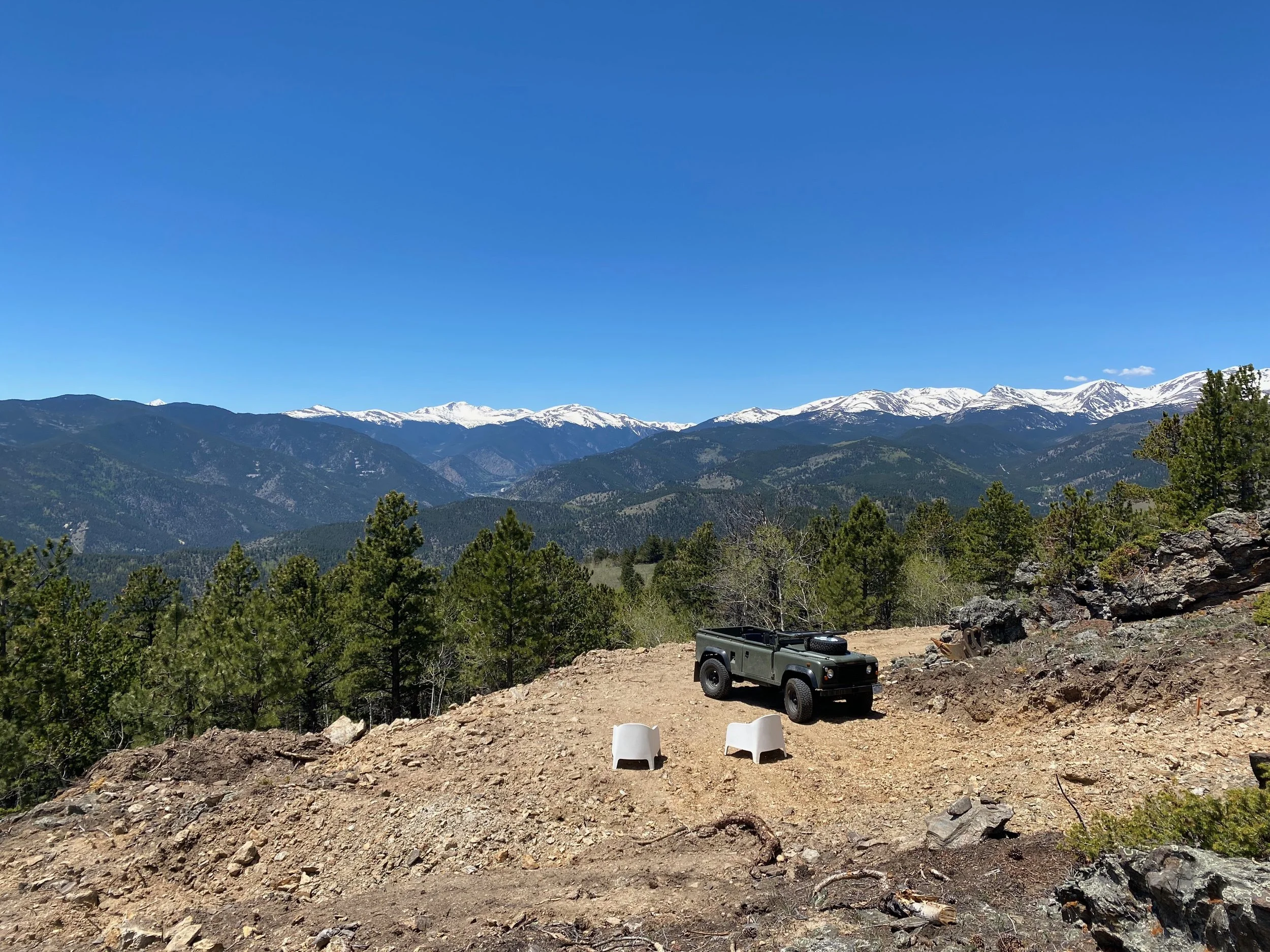
Reading the Mountain
Once ownership and boundaries were understood, attention shifted to the landscape itself.
Every prospective homesite was evaluated in the field-not only for its views, but for solar orientation, topography, drainage, privacy, prevailing winds, and its relationship to neighboring parcels. Days were spent walking ridgelines, returning in different seasons, and understanding how each site would live rather than simply how it would look.
The mountain ultimately determined where each home belonged. The role of the developer was to recognize those places rather than impose them.
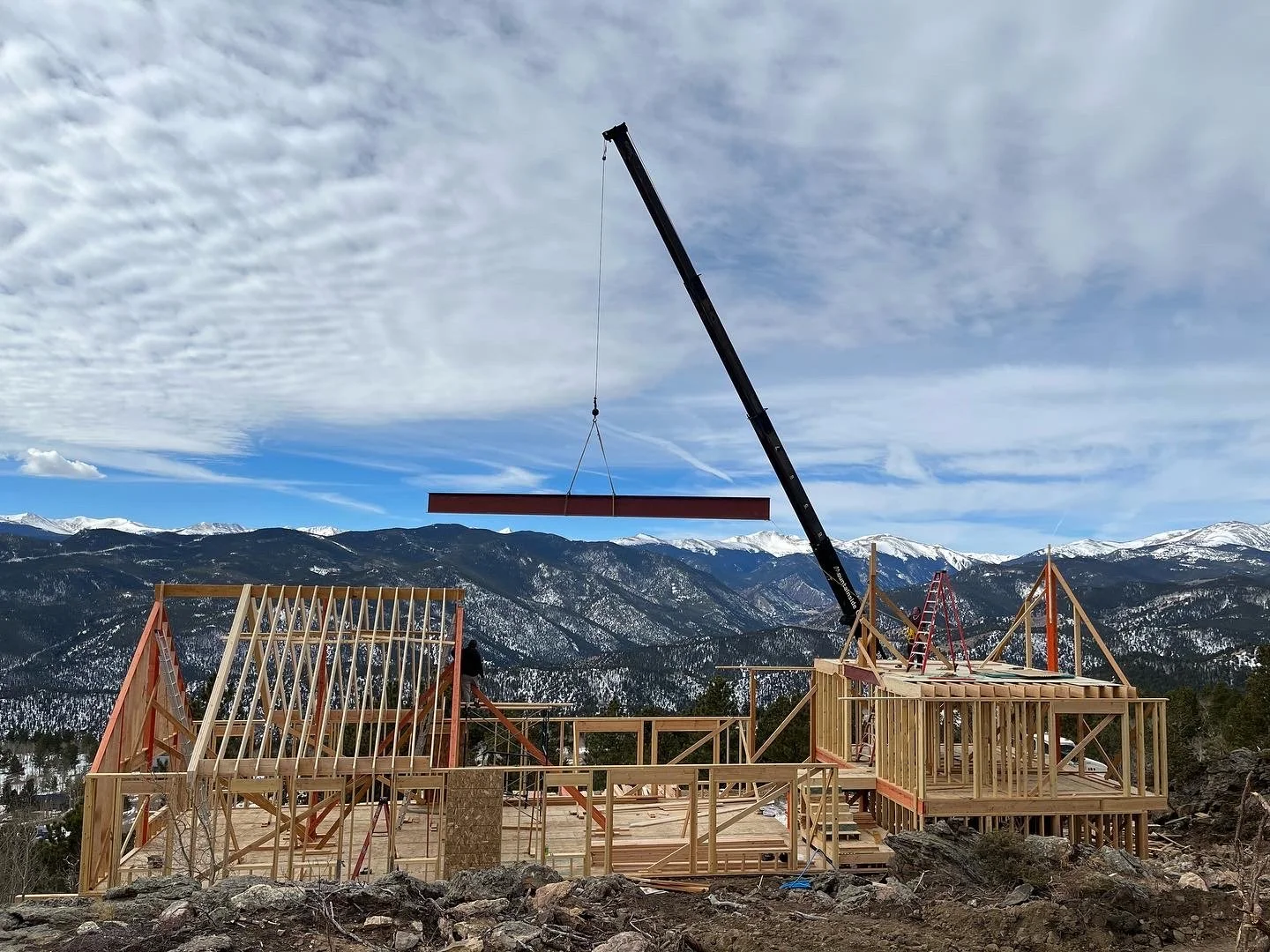
Building Where Few Would
Selecting exceptional homesites was only the beginning. Constructing modern residences above 9,000 feet required years of refinement in logistics, engineering, and project management.
Every beam, panel, window, and piece of equipment traveled steep mountain roads before being carefully placed within a rugged alpine environment. Through every season, Bonanza Land LLC developed a repeatable process for delivering sophisticated architecture where conventional development would have been considered impractical.
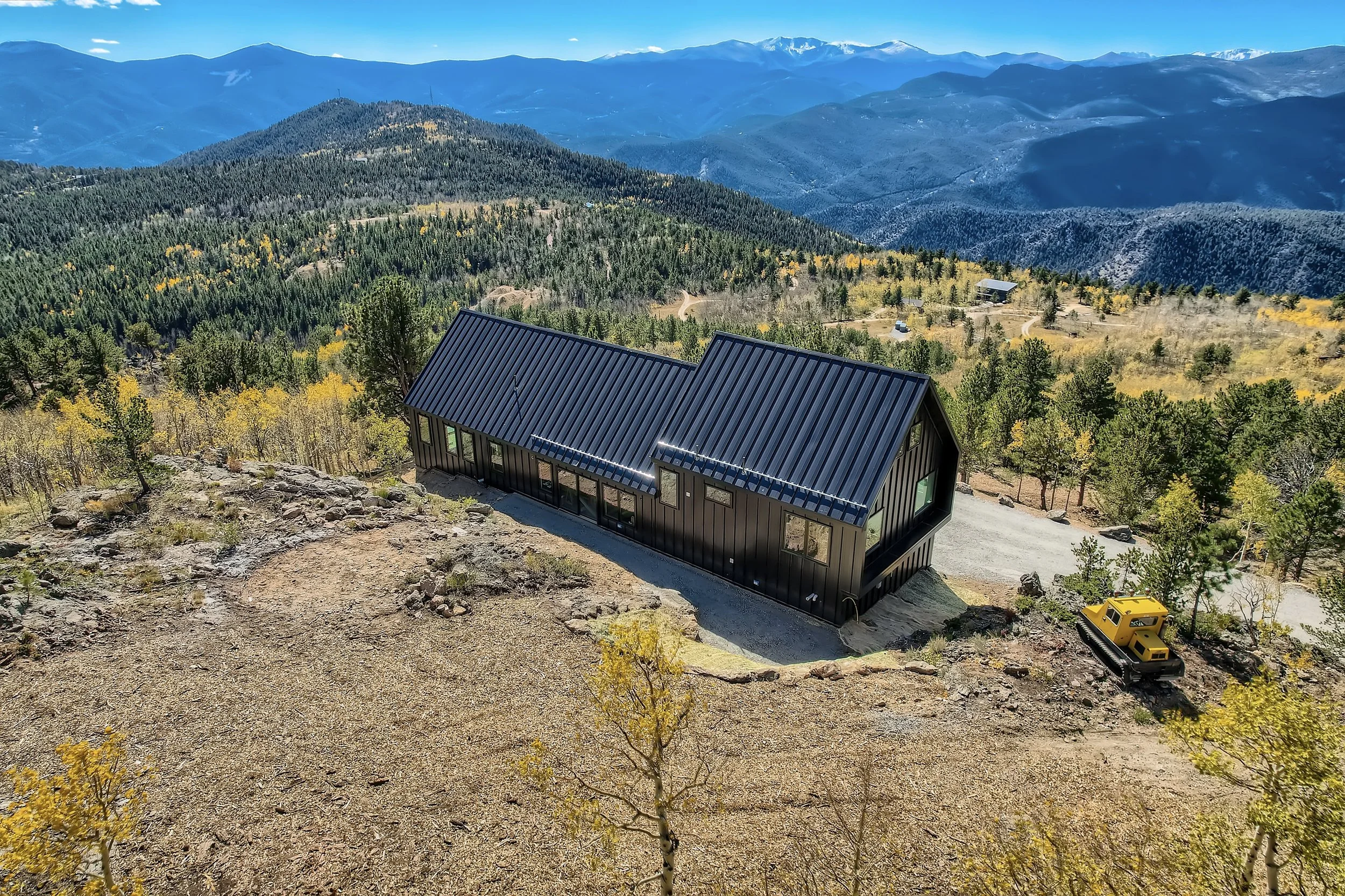
Proof of Concept
What began as an experiment became a proven model. Alps Hill demonstrates that modern, grid-independent architecture can be successfully integrated into historic mountain landscapes while preserving the character that makes them extraordinary.


The Crest
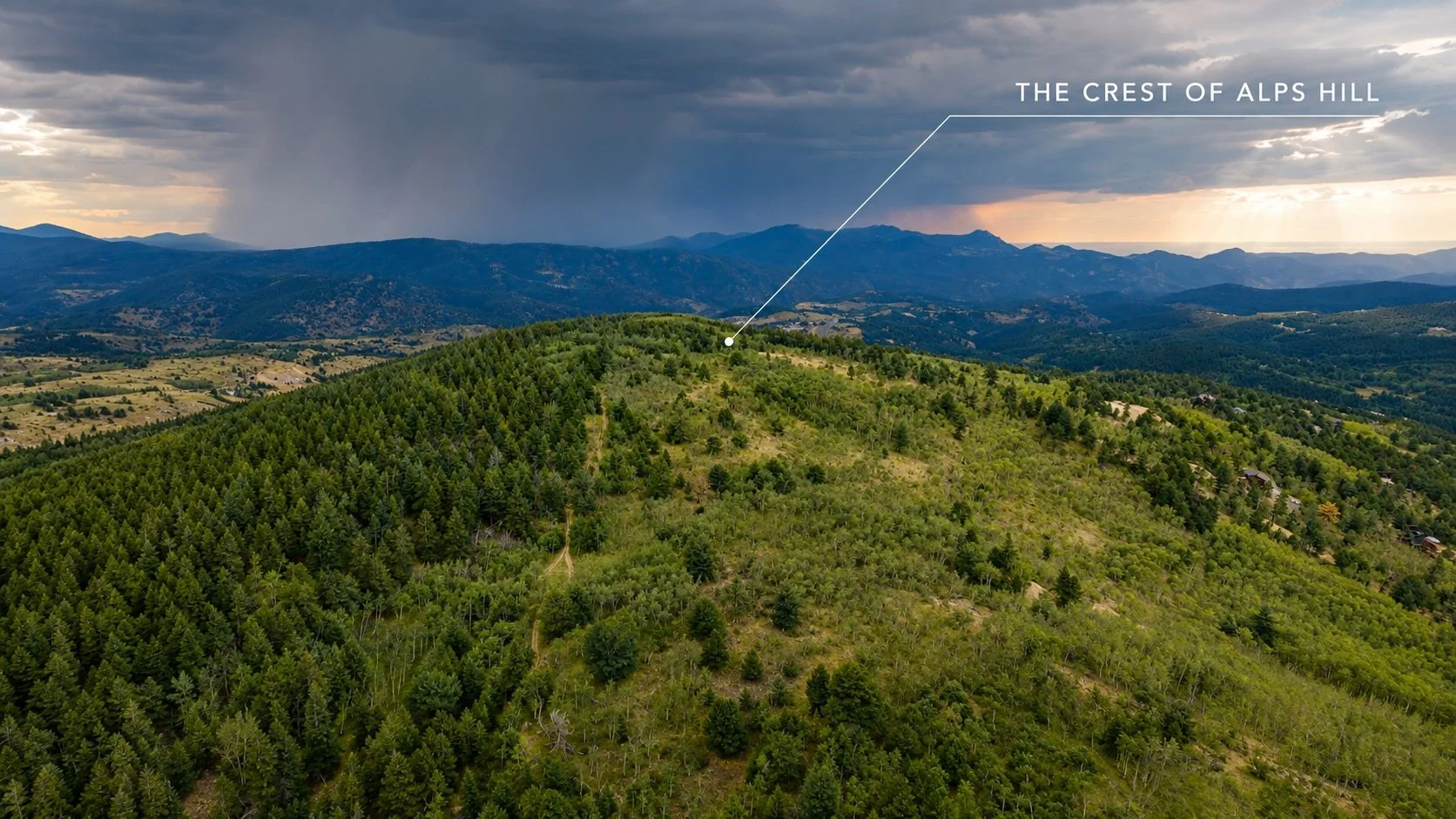
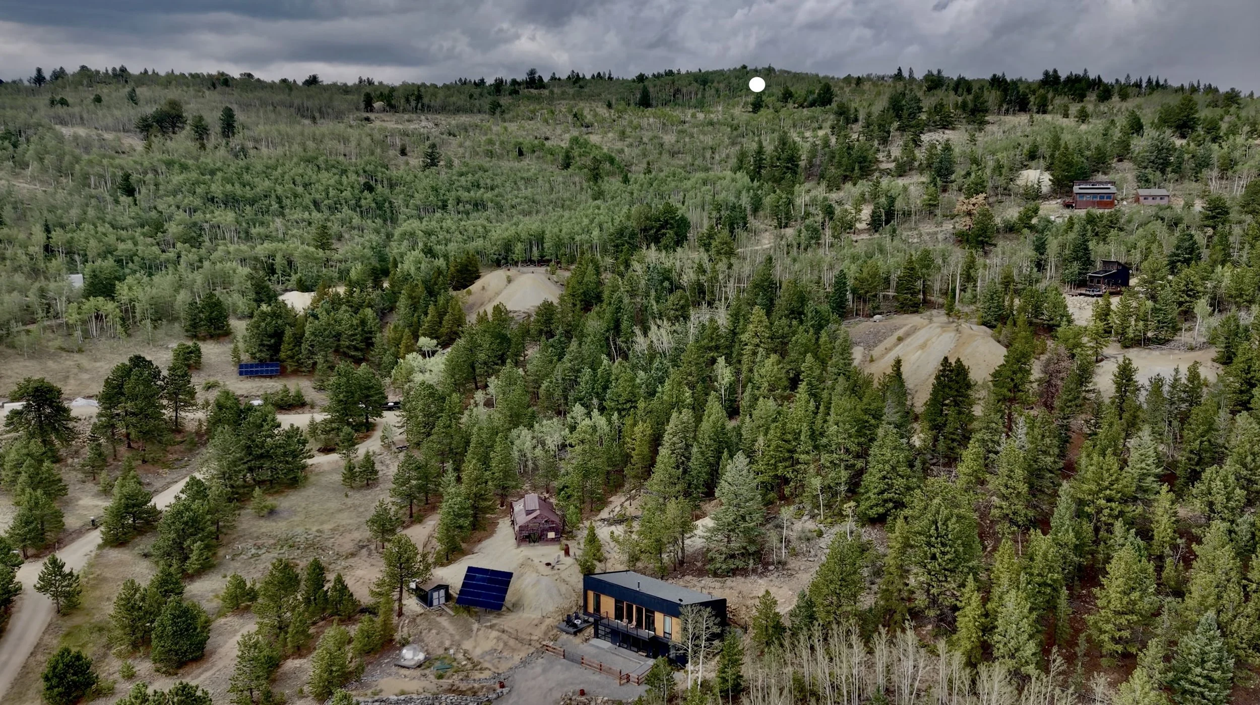
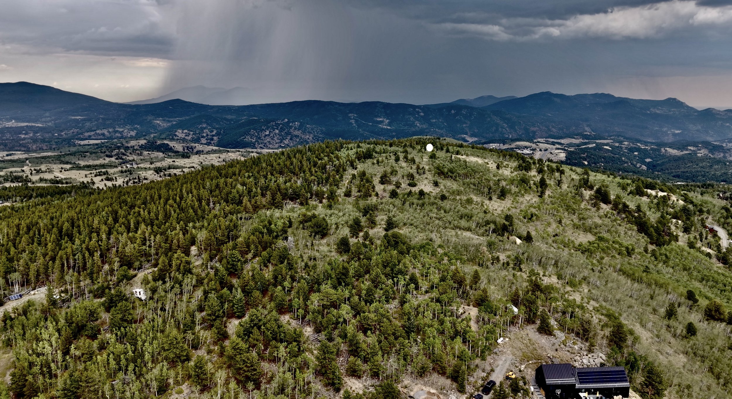
The Crest of Alps Hill includes four exceptional homesites overlooking the Continental Divide, together with additional lands that broaden the opportunity for future stewardship.
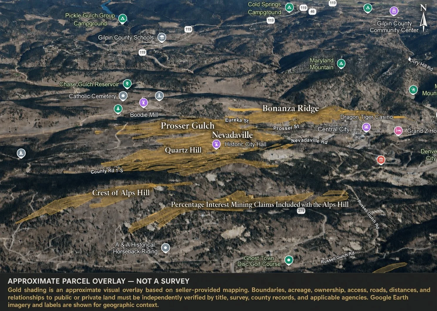
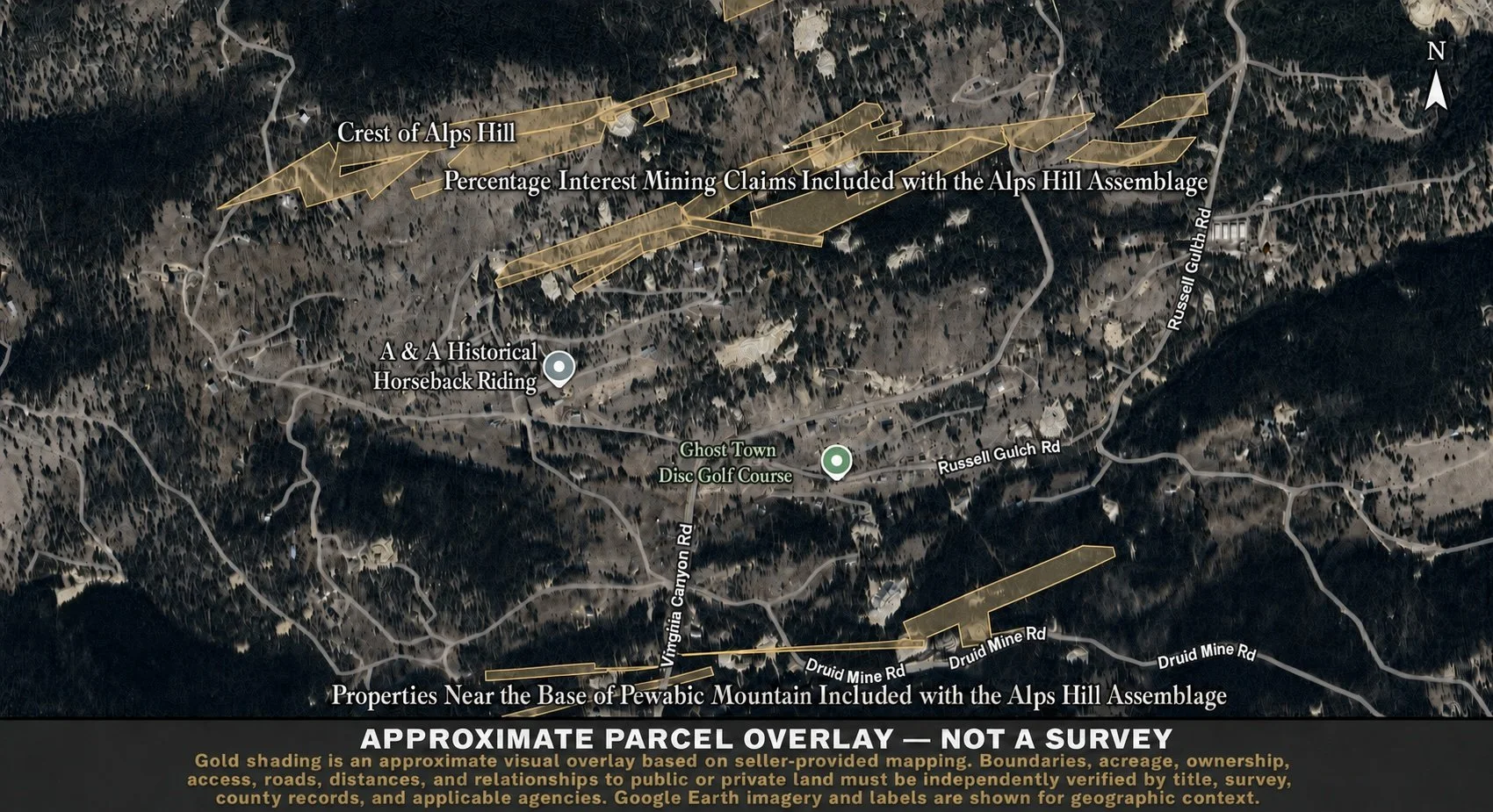
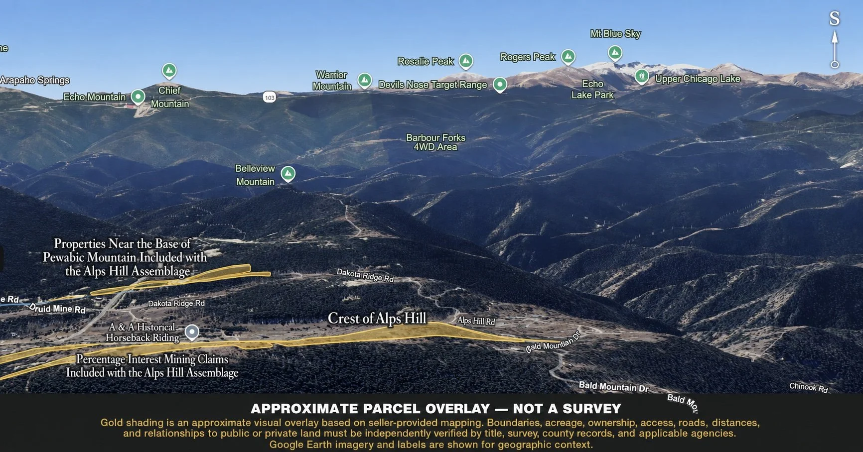
The assemblage also includes more than two dozen acres of patented mining claims held as percentage interests along the eastern boundary. These interests help preserve the character and openness of the surrounding landscape while also presenting the opportunity for a future steward to acquire the remaining ownership interests over time.
This patient process of consolidating fragmented mining claims is the very approach through which much of the broader Bonanza Land LLC portfolio was assembled over the past three decades.
Also included are several wholly owned parcels below the crest, as well as additional holdings near the base of Pewabic Mountain, across the valley and within sight of the crest itself.
For those who recognize the long-term value of historic mining land, stewardship does not end with acquisition. It continues through the thoughtful consolidation of fragmented ownership, gradually restoring coherence to landscapes that have been divided for generations.
Collectively, these properties represent not simply a collection of homesites, but the continuation of a vision already proven. The following perspectives reveal the landscape that remains-and the opportunities it presents.
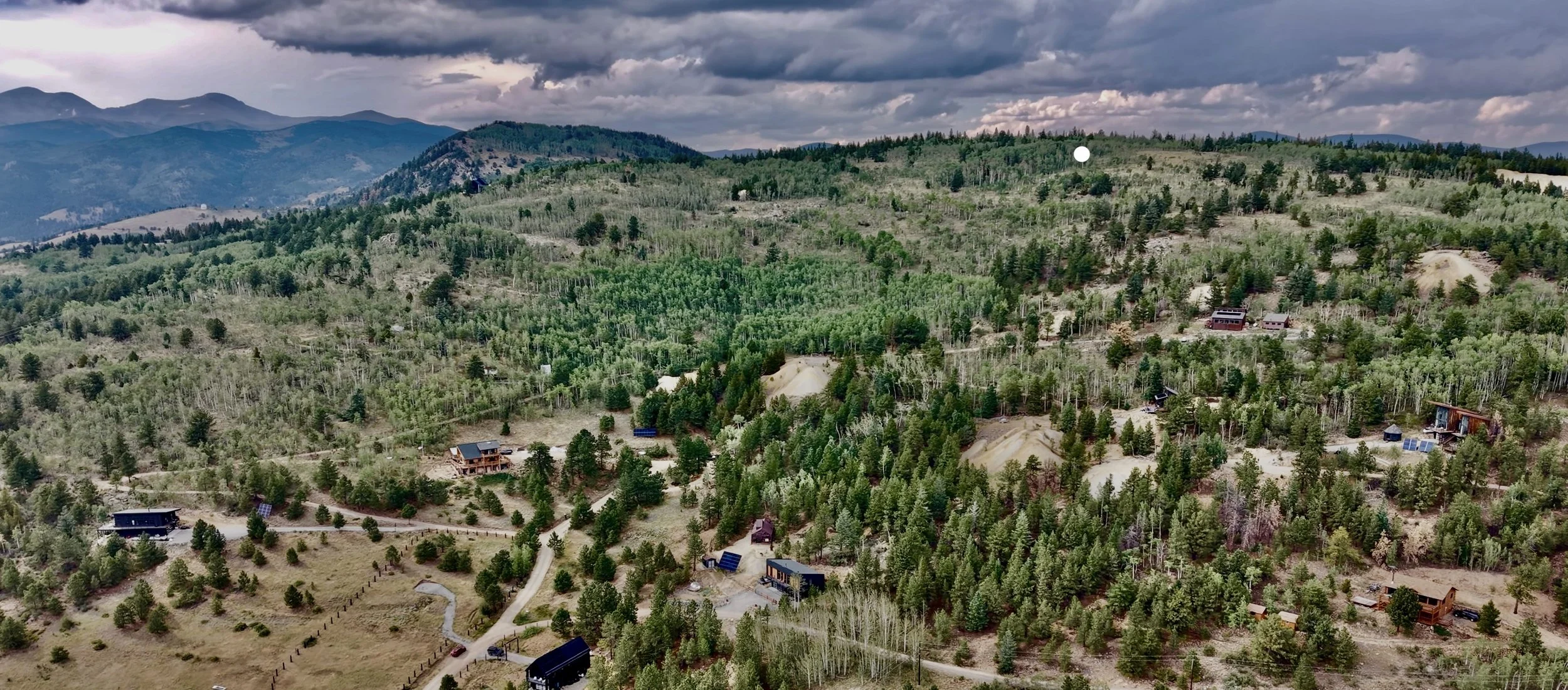
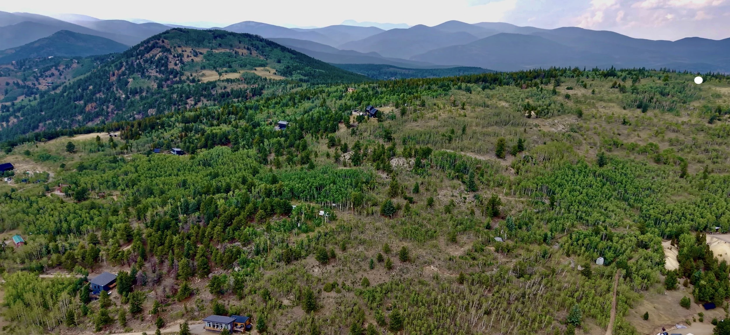
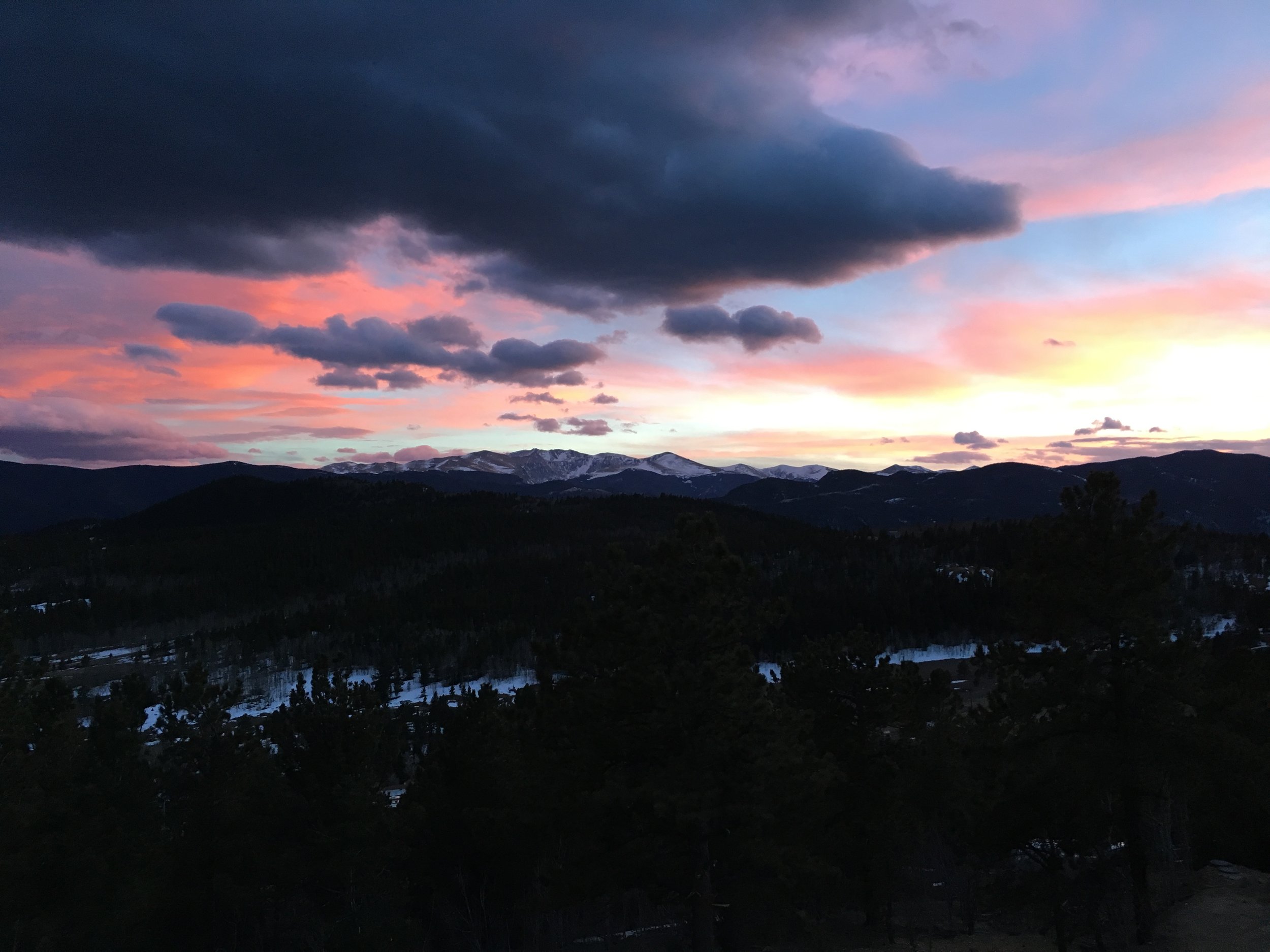
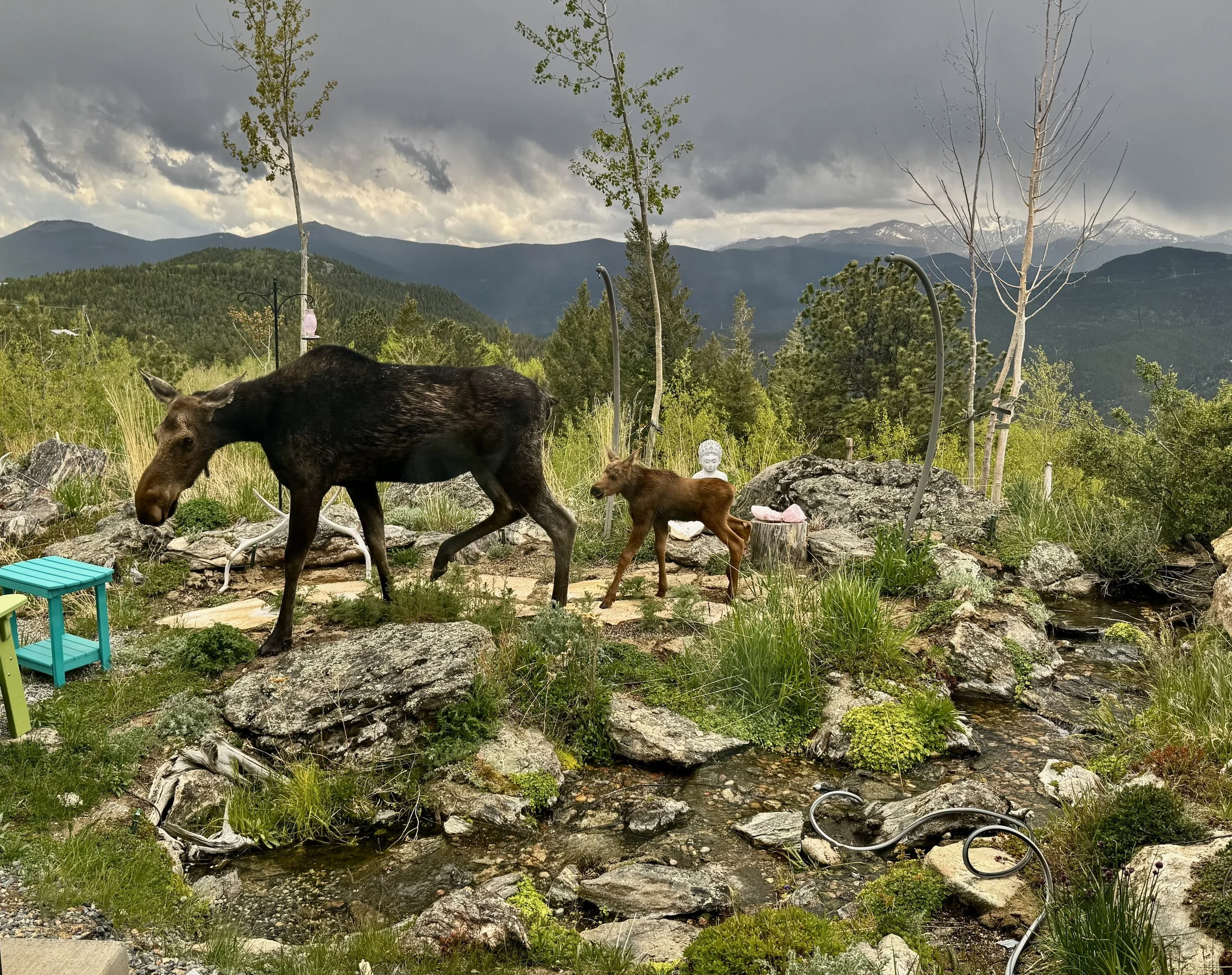
Life on The Crest
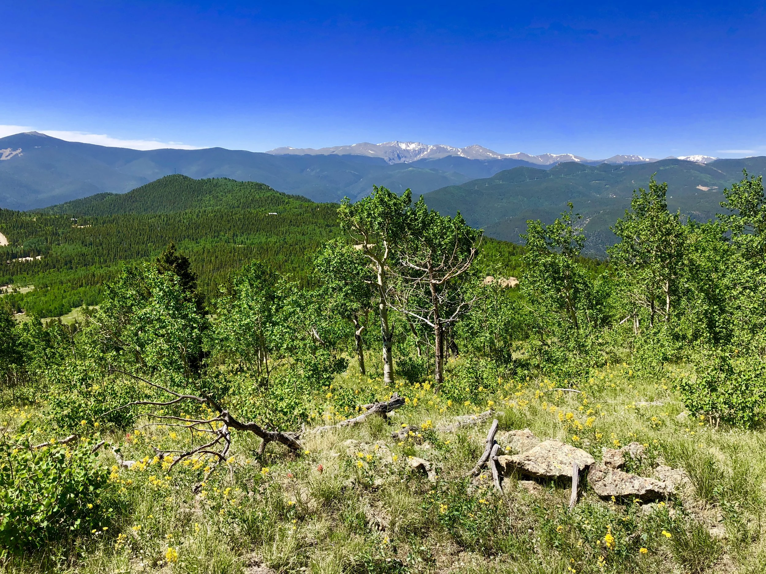
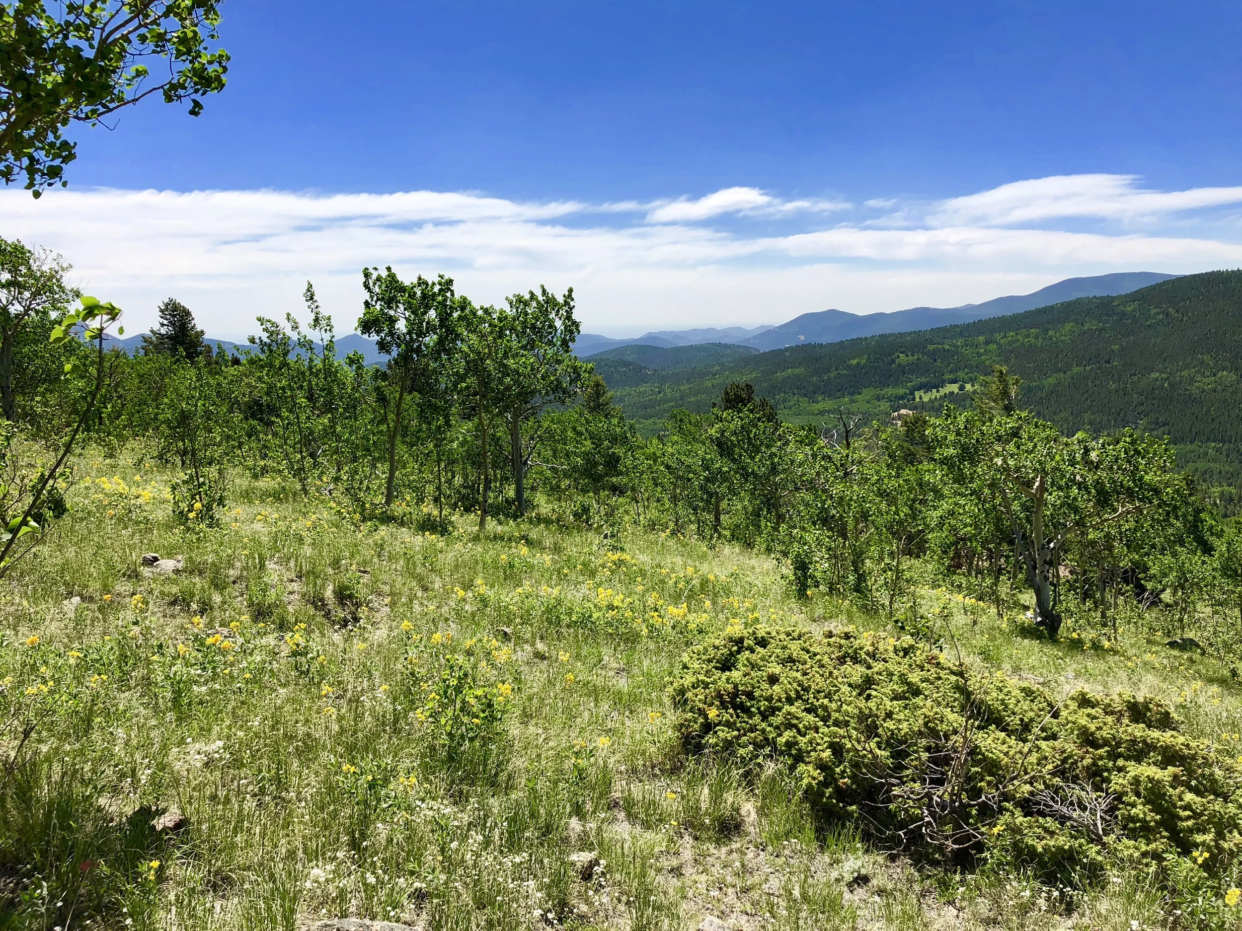
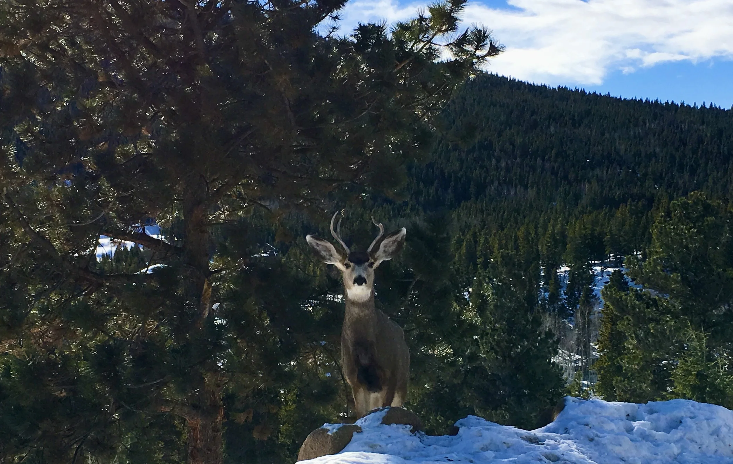
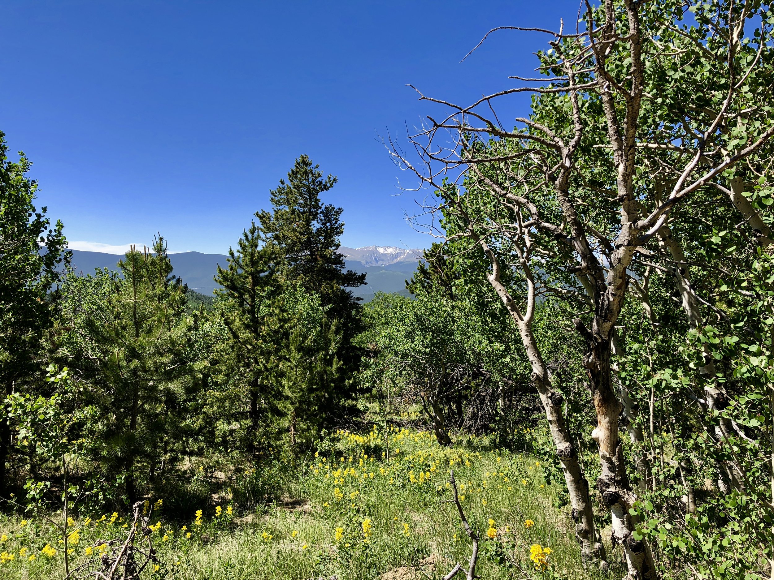
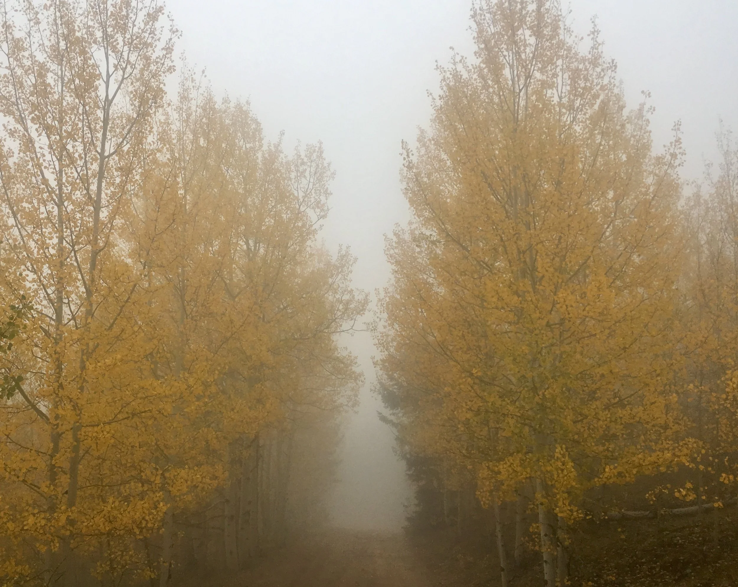
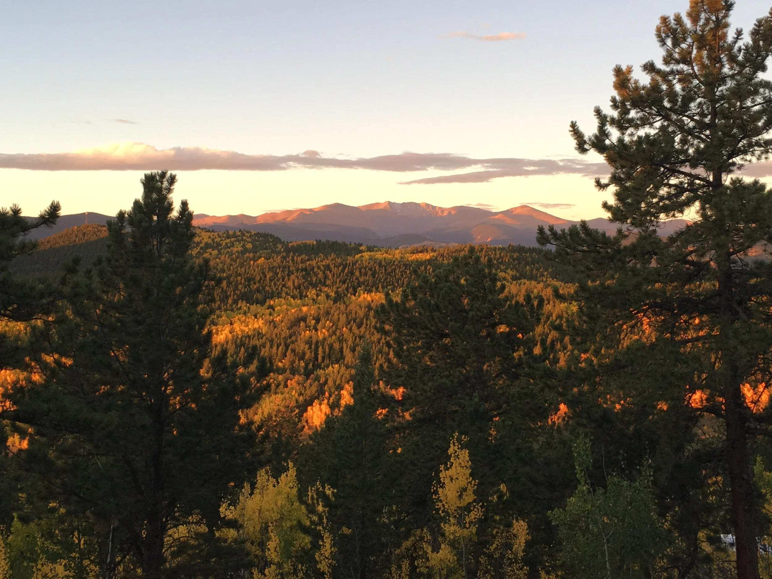
Regional Context
The following maps place the Alps Hill Assemblage within the broader Gilpin County portfolio and illustrate the extent of the land assembled over three decades. Together they show the crest, surrounding holdings, associated percentage-interest mining claims, and additional parcels near the base of Pewabic Mountain that are included with the offering.
Opportunity
Alps Hill demonstrates what is possible when vision, perseverance, and thoughtful stewardship come together.
Over the past decade, Bonanza Land LLC transformed historic patented mining claims into a thriving mountain community where modern architecture, advanced grid-independent infrastructure, and respect for the landscape exist in harmony. The completed residences below the crest are not conceptual-they are tangible proof of what has already been accomplished.
The remaining Crest of Alps Hill offers the next steward an opportunity to build upon that legacy. Four exceptional homesites occupy one of the highest and most dramatic ridgelines in the assemblage, overlooking the Continental Divide and benefiting from the knowledge, infrastructure, and experience developed throughout the community below.
Included with the offering are additional wholly owned parcels, properties near the base of Pewabic Mountain, and percentage-interest mining claims that help preserve the surrounding landscape while also presenting opportunities for continued stewardship through the thoughtful consolidation of historic ownership interests.
Rather than prescribing a single outcome, the assemblage invites the next steward to define its next chapter-whether through exceptional mountain residences, conservation, hospitality, wellness, or an entirely new vision inspired by the landscape itself.
Properties Included with the Alps Hill Assemblage
The preceding pages have introduced the philosophy behind Alps Hill, documented its successful realization, and illustrated the extraordinary landscape that defines this mountain community. They have shown what is possible when thoughtful stewardship, modern design, and perseverance come together over time.
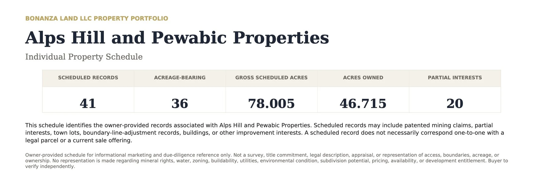
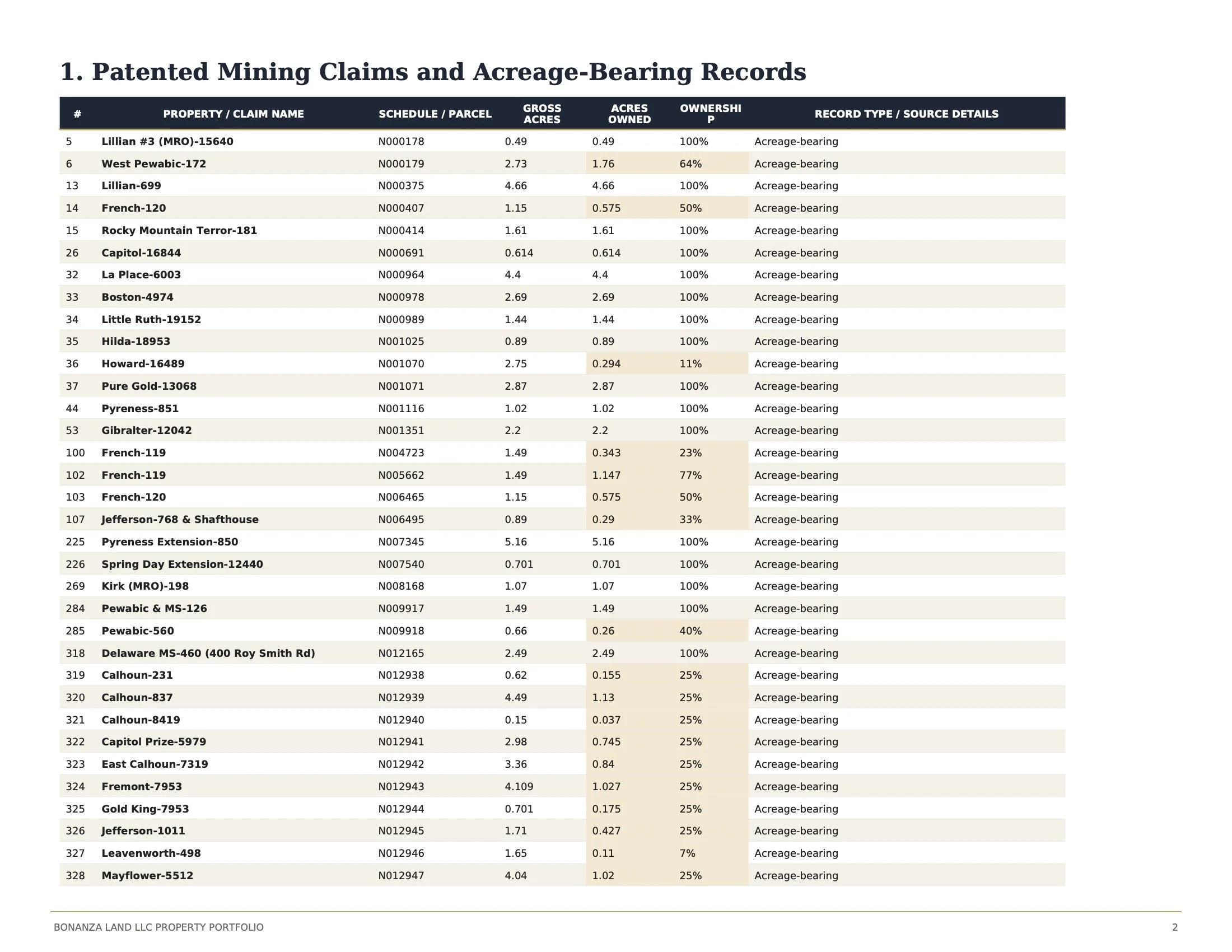
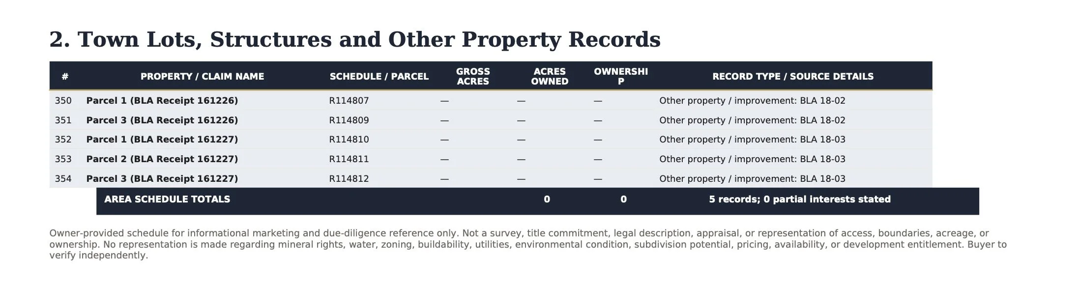
The following property schedule identifies the individual holdings included within the Alps Hill Assemblage. Together they comprise a carefully assembled collection of patented mining claims, buildable homesites, additional wholly owned parcels, properties near the base of Pewabic Mountain, and percentage-interest mining claims acquired through decades of patient research and strategic acquisition.
While each parcel possesses its own legal identity, their greatest value lies in their relationship to one another.
Collectively, they preserve the continuity of the mountain landscape, provide exceptional opportunities for future stewardship, and reflect a long-term commitment to assembling and caring for one of Colorado's most remarkable high-altitude environments.
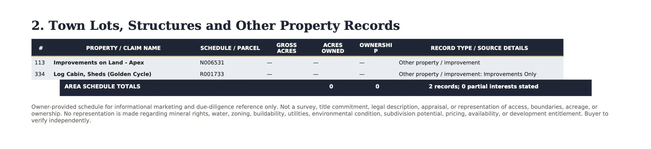
The schedule that follows serves as both a legal inventory and a record of that stewardship.

A Proven Legacy
The Alps Hill Assemblage represents more than a successful mountain development. It demonstrates what can be achieved through vision, patience, and an enduring respect for the land.
Over the past decade, Bonanza Land LLC transformed historic patented mining claims into a community of modern, grid-independent residences overlooking the Continental Divide. Every completed home, every restored roadway, every carefully chosen homesite, and every assembled parcel reflects years of thoughtful decision-making rather than short-term speculation.
The remaining holdings invite the next steward to continue that legacy in whatever form best reflects their own vision. Whether through exceptional mountain residences, conservation, hospitality, or an entirely new approach inspired by the landscape itself, Alps Hill provides something increasingly rare: not simply undeveloped land, but a proven foundation upon which the next chapter can confidently be written.
CHAPTER VI
____________________________________________________________
Portfolio Headquarters & Archive
The Operational Heart of the Bonanza Land LLC Portfolio.
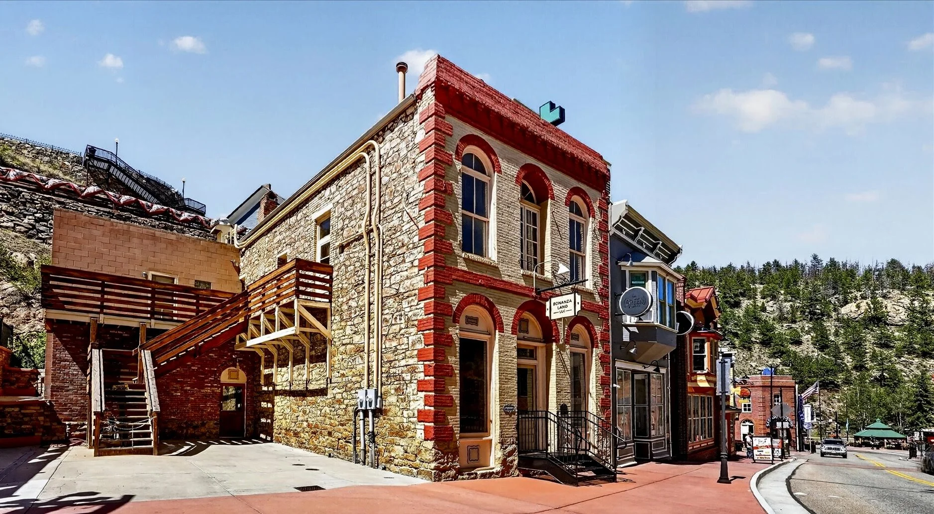
While the preceding chapters have explored mountain landscapes, historic mining claims, demonstrated communities, and future opportunities, the decades of acquisition, research, planning, design, development, and stewardship behind those accomplishments were coordinated from one place.
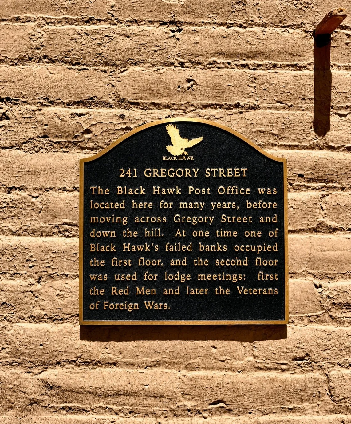
241 Gregory Street has served as the Portfolio Headquarters of Bonanza Land LLC-the operational center from which one of Colorado's most remarkable collections of patented mining properties was assembled, managed, and thoughtfully advanced.
More than an office, it has functioned as a design studio, research center, archive, and gallery-bringing together the people, ideas, and resources that transformed a long-term vision into a remarkable portfolio of Colorado mountain properties.
A Historic Setting
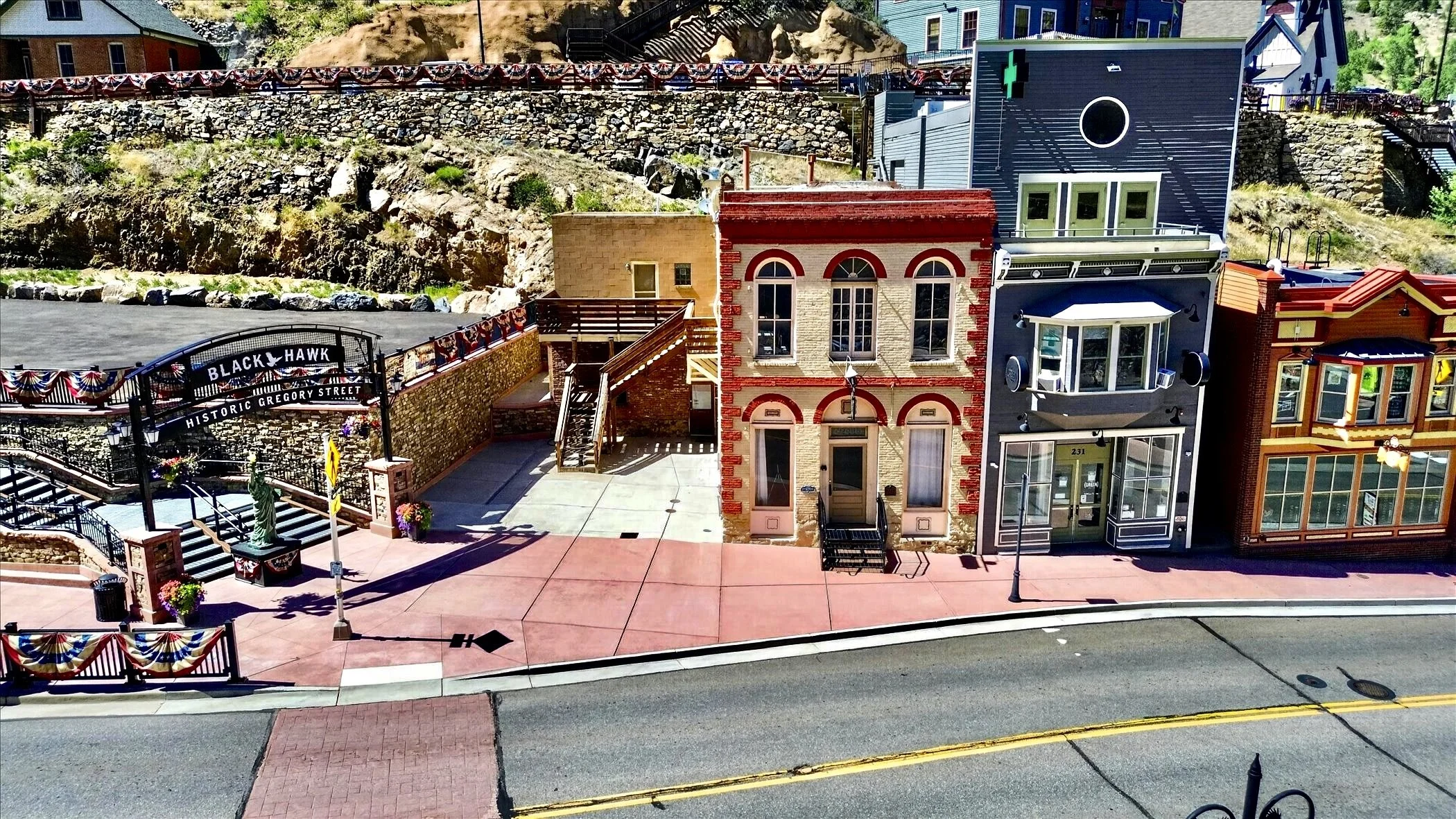
Located on Historic Gregory Street in the heart of Black Hawk, the headquarters occupies a prominent position within one of Colorado's most significant historic mining communities.
At the Center of the Portfolio
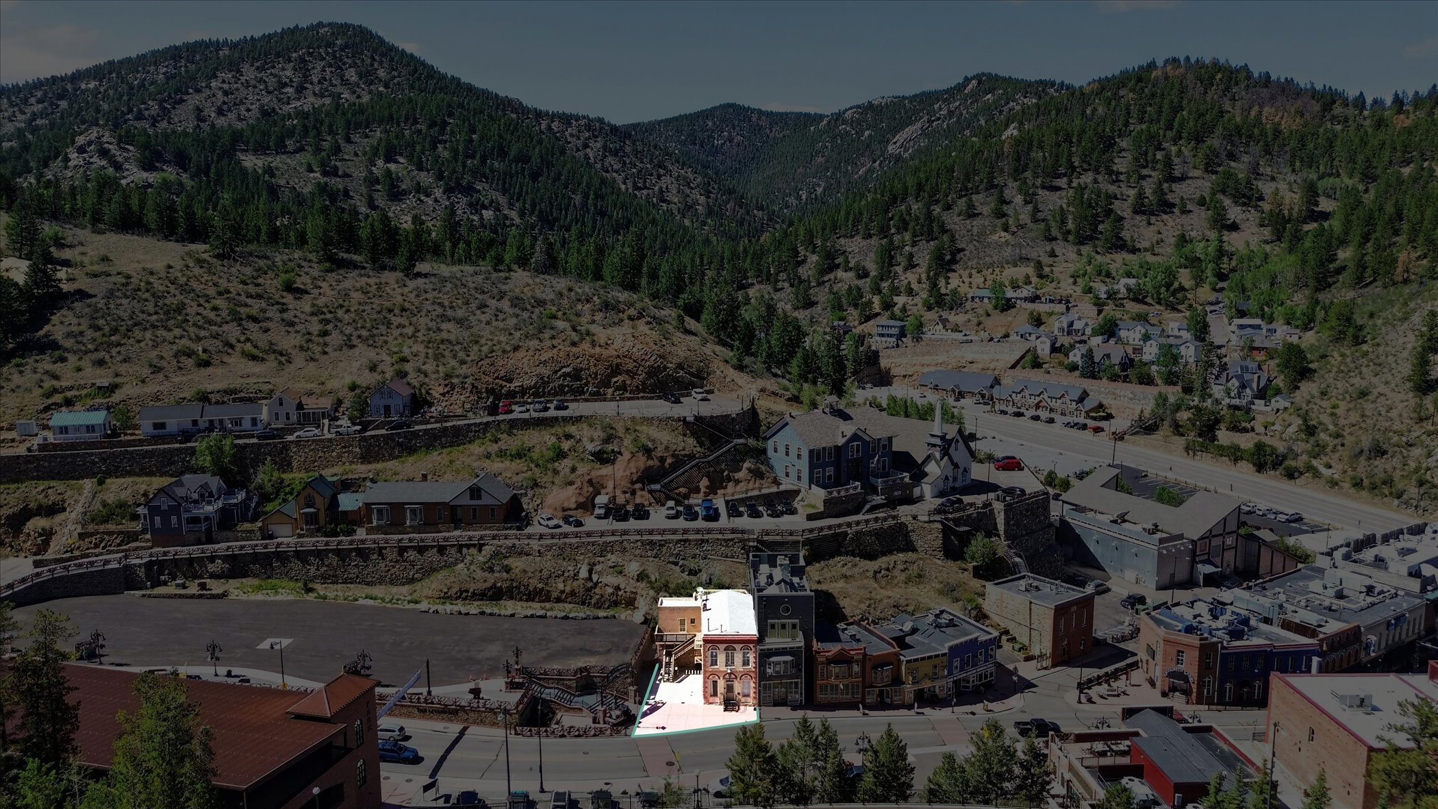
From this location, decades of acquisitions, research, planning, development, and stewardship were coordinated across the surrounding mountain properties and historic mining districts featured throughout this portfolio.
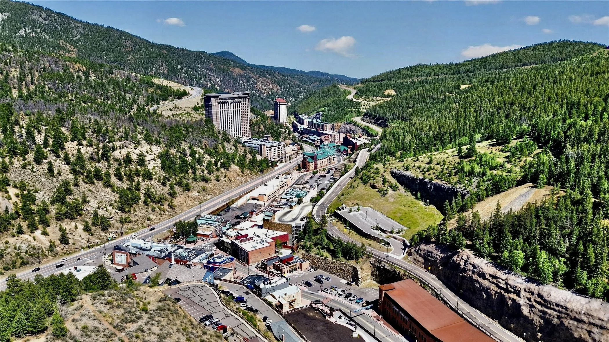
241 Gregory Street occupies a prominent location within the historic commercial core of Black Hawk. Today the city serves as Colorado's principal gaming destination, while continuing to preserve one of the state's most important mining-era downtowns. From this location, Bonanza Land LLC coordinated the acquisition, stewardship, and planning of properties extending across the surrounding mountains.
From Historic Landmark to Portfolio Headquarters
Long before it became the Portfolio Headquarters of Bonanza Land LLC, 241 Gregory Street had already secured its place in the history of Black Hawk.
Constructed during the great mining era of the 1870s, the building has stood along Historic Gregory Street for more than 150 years, evolving alongside one of Colorado's most remarkable mountain communities.
Originally built as a bank during Black Hawk's formative years, the building later served as the community's post office, connecting generations of residents as the mining camp matured into an established mountain town. Over time, it also became home to civic organizations, including the Improved Order of Red Men and later the Veterans of Foreign Wars.
In the twentieth century, the building adapted once again, serving as a medical clinic and, for a brief period during the early years of legalized gaming, as one of Black Hawk's earliest casinos.
Each chapter reflected the changing needs of the community while preserving the character of the original structure.
When Bonanza Land LLC acquired the property, the building entered another chapter-not as a commercial enterprise, but as the operational headquarters for assembling, researching, planning, and stewarding one of Colorado's most significant collections of patented mining properties.
Today, the same walls that once served bankers, postal workers, civic organizations, physicians, and visitors now house maps, surveys, archives, engineering records, photographs, and decades of research documenting Colorado's historic mining landscape.
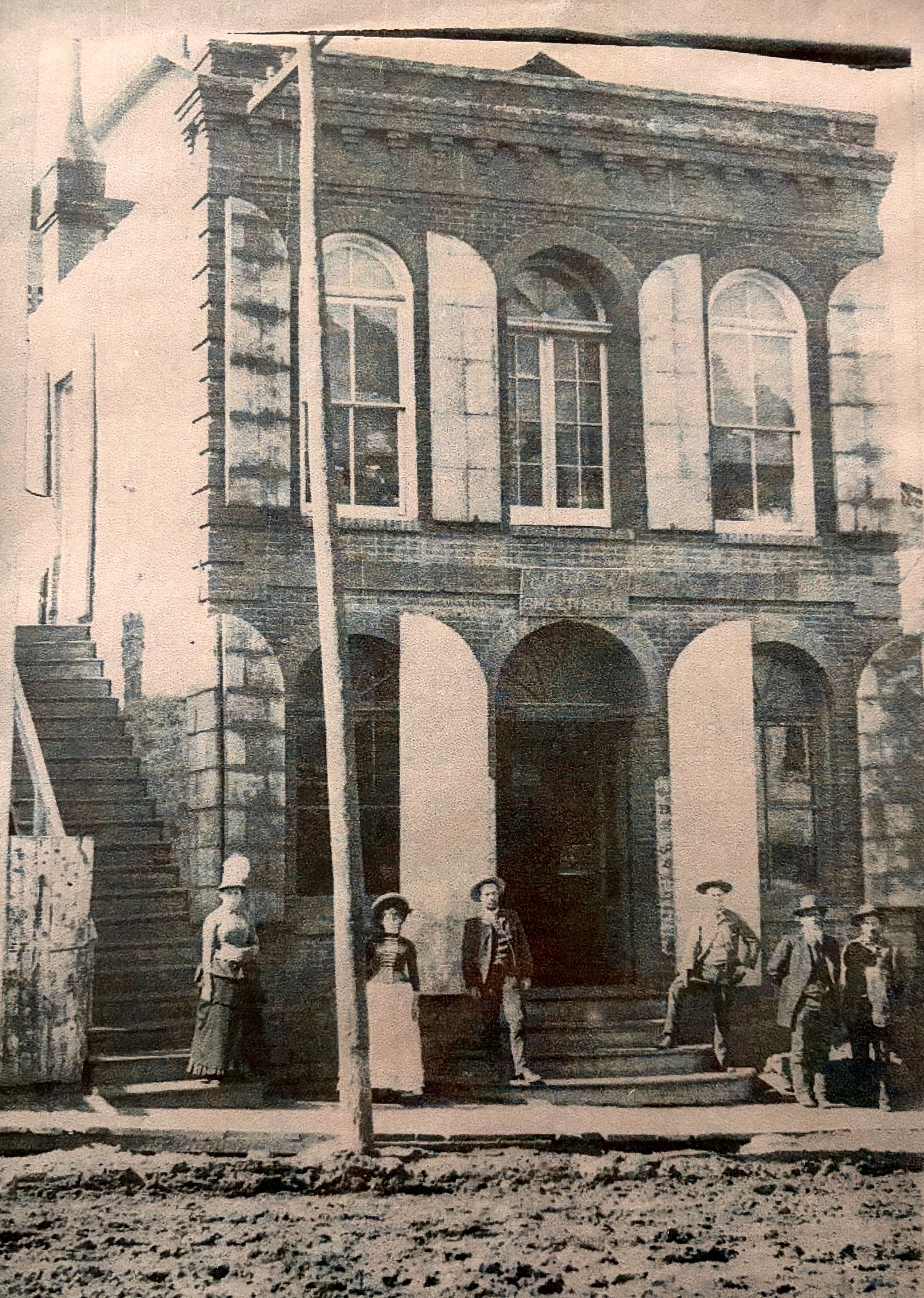
241 Gregory Street during Black Hawk's mining era. More than a century later, the building continues to serve the community through a new chapter of stewardship.
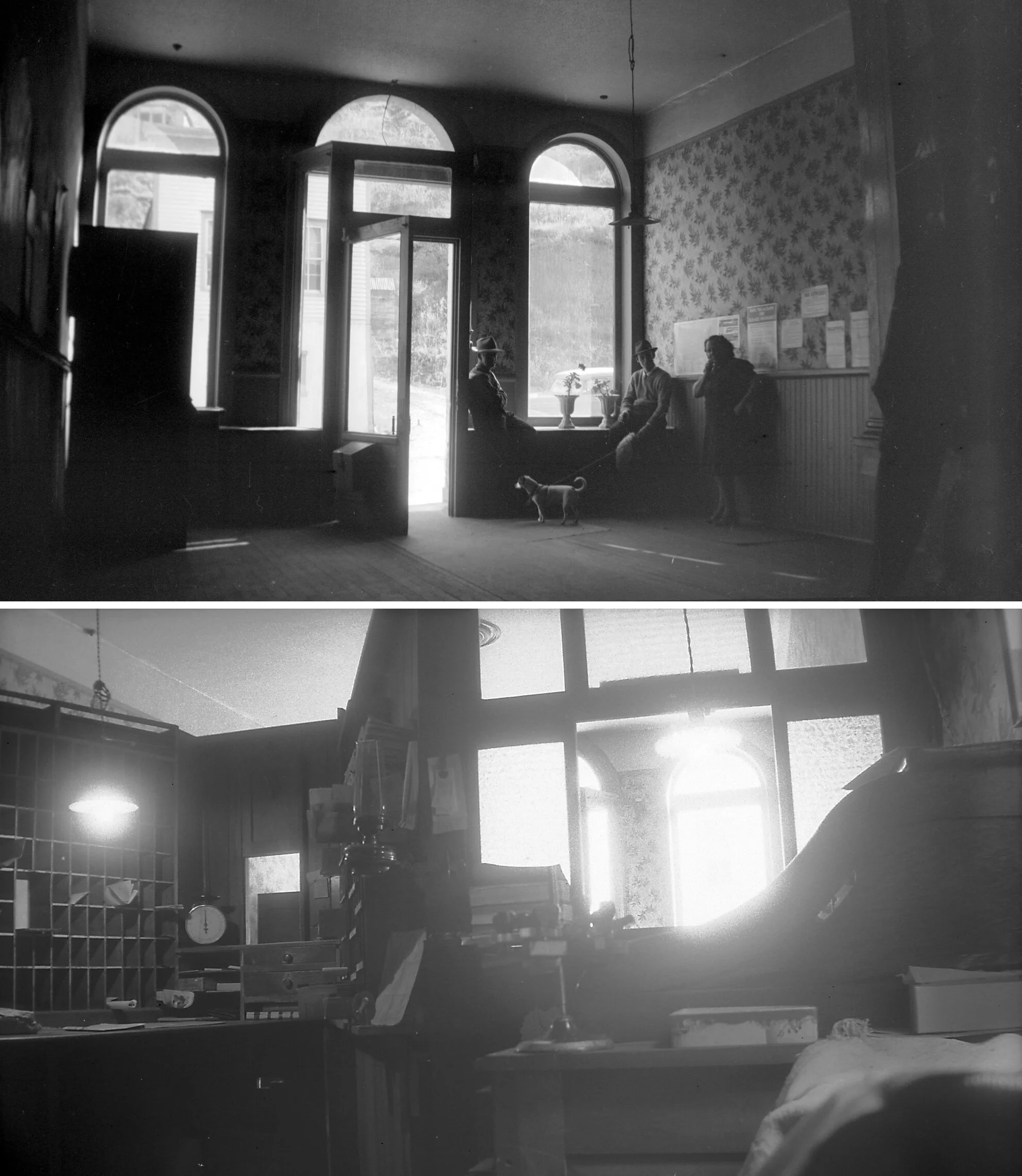
INTERIORS OF THE BLACK HAWK POST OFFICE
Historic interior photographs showing the public lobby (top) and postal workroom (bottom). Historical records indicate the building served as the Black Hawk Post Office into the 1940s.
From Historic Landmark to Working Archive
For more than thirty years, the rooms within 241 Gregory Street became far more than office space.
Here, historic mining records were assembled, ownership histories reconstructed, surveys analyzed, maps compared, acquisitions negotiated, and thousands of individual documents organized into what would become one of Colorado's most significant privately assembled portfolios of patented mining properties.
The building evolved into an archive, research library, planning studio, and design workspace where long-term stewardship was translated into action. Every assemblage presented throughout this portfolio was researched, mapped, evaluated, and ultimately coordinated from within these walls.
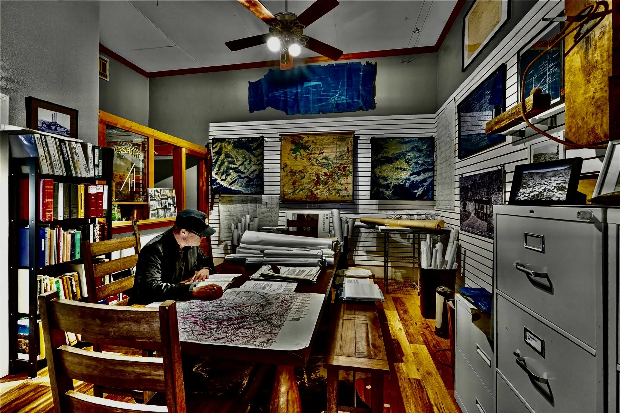
Research Studio
Historic maps, mining records, engineering drawings, surveys, and acquisition files were assembled and studied here over more than three decades as the Bonanza Land LLC portfolio was researched, expanded, and managed.
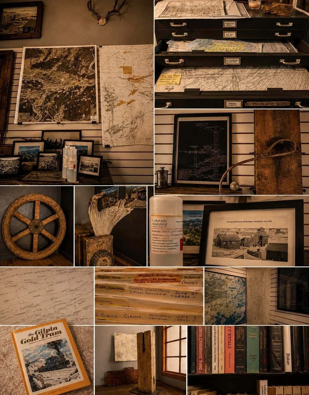
The Working Archive
More than three decades of research, acquisition, and stewardship produced an extensive working archive documenting Colorado's historic mining districts.
Original survey plats, patented mining claim maps, engineering drawings, geological references, aerial photography, title records, historic photographs, development studies, and acquisition files were assembled here to support the planning and stewardship of the Bonanza Land LLC Portfolio.